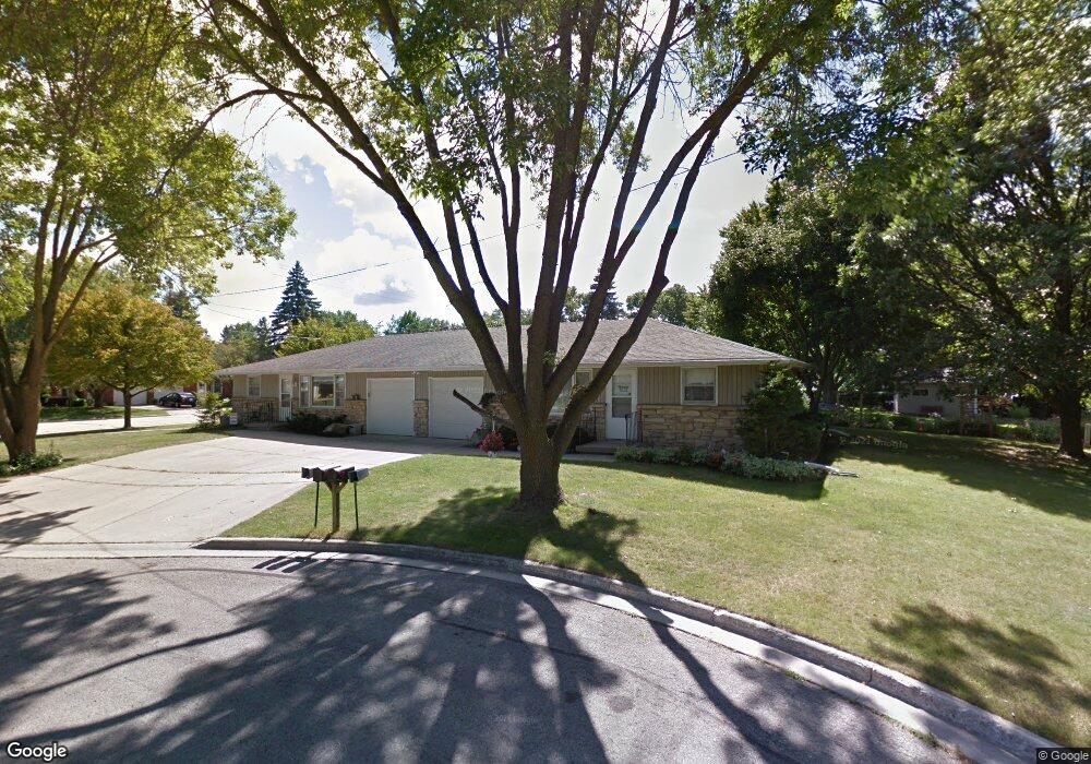
1402 Springdale Ln Unit 1406 Green Bay, WI 54304
MacArthur Heights NeighborhoodEstimated Value: $343,573 - $384,000
6
Beds
2
Baths
1,920
Sq Ft
$190/Sq Ft
Est. Value
About This Home
This home is located at 1402 Springdale Ln Unit 1406, Green Bay, WI 54304 and is currently estimated at $365,393, approximately $190 per square foot. 1402 Springdale Ln Unit 1406 is a home located in Brown County with nearby schools including MacArthur Elementary School, Lombardi Middle School, and Southwest High School.
Ownership History
Date
Name
Owned For
Owner Type
Purchase Details
Closed on
Feb 9, 2015
Sold by
Carter Janice M and Boncher John T
Bought by
Springdale Properties Llc
Current Estimated Value
Purchase Details
Closed on
Feb 22, 2001
Sold by
Charles David P
Bought by
Carter Janice M and Boncher John T
Home Financials for this Owner
Home Financials are based on the most recent Mortgage that was taken out on this home.
Original Mortgage
$100,000
Interest Rate
7.13%
Create a Home Valuation Report for This Property
The Home Valuation Report is an in-depth analysis detailing your home's value as well as a comparison with similar homes in the area
Home Values in the Area
Average Home Value in this Area
Purchase History
| Date | Buyer | Sale Price | Title Company |
|---|---|---|---|
| Springdale Properties Llc | $146,000 | Bay Title & Abstract | |
| Carter Janice M | $125,000 | Bay Title & Abstract Inc |
Source: Public Records
Mortgage History
| Date | Status | Borrower | Loan Amount |
|---|---|---|---|
| Previous Owner | Carter Janice M | $100,000 |
Source: Public Records
Tax History Compared to Growth
Tax History
| Year | Tax Paid | Tax Assessment Tax Assessment Total Assessment is a certain percentage of the fair market value that is determined by local assessors to be the total taxable value of land and additions on the property. | Land | Improvement |
|---|---|---|---|---|
| 2024 | $4,698 | $239,300 | $42,000 | $197,300 |
| 2023 | $4,645 | $239,300 | $42,000 | $197,300 |
| 2022 | $4,403 | $239,300 | $42,000 | $197,300 |
| 2021 | $3,752 | $154,000 | $29,000 | $125,000 |
| 2020 | $3,723 | $154,000 | $29,000 | $125,000 |
| 2019 | $3,637 | $154,000 | $29,000 | $125,000 |
| 2018 | $3,531 | $154,000 | $29,000 | $125,000 |
| 2017 | $3,440 | $154,000 | $29,000 | $125,000 |
| 2016 | $3,396 | $154,000 | $29,000 | $125,000 |
| 2015 | $3,306 | $151,300 | $29,000 | $122,300 |
| 2014 | $3,403 | $151,300 | $29,000 | $122,300 |
| 2013 | $3,403 | $151,300 | $29,000 | $122,300 |
Source: Public Records
Map
Nearby Homes
- 2439 W Point Rd
- 1518 Shannon St
- 1306 Nelson St Unit 1308
- 2479 Valiant Ln
- 1973 Knotty Pine Dr
- 1663 Birchwood Dr
- 1956 Belmont Dr
- 510 Lambeau St
- 2466 Parkwood Dr
- 1428 Argonne Dr
- 1522 Argonne Dr
- 2640 He Nis Ra Ln
- 1514 Ashley Ct
- 2581 Dunbar Ln
- 2060 Trissino Way
- 1817 Aspen Ln
- 2031 Bradbury Ln
- 2060 Wintergreen Ct
- 1307 Blue Ridge Dr
- 809 Mitchell St
- 1406 Springdale Ln
- 2220 9th St
- 1405 Springdale Ln Unit 1407
- 2234 9th St
- 2201 9th St Unit 2211
- 2250 9th St
- 2160 9th St
- 2221 9th St Unit 2231
- 2167 9th St
- 1424 Springdale Ln
- 2264 9th St
- 2150 9th St
- 1433 Acorn Dr Unit 1435
- 1423 Springdale Ln
- 2151 9th St
- 1432 Springdale Ln
- 2280 9th St
- 2136 9th St
- 1430 Acorn Dr Unit 1432
- 1427 Springdale Ln