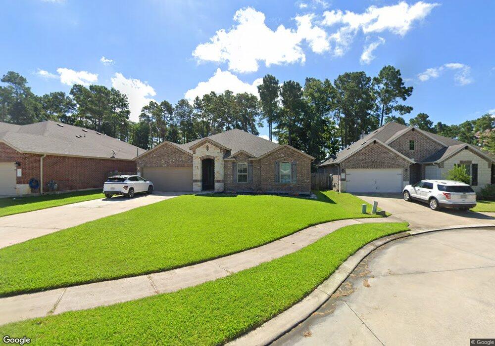
14023 Beaverhead Range Conroe, TX 77385
Estimated Value: $383,299 - $502,000
4
Beds
2
Baths
2,540
Sq Ft
$168/Sq Ft
Est. Value
About This Home
This home is located at 14023 Beaverhead Range, Conroe, TX 77385 and is currently estimated at $426,575, approximately $167 per square foot. 14023 Beaverhead Range is a home located in Montgomery County with nearby schools including Bush Elementary School, Mitchell Intermediate School, and McCullough Junior High School.
Ownership History
Date
Name
Owned For
Owner Type
Purchase Details
Closed on
Dec 21, 2021
Sold by
Offerpad Spe Borrower A Llc
Bought by
Markus Melissa A and Markus William F
Current Estimated Value
Home Financials for this Owner
Home Financials are based on the most recent Mortgage that was taken out on this home.
Original Mortgage
$244,930
Outstanding Balance
$224,876
Interest Rate
2.98%
Mortgage Type
New Conventional
Estimated Equity
$201,699
Purchase Details
Closed on
Mar 10, 2017
Sold by
Dr Horton Texas Ltd
Bought by
Barnhill Justin Keith
Home Financials for this Owner
Home Financials are based on the most recent Mortgage that was taken out on this home.
Original Mortgage
$262,153
Interest Rate
4.19%
Mortgage Type
FHA
Create a Home Valuation Report for This Property
The Home Valuation Report is an in-depth analysis detailing your home's value as well as a comparison with similar homes in the area
Home Values in the Area
Average Home Value in this Area
Purchase History
| Date | Buyer | Sale Price | Title Company |
|---|---|---|---|
| Markus Melissa A | -- | First American Title | |
| Barnhill Justin Keith | -- | Dhi Title |
Source: Public Records
Mortgage History
| Date | Status | Borrower | Loan Amount |
|---|---|---|---|
| Open | Markus Melissa A | $244,930 | |
| Previous Owner | Barnhill Justin Keith | $262,153 |
Source: Public Records
Tax History
| Year | Tax Paid | Tax Assessment Tax Assessment Total Assessment is a certain percentage of the fair market value that is determined by local assessors to be the total taxable value of land and additions on the property. | Land | Improvement |
|---|---|---|---|---|
| 2025 | $6,721 | $403,726 | $58,000 | $345,726 |
| 2024 | $6,426 | $424,192 | $58,000 | $366,192 |
| 2023 | $6,426 | $405,260 | $58,000 | $347,260 |
| 2022 | $10,932 | $378,070 | $58,000 | $320,070 |
| 2021 | $8,934 | $283,740 | $58,000 | $225,740 |
| 2020 | $9,598 | $287,540 | $57,180 | $230,360 |
| 2019 | $9,670 | $279,120 | $57,180 | $221,940 |
| 2018 | $7,333 | $273,620 | $57,180 | $216,440 |
| 2017 | $9,445 | $273,620 | $57,180 | $216,440 |
| 2016 | $1,145 | $57,180 | $57,180 | $0 |
Source: Public Records
Map
Nearby Homes
- 14023 Beaverhead Range Ct
- 14206 Rainier Peak Crossing
- 14021 Stony Gap Ln
- 13912 Acadia Point Ct
- 14097 Lake Crescent Dr
- 13917 Nicolet Arbor Ln
- 14200 Wallowa Ridge Ln
- 14130 Savage River Ct
- 14106 Locke Point Ct
- 14046 Wolftrap Ln
- 14107 Windigo Ct
- 14227 Glacier Bay Ct
- 14103 Ash Mountain Ln
- 14207 Glacier Bay Ct
- 13928 Payette Arbor Ct
- 14214 Glacier Bay Ct
- 14132 Lake Lodge Dr
- 14096 Silver Falls Ct
- 14243 Volcano Perch Dr
- 13316 Bear Creek Ct
- 14019 Beaverhead Range Ct
- 14027 Beaverhead Range Ct
- 14015 Beaverhead Range Ct
- 14011 Beaverhead Range Ct
- 14022 Beaverhead Range
- 14026 Beaverhead Range Ct
- 14018 Beaverhead Range Ct
- 14030 Beaverhead Range Ct
- 14014 Beaverhead Range Ct
- 14007 Beaverhead Range Ct
- 14010 Beaverhead Range Ct
- 14020 S Wind Cave Ct
- 14026 S Wind Cave Ct
- 14030 S Wind Cave Ct
- 14014 S Wind Cave Ct
- 14003 Beaverhead Range Ct
- 14006 Beaverhead Range Ct
- 14023 Sand Ridge Crossing
- 14027 Sand Ridge Crossing
- 14019 Sand Ridge Crossing