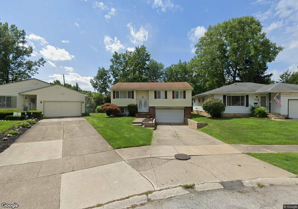
14024 Rochelle Dr Maple Heights, OH 44137
Estimated Value: $157,752 - $194,000
3
Beds
2
Baths
1,576
Sq Ft
$109/Sq Ft
Est. Value
About This Home
This home is located at 14024 Rochelle Dr, Maple Heights, OH 44137 and is currently estimated at $172,438, approximately $109 per square foot. 14024 Rochelle Dr is a home located in Cuyahoga County with nearby schools including Abraham Lincoln Elementary School, Rockside/ J.F. Kennedy School, and Barack Obama School.
Ownership History
Date
Name
Owned For
Owner Type
Purchase Details
Closed on
Apr 11, 1994
Sold by
Hartman Michael A
Bought by
Pleasant John A
Current Estimated Value
Purchase Details
Closed on
Dec 8, 1986
Sold by
James Carroll
Bought by
Hartman Michael A
Purchase Details
Closed on
Sep 28, 1978
Sold by
Carroll James and Carroll Elizabeth
Bought by
James Carroll
Purchase Details
Closed on
Jan 1, 1975
Bought by
Carroll James and Carroll Elizabeth
Create a Home Valuation Report for This Property
The Home Valuation Report is an in-depth analysis detailing your home's value as well as a comparison with similar homes in the area
Home Values in the Area
Average Home Value in this Area
Purchase History
| Date | Buyer | Sale Price | Title Company |
|---|---|---|---|
| Pleasant John A | $87,500 | -- | |
| Hartman Michael A | $72,000 | -- | |
| James Carroll | -- | -- | |
| Carroll James | -- | -- |
Source: Public Records
Tax History Compared to Growth
Tax History
| Year | Tax Paid | Tax Assessment Tax Assessment Total Assessment is a certain percentage of the fair market value that is determined by local assessors to be the total taxable value of land and additions on the property. | Land | Improvement |
|---|---|---|---|---|
| 2024 | $4,453 | $51,695 | $8,645 | $43,050 |
| 2023 | $3,412 | $34,130 | $7,390 | $26,740 |
| 2022 | $3,399 | $34,130 | $7,390 | $26,740 |
| 2021 | $3,638 | $34,130 | $7,390 | $26,740 |
| 2020 | $3,299 | $27,970 | $6,060 | $21,910 |
| 2019 | $3,289 | $79,900 | $17,300 | $62,600 |
| 2018 | $3,273 | $27,970 | $6,060 | $21,910 |
| 2017 | $3,190 | $26,570 | $4,270 | $22,300 |
| 2016 | $3,090 | $26,570 | $4,270 | $22,300 |
| 2015 | $3,070 | $26,570 | $4,270 | $22,300 |
| 2014 | $3,070 | $28,570 | $4,590 | $23,980 |
Source: Public Records
Map
Nearby Homes
- 13835 Milo Rd
- 13732 Carpenter Rd
- 6318 Valley Ranch Dr
- 13804 Rockside Rd
- 13712 Rockside Rd
- SL15 Rocky Top Ct
- 13578 Foxcroft Dr
- 13577 Robinhood Dr
- 14775 Lisa Dr
- 12955 Milo Rd
- 6437 Kimberly Dr
- TBD Meadowbrook Rd
- 14917 Summit Ave
- 6378 Valley Ranch Dr
- 6372 Valley Ranch Dr
- 14916 Summit Ave
- 12940 Fruitside Rd
- 14951 Carol Dr
- 6030 Dunham Rd
- 14106 Tabor Ave
- 14008 Rochelle Dr
- 14038 Rochelle Dr
- 13830 Martin Dr
- 14066 Rochelle Dr
- 13850 Martin Dr
- 13820 Martin Dr
- 14082 Rochelle Dr
- 13900 Grove Dr
- 13810 Martin Dr
- 14067 Rochelle Dr
- 14006 Lisa Dr
- 14106 Rochelle Dr
- 14014 Lisa Dr
- 13800 Martin Dr
- 14083 Rochelle Dr
- 14122 Rochelle Dr
- 14022 Lisa Dr
- 13770 Martin Dr
- 13831 Grove Dr
- 13891 Grove Dr