Estimated Value: $325,000 - $371,000
--
Bed
3
Baths
3,152
Sq Ft
$108/Sq Ft
Est. Value
About This Home
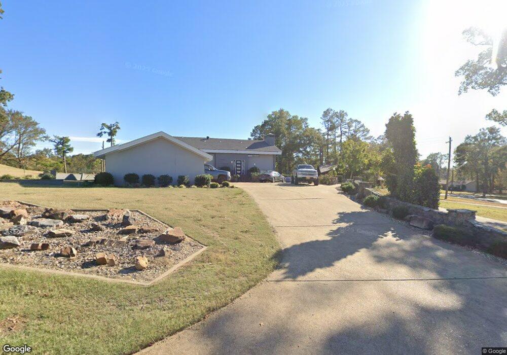
This home is located at 1403 Airpark Rd, Wynne, AR 72396 and is currently estimated at $339,342, approximately $107 per square foot. 1403 Airpark Rd is a home located in Cross County with nearby schools including Wynne Intermediate School, Wynne Primary School, and Wynne Junior High School.
Ownership History
Date
Name
Owned For
Owner Type
Purchase Details
Closed on
Oct 7, 2019
Sold by
Hkr Llc
Bought by
Ledford Steven Lewis
Current Estimated Value
Home Financials for this Owner
Home Financials are based on the most recent Mortgage that was taken out on this home.
Original Mortgage
$150,955
Outstanding Balance
$131,972
Interest Rate
3.4%
Mortgage Type
New Conventional
Estimated Equity
$207,370
Purchase Details
Closed on
Jul 16, 2012
Sold by
Gregson John Ed
Bought by
Campbell Amy R
Home Financials for this Owner
Home Financials are based on the most recent Mortgage that was taken out on this home.
Original Mortgage
$200,000
Interest Rate
3.79%
Mortgage Type
Purchase Money Mortgage
Purchase Details
Closed on
Apr 8, 2003
Bought by
Gregson John Ed
Purchase Details
Closed on
Nov 17, 1999
Bought by
Gregson John Ed
Create a Home Valuation Report for This Property
The Home Valuation Report is an in-depth analysis detailing your home's value as well as a comparison with similar homes in the area
Home Values in the Area
Average Home Value in this Area
Purchase History
| Date | Buyer | Sale Price | Title Company |
|---|---|---|---|
| Ledford Steven Lewis | $159,000 | Cowling Title Co | |
| Campbell Amy R | $225,000 | Cowling Title Company | |
| Gregson John Ed | $25,000 | -- | |
| Gregson John Ed | $270,000 | -- |
Source: Public Records
Mortgage History
| Date | Status | Borrower | Loan Amount |
|---|---|---|---|
| Open | Ledford Steven Lewis | $150,955 | |
| Previous Owner | Campbell Amy R | $200,000 |
Source: Public Records
Tax History Compared to Growth
Tax History
| Year | Tax Paid | Tax Assessment Tax Assessment Total Assessment is a certain percentage of the fair market value that is determined by local assessors to be the total taxable value of land and additions on the property. | Land | Improvement |
|---|---|---|---|---|
| 2024 | $1,378 | $38,020 | $6,790 | $31,230 |
| 2023 | $1,457 | $38,020 | $6,790 | $31,230 |
| 2022 | $1,507 | $38,020 | $6,790 | $31,230 |
| 2021 | $1,507 | $38,020 | $6,790 | $31,230 |
| 2020 | $1,507 | $38,020 | $6,790 | $31,230 |
| 2019 | $1,249 | $32,800 | $5,060 | $27,740 |
| 2018 | $1,624 | $32,800 | $5,060 | $27,740 |
| 2017 | $2,751 | $55,570 | $5,060 | $50,510 |
| 2016 | $2,751 | $55,570 | $5,060 | $50,510 |
| 2015 | $2,751 | $55,570 | $5,060 | $50,510 |
| 2014 | $2,582 | $59,230 | $6,930 | $52,300 |
Source: Public Records
Map
Nearby Homes
- 1404 Airpark Rd
- 1011 Hilltop Dr
- 1310 Bridges Ave E
- 1308 Killough Rd N
- 226 Nathan Dr E
- 29 Sunset Dr
- 568 Killough Rd N
- 594 Malone St N
- 35 Morningside Dr
- 108 Nathan Dr E
- 109 Nathan Dr E
- 1008 Languille Ave E
- 2 Donegal Cir
- 6 A Londonderry Cir
- 4 Briarcliff Cir
- 1484 Hamilton Ave E
- 1920 Airpark Rd
- 1910 Hess Ln
- 1405 Peterson Rd
- 1737 Peterson Rd
- 1401 Airpark Rd
- 902 Killough Rd N
- 1405 Airpark Rd
- 1008 Killough Rd N
- 2 Sunset Dr
- 909 Killough Rd N
- 907 Killough Rd N
- 1406 Airpark Rd
- 4 Sunset Dr
- 1003 Killough Rd N
- 1407 Airpark Rd
- 812 Killough Rd N
- 1010 Killough Rd N
- 1221 Languille Ave E
- 813 Killough Rd N
- 6 Sunset Dr
- 1212 Donald Dr E
- 1105 Killough Rd N
- 1220 Languille Ave E
- 1408 Airpark Rd