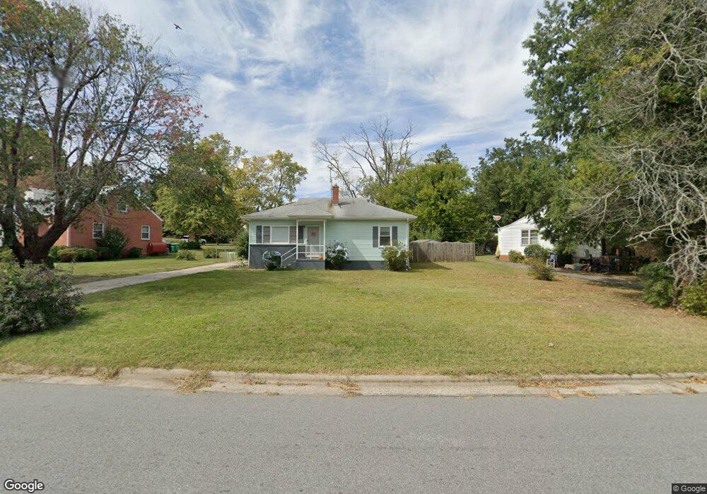
1403 Mcguinn Dr High Point, NC 27262
Greater High Point NeighborhoodEstimated Value: $141,000 - $169,000
About This Home
This home is located at 1403 Mcguinn Dr, High Point, NC 27262 and is currently estimated at $155,644, approximately $157 per square foot. 1403 Mcguinn Dr is a home located in Guilford County with nearby schools including Kirkman Park Elementary School, Penn-Griffin School for the Arts, and T.W. Andrews High School.
Ownership History
We collect this data history from publicly available records. To have your information removed, we recommend requesting removal directly through your county’s website.
Purchase Details
Home Financials for this Owner
Home Financials are based on the most recent Mortgage that was taken out on this home.Home Values in the Area
Average Home Value in this Area
Purchase History
We collect this data history from publicly available records. To have your information removed, we recommend requesting removal directly through your county’s website.
| Date | Buyer | Sale Price | Title Company |
|---|---|---|---|
| $51,000 | -- |
Mortgage History
We collect this data history from publicly available records. To have your information removed, we recommend requesting removal directly through your county’s website.
| Date | Status | Borrower | Loan Amount |
|---|---|---|---|
| Open | $62,550 |
Tax History
We collect this data history from publicly available records. To have your information removed, we recommend requesting removal directly through your county’s website.
| Year | Tax Paid | Tax Assessment Tax Assessment Total Assessment is a certain percentage of the fair market value that is determined by local assessors to be the total taxable value of land and additions on the property. | Land | Improvement |
|---|---|---|---|---|
| 2025 | $820 | $59,500 | $22,000 | $37,500 |
| 2024 | $820 | $59,500 | $22,000 | $37,500 |
| 2023 | $820 | $59,500 | $22,000 | $37,500 |
| 2022 | $802 | $59,500 | $22,000 | $37,500 |
| 2021 | $515 | $37,400 | $10,000 | $27,400 |
| 2020 | $515 | $37,400 | $10,000 | $27,400 |
| 2019 | $515 | $37,400 | $0 | $0 |
| 2018 | $513 | $37,400 | $0 | $0 |
| 2017 | $515 | $37,400 | $0 | $0 |
| 2016 | $484 | $34,500 | $0 | $0 |
| 2015 | $486 | $34,500 | $0 | $0 |
| 2014 | $495 | $34,500 | $0 | $0 |
Map
- 1112 Guyer St
- 1445 Bailey Cir
- 1604 E Lexington Ave
- 1014 Montlieu Ave
- 1410 Wiltshire St
- 1415 Wiltshire St
- 1412 Bragg Ave
- 1414 Bragg Ave
- 524 Ashburn St
- 1509 & 1511 Wiltshire St
- 1108 Dartmouth Ave
- 1308 Boundary Ave
- 1508 Boundary Ave
- 1528 Graves Ave
- 1602 Boundary Ave
- 1604 Boundary Ave
- 1606 Boundary Ave
- 1511 Davis Ave
- 1006 Gordon St
- 2009 Mcguinn Dr
- 1405 Mcguinn Dr
- 1401 Mcguinn Dr
- 1106 Terrell Dr
- 1407 Mcguinn Dr
- 1108 Terrell Dr
- 1409 Mcguinn Dr
- 1313 Mcguinn Dr
- 1110 Terrell Dr
- 1411 Mcguinn Dr
- 1225 Terrell Dr
- 1107 Terrell Dr
- 1112 Terrell Dr
- 1311 Mcguinn Dr
- 1014 Terrell Dr
- 1413 Mcguinn Dr
- 1111 Terrell Dr
- 1012 Terrell Dr
- 1307 Mcguinn Dr
- 1113 Terrell Dr
- 1308 Mcguinn Dr
Ask me questions while you tour the home.