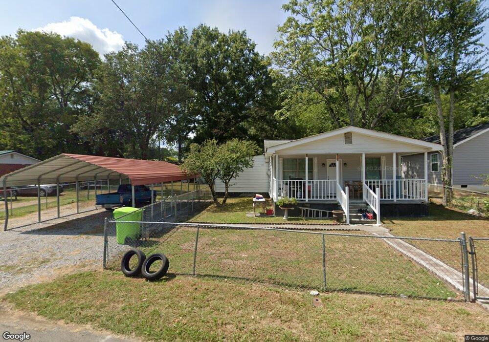
1403 Nolan Rd Dalton, GA 30721
Estimated Value: $145,462 - $183,000
--
Bed
1
Bath
925
Sq Ft
$185/Sq Ft
Est. Value
About This Home
This home is located at 1403 Nolan Rd, Dalton, GA 30721 and is currently estimated at $170,866, approximately $184 per square foot. 1403 Nolan Rd is a home located in Whitfield County with nearby schools including Eastside Elementary School, Eastbrook Middle School, and Southeast Whitfield County High School.
Ownership History
Date
Name
Owned For
Owner Type
Purchase Details
Closed on
Dec 3, 2021
Sold by
Sanchez Gabriel
Bought by
Ortiz Sonia Ayala and Barajas Cuahuctemoc Figueroa
Current Estimated Value
Purchase Details
Closed on
Jun 24, 2013
Sold by
Swafford William H
Bought by
Swafford William H
Home Financials for this Owner
Home Financials are based on the most recent Mortgage that was taken out on this home.
Original Mortgage
$41,729
Interest Rate
4.75%
Mortgage Type
FHA
Purchase Details
Closed on
Oct 1, 1990
Bought by
Swafford William H and Stella Mae
Create a Home Valuation Report for This Property
The Home Valuation Report is an in-depth analysis detailing your home's value as well as a comparison with similar homes in the area
Home Values in the Area
Average Home Value in this Area
Purchase History
| Date | Buyer | Sale Price | Title Company |
|---|---|---|---|
| Ortiz Sonia Ayala | -- | -- | |
| Swafford William H | -- | -- | |
| Swafford William H | -- | -- |
Source: Public Records
Mortgage History
| Date | Status | Borrower | Loan Amount |
|---|---|---|---|
| Previous Owner | Swafford William H | $41,729 |
Source: Public Records
Tax History Compared to Growth
Tax History
| Year | Tax Paid | Tax Assessment Tax Assessment Total Assessment is a certain percentage of the fair market value that is determined by local assessors to be the total taxable value of land and additions on the property. | Land | Improvement |
|---|---|---|---|---|
| 2024 | $614 | $58,831 | $7,000 | $51,831 |
| 2023 | $614 | $24,445 | $4,360 | $20,085 |
| 2022 | $338 | $20,016 | $4,360 | $15,656 |
| 2021 | $338 | $20,016 | $4,360 | $15,656 |
| 2020 | $338 | $20,016 | $4,360 | $15,656 |
| 2019 | $338 | $20,016 | $4,360 | $15,656 |
| 2018 | $338 | $20,016 | $4,360 | $15,656 |
| 2017 | $338 | $20,016 | $4,360 | $15,656 |
| 2016 | $273 | $16,578 | $2,310 | $14,268 |
| 2014 | $275 | $16,578 | $2,310 | $14,268 |
| 2013 | -- | $16,578 | $2,310 | $14,268 |
Source: Public Records
Map
Nearby Homes
- 1007 Locke Dr
- 1302 Jackson Rd
- trac 2 Roosevelt Dr
- trac 3 Roosevelt Dr
- 1412 Stevenson Dr
- 514 Sheridan Ave
- 1629 Roosevelt Dr
- 1320 Coker Dr
- Lot 5 River Bend Rd
- Lot 4 Riverbend Rd
- Lot 7 Riverbend Rd
- 1902 Bartenfield Dr
- 902 Mattie Dr
- Lot 3 Riverbend Rd
- Lot 2 Riverbend Rd
- 945 Riverbend Rd
- Lot 4 Liberty Dr
- Lot 10 Liberty Dr
- Lot 9 Liberty Dr
- 136 Wiltshire Dr
- 1401 Nolan Rd
- 1406 Jackson Rd
- 1319 Jackson Rd
- 1331 Jackson Rd
- 1417 Nolan Rd
- 1408 Nolan Rd
- 1506 Coker Dr
- 1507 Coker Dr
- 1500 Coker Dr
- 732 Sheridan Ave
- 1500 Jackson Rd
- 800 Sheridan Ave
- 1419 Coker Dr
- 724 Sheridan Ave
- 1507 Jackson Rd
- 737 Sheridan Ave
- 1322 Jackson Rd
- 735 Sheridan Ave
- 1318 Jackson Rd
- 702 Sheridan Ave