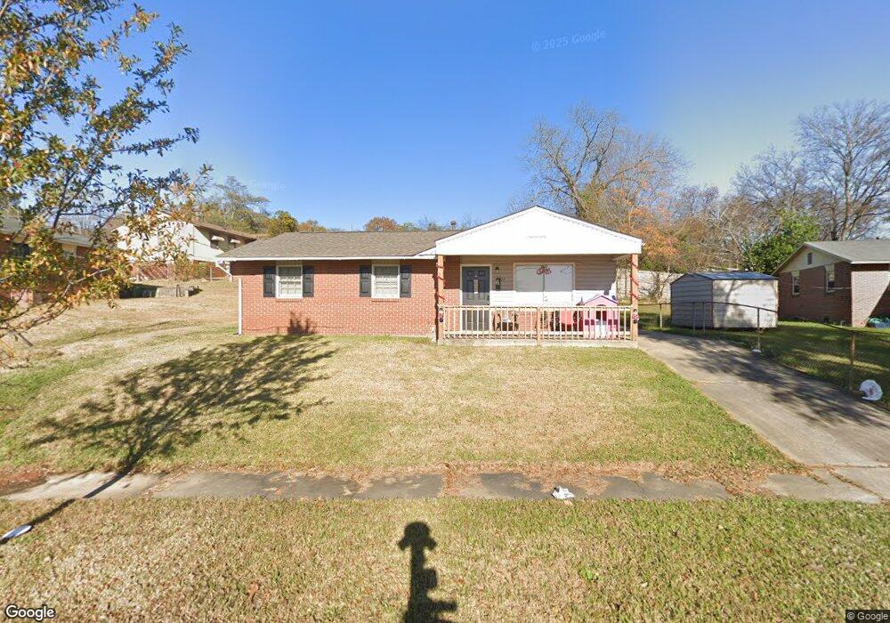
1403 Shepherd Dr Columbus, GA 31906
Bottoms-Meeler's Hill NeighborhoodEstimated Value: $104,000 - $161,000
3
Beds
2
Baths
1,600
Sq Ft
$82/Sq Ft
Est. Value
About This Home
This home is located at 1403 Shepherd Dr, Columbus, GA 31906 and is currently estimated at $130,762, approximately $81 per square foot. 1403 Shepherd Dr is a home located in Muscogee County with nearby schools including Davis Elementary School, Baker Middle School, and Jordan Vocational High School.
Ownership History
Date
Name
Owned For
Owner Type
Purchase Details
Closed on
Apr 2, 2020
Sold by
Sfr3 Llc
Bought by
Sfr3 008 Llc
Current Estimated Value
Purchase Details
Closed on
Jun 21, 2019
Sold by
Thomas Princess Nicole
Bought by
Sfr3 Llc
Purchase Details
Closed on
Sep 28, 2011
Sold by
Williams Idella
Bought by
Nelson Princess Thomas and Williams Latoya Simone
Create a Home Valuation Report for This Property
The Home Valuation Report is an in-depth analysis detailing your home's value as well as a comparison with similar homes in the area
Home Values in the Area
Average Home Value in this Area
Purchase History
| Date | Buyer | Sale Price | Title Company |
|---|---|---|---|
| Sfr3 008 Llc | -- | -- | |
| Sfr3 Llc | $60,000 | -- | |
| Nelson Princess Thomas | -- | -- |
Source: Public Records
Tax History Compared to Growth
Tax History
| Year | Tax Paid | Tax Assessment Tax Assessment Total Assessment is a certain percentage of the fair market value that is determined by local assessors to be the total taxable value of land and additions on the property. | Land | Improvement |
|---|---|---|---|---|
| 2025 | $1,364 | $34,840 | $3,812 | $31,028 |
| 2024 | $1,364 | $34,840 | $3,812 | $31,028 |
| 2023 | $1,372 | $34,840 | $3,812 | $31,028 |
| 2022 | $1,148 | $28,124 | $3,812 | $24,312 |
| 2021 | $1,148 | $28,124 | $3,812 | $24,312 |
| 2020 | $980 | $24,000 | $3,160 | $20,840 |
| 2019 | $1,171 | $28,592 | $3,812 | $24,780 |
| 2018 | $1,171 | $28,592 | $3,812 | $24,780 |
| 2017 | $0 | $28,592 | $3,812 | $24,780 |
| 2016 | -- | $20,175 | $1,864 | $18,311 |
| 2015 | -- | $20,175 | $1,864 | $18,311 |
| 2014 | -- | $20,175 | $1,864 | $18,311 |
| 2013 | -- | $20,175 | $1,864 | $18,311 |
Source: Public Records
Map
Nearby Homes
- 1516 Shepherd Dr
- 1616 Crest Dr
- 1820 Overlook St
- 1811 Park Dr
- 1806 Elmwood Dr
- 911 Oakview Ave
- 1312 10th St
- 912 Magnolia Ave
- 1103 Martin Luther King Junior Blvd
- 1001 Blandford Ave
- 752 Portland Ave
- 2005 7th St
- 1136 E Dinglewood Dr
- 2039 8th St
- 2551 Wynnton Rd
- 745 Brown Ave
- 2113 8th St
- 2114 George St
- 2211 8th St
- 2205 Willard St