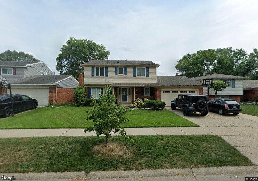
14032 Hubbard St Livonia, MI 48154
Estimated Value: $385,146 - $414,000
--
Bed
2
Baths
2,089
Sq Ft
$193/Sq Ft
Est. Value
About This Home
This home is located at 14032 Hubbard St, Livonia, MI 48154 and is currently estimated at $402,287, approximately $192 per square foot. 14032 Hubbard St is a home located in Wayne County with nearby schools including Kennedy Elementary School, Johnson Upper Elementary School, and Frost Middle School.
Ownership History
Date
Name
Owned For
Owner Type
Purchase Details
Closed on
Apr 15, 2025
Sold by
Michael T Curran Trust and Oatman Maureen A
Bought by
Roberts Deirdre M
Current Estimated Value
Purchase Details
Closed on
Jun 21, 2012
Sold by
Curran Michael T
Bought by
Michael T Curran Trust
Purchase Details
Closed on
Jul 27, 2007
Sold by
Prudential Relocation Inc
Bought by
Curran Michael T
Purchase Details
Closed on
Jun 29, 2007
Sold by
Kurzyniec Stephen J and Kurzyniec Elizabeth R
Bought by
Prudential Relocation Inc
Purchase Details
Closed on
Jan 18, 2001
Sold by
Mccallum David L
Bought by
Kurzyniec Elizabeth R
Purchase Details
Closed on
Jun 27, 1994
Sold by
Sabuda Mark S
Bought by
Mccallum David L and Mccallum Debra
Create a Home Valuation Report for This Property
The Home Valuation Report is an in-depth analysis detailing your home's value as well as a comparison with similar homes in the area
Home Values in the Area
Average Home Value in this Area
Purchase History
| Date | Buyer | Sale Price | Title Company |
|---|---|---|---|
| Roberts Deirdre M | -- | None Listed On Document | |
| Michael T Curran Trust | -- | None Available | |
| Curran Michael T | $220,000 | Fidelity National Title | |
| Prudential Relocation Inc | $220,000 | Fidelity National Title | |
| Kurzyniec Elizabeth R | -- | -- | |
| Mccallum David L | $135,000 | -- |
Source: Public Records
Tax History Compared to Growth
Tax History
| Year | Tax Paid | Tax Assessment Tax Assessment Total Assessment is a certain percentage of the fair market value that is determined by local assessors to be the total taxable value of land and additions on the property. | Land | Improvement |
|---|---|---|---|---|
| 2025 | $2,177 | $173,500 | $0 | $0 |
| 2024 | $2,177 | $166,000 | $0 | $0 |
| 2023 | $2,077 | $152,400 | $0 | $0 |
| 2022 | $3,647 | $139,200 | $0 | $0 |
| 2021 | $3,543 | $130,400 | $0 | $0 |
| 2019 | $3,399 | $122,000 | $0 | $0 |
| 2018 | $1,756 | $111,800 | $0 | $0 |
| 2017 | $3,108 | $107,300 | $0 | $0 |
| 2016 | $3,268 | $107,300 | $0 | $0 |
| 2015 | $7,757 | $96,990 | $0 | $0 |
| 2012 | -- | $73,390 | $15,300 | $58,090 |
Source: Public Records
Map
Nearby Homes
- 14214 Cranston St
- 32950 Perth St
- 32136 Lyndon St
- 33025 Martin St
- 14327 Arden St
- 33040 Allen St
- 14563 Melrose St
- 14677 Auburndale St
- 14164 Bainbridge St
- 14879 Fairfield St
- 14154 Hubbell St
- 31126 Grennada St
- 31221 Lyndon St
- 14292 Hubbell St
- 15075 Hubbard St Unit 5
- 15040 Berwick St
- 32651 5 Mile Rd Unit 15
- 14127 Hillcrest St
- 30831 Lyndon St
- 30261 Buckingham St
- 14050 Hubbard St
- 14014 Hubbard St
- 14035 Cranston St
- 14068 Hubbard St
- 13996 Hubbard St
- 14053 Cranston St
- 14015 Cranston St
- 14071 Cranston St
- 13999 Cranston St
- 14086 Hubbard St
- 13978 Hubbard St
- 14033 Hubbard St
- 14051 Hubbard St
- 14015 Hubbard St
- 14089 Cranston St
- 13981 Cranston St
- 13997 Hubbard St
- 14069 Hubbard St
- 14104 Hubbard St
- 13960 Hubbard St