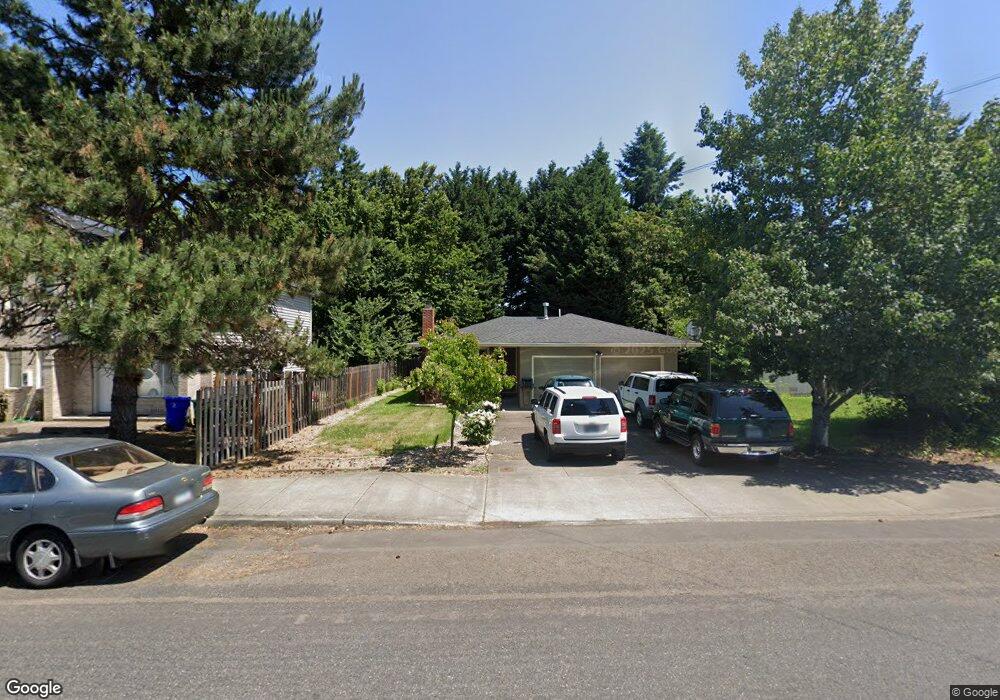
14032 SE Arista Dr Milwaukie, OR 97267
Estimated Value: $421,000 - $457,000
3
Beds
2
Baths
1,142
Sq Ft
$390/Sq Ft
Est. Value
About This Home
This home is located at 14032 SE Arista Dr, Milwaukie, OR 97267 and is currently estimated at $445,774, approximately $390 per square foot. 14032 SE Arista Dr is a home located in Clackamas County with nearby schools including Oak Grove Elementary School, Alder Creek Middle School, and Rex Putnam High School.
Ownership History
Date
Name
Owned For
Owner Type
Purchase Details
Closed on
Apr 25, 2013
Sold by
Laboissiere Steve
Bought by
Nicholson David and Nicholson Sharon
Current Estimated Value
Purchase Details
Closed on
Dec 10, 1998
Sold by
Keeth Troy Arnold and Keeth Lori Lin
Bought by
Labossiere Steve
Home Financials for this Owner
Home Financials are based on the most recent Mortgage that was taken out on this home.
Original Mortgage
$136,680
Interest Rate
6.78%
Mortgage Type
VA
Purchase Details
Closed on
May 20, 1996
Sold by
Benson Phillip E and Benson Leslie A
Bought by
Keeth Troy Arnold and Keeth Lori Lin
Home Financials for this Owner
Home Financials are based on the most recent Mortgage that was taken out on this home.
Original Mortgage
$108,800
Interest Rate
8.07%
Create a Home Valuation Report for This Property
The Home Valuation Report is an in-depth analysis detailing your home's value as well as a comparison with similar homes in the area
Home Values in the Area
Average Home Value in this Area
Purchase History
| Date | Buyer | Sale Price | Title Company |
|---|---|---|---|
| Nicholson David | $175,000 | First American | |
| Labossiere Steve | $134,000 | Ticor Title Insurance | |
| Keeth Troy Arnold | $117,000 | First American Title Ins Co |
Source: Public Records
Mortgage History
| Date | Status | Borrower | Loan Amount |
|---|---|---|---|
| Previous Owner | Labossiere Steve | $136,680 | |
| Previous Owner | Keeth Troy Arnold | $108,800 |
Source: Public Records
Tax History Compared to Growth
Tax History
| Year | Tax Paid | Tax Assessment Tax Assessment Total Assessment is a certain percentage of the fair market value that is determined by local assessors to be the total taxable value of land and additions on the property. | Land | Improvement |
|---|---|---|---|---|
| 2025 | $4,009 | $210,157 | -- | -- |
| 2024 | $3,868 | $204,036 | -- | -- |
| 2023 | $3,868 | $198,094 | $0 | $0 |
| 2022 | $3,558 | $192,325 | $0 | $0 |
| 2021 | $3,429 | $186,724 | $0 | $0 |
| 2020 | $3,322 | $181,286 | $0 | $0 |
| 2019 | $3,275 | $176,006 | $0 | $0 |
| 2018 | $2,868 | $170,880 | $0 | $0 |
| 2017 | $2,777 | $165,903 | $0 | $0 |
| 2016 | $2,679 | $161,071 | $0 | $0 |
| 2015 | $2,603 | $156,380 | $0 | $0 |
| 2014 | $2,461 | $151,825 | $0 | $0 |
Source: Public Records
Map
Nearby Homes
- 14368 SE Lee Ave
- 14007 SE Cedar Ave
- 0 SE Cedar Ave
- 13770 SE Linden Ln
- 14222 SE Laurie Ave
- 2850 SE Oak Grove Blvd
- 985 SE Rim Rock Ln
- 15316 SE Lee Ave
- 14824 SE Kellogg Ave
- 3396 SE Loeffelman Rd
- 14411 SE Wagner Ln
- 15565 SE Wildwoods Ct
- 15315 SE East Ave
- 12735 SE 26th Ave
- 15427 SE River Rd
- 3200 SE Silver Leaf Ln Unit 33
- 14437 SE Hillgrove Ct
- 15323 SE Fairoaks Ave
- 12815 SE 31st Ave
- 12556 SE 23rd Ave
- 14028 SE Arista Dr
- 14102 SE Arista Dr
- 14026 SE Arista Dr
- 14020 SE Arista Dr
- 14112 SE Arista Dr
- 14031 SE Rupert Dr
- 14021 SE Rupert Dr
- 14101 SE Rupert Dr
- 14140 SE Arista Dr
- 14115 SE Rupert Dr
- 14023 SE Arista Dr
- 14095 SE Arista Dr
- 14005 SE Rupert Dr
- 14105 SE Arista Dr
- 14016 SE Arista Dr
- 14154 SE Arista Dr
- 14111 SE Arista Dr
- 14021 SE Arista Dr
- 14121 SE Rupert Dr
- 14131 SE Arista Dr