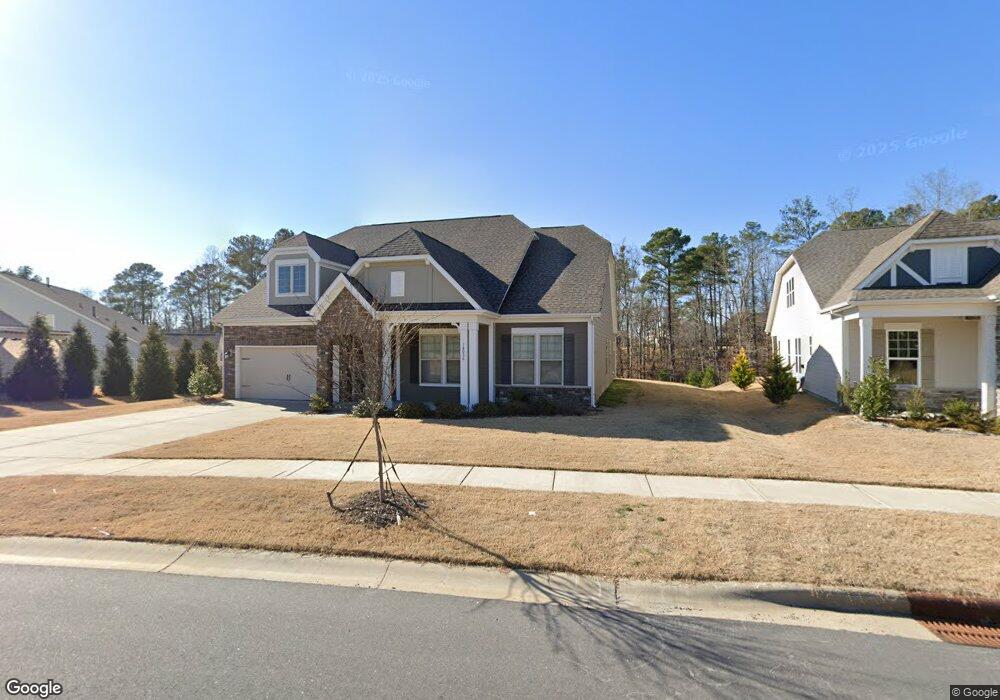
14036 Heron Crest Trace Unit 112 Charlotte, NC 28278
The Palisades NeighborhoodEstimated Value: $586,463 - $628,000
3
Beds
2
Baths
2,450
Sq Ft
$250/Sq Ft
Est. Value
About This Home
This home is located at 14036 Heron Crest Trace Unit 112, Charlotte, NC 28278 and is currently estimated at $612,116, approximately $249 per square foot. 14036 Heron Crest Trace Unit 112 is a home located in Mecklenburg County with nearby schools including Palisades Park Elementary School, Southwest Middle School, and Unity Classical Charter School.
Ownership History
Date
Name
Owned For
Owner Type
Purchase Details
Closed on
Jun 28, 2021
Sold by
Taylor Morrison Of Carolinas Inc
Bought by
Robinson Marquis Dishon and Robinson Crystal Nicole
Current Estimated Value
Home Financials for this Owner
Home Financials are based on the most recent Mortgage that was taken out on this home.
Original Mortgage
$362,588
Interest Rate
2.9%
Mortgage Type
FHA
Purchase Details
Closed on
Nov 25, 2020
Sold by
North Reach Holdings Llc
Bought by
Bonterra Builders Llc
Create a Home Valuation Report for This Property
The Home Valuation Report is an in-depth analysis detailing your home's value as well as a comparison with similar homes in the area
Home Values in the Area
Average Home Value in this Area
Purchase History
| Date | Buyer | Sale Price | Title Company |
|---|---|---|---|
| Robinson Marquis Dishon | $392,000 | None Available | |
| Bonterra Builders Llc | $192,500 | None Available |
Source: Public Records
Mortgage History
| Date | Status | Borrower | Loan Amount |
|---|---|---|---|
| Previous Owner | Robinson Marquis Dishon | $362,588 |
Source: Public Records
Tax History Compared to Growth
Tax History
| Year | Tax Paid | Tax Assessment Tax Assessment Total Assessment is a certain percentage of the fair market value that is determined by local assessors to be the total taxable value of land and additions on the property. | Land | Improvement |
|---|---|---|---|---|
| 2025 | $3,885 | $557,700 | $110,000 | $447,700 |
| 2024 | $3,885 | $557,700 | $110,000 | $447,700 |
| 2023 | $3,824 | $557,700 | $110,000 | $447,700 |
| 2022 | $3,600 | $397,100 | $75,000 | $322,100 |
| 2021 | $656 | $75,000 | $75,000 | $0 |
| 2020 | $653 | $75,000 | $75,000 | $0 |
| 2019 | $646 | $75,000 | $75,000 | $0 |
| 2018 | $391 | $0 | $0 | $0 |
Source: Public Records
Map
Nearby Homes
- 10039 St Kitts Landing Ln
- 16018 River Tree Ln
- 12009 Blue Gull Ct
- 15213 Shallow Ridge Rd
- 15216 Shallow Ridge Rd
- 15636 Oleander Dr
- 18033 Grey Mossrun Dr
- 14008 Little Spring Ct
- 17150 Sand Bank Rd
- 12002 Cove Ct
- 15608 Woodland Ridge Ln Unit 13
- 15818 Sparrowridge Ct
- 12018 Cove Ct
- 17210 Sand Bank Rd
- 15620 Lake Ridge Rd
- 17436 Langston Dr
- 18619 Studman Branch Ave
- 16325 Riverpointe Dr
- 45528 Misty Bluff Dr
- 16321 Riverpointe Dr
- 14032 Heron Crest Trace
- 16044 Deer River Rd
- 16040 Deer River Rd Unit 111
- 14037 Heron Crest Trace Unit 131
- 16048 Deer River Rd
- 16041 Deer River Rd
- 14027 Heron Crest Trace Unit 130
- 16032 Deer River Rd Unit NR 132
- 14021 Heron Crest Trace Unit 129
- 0 Heron Crest Trace
- 16028 Deer River Rd Unit 133
- 16028 Deer River Rd
- 16045 Deer River Rd
- 15905 Turtle Grove Trail
- 16049 Deer River Rd
- 14015 Heron Crest Trace Unit 128
- 16022 Deer River Rd Unit NR 134
- 14008 Heron Crest Trace
- 16037 Deer River Rd
- 16033 Deer River Rd