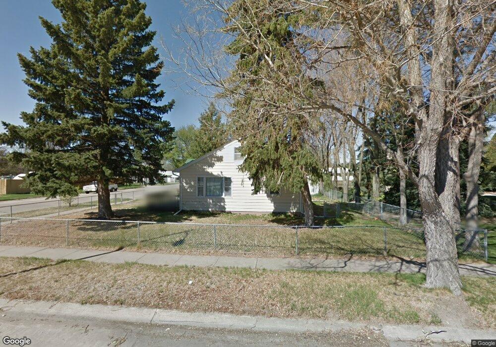
1404 Emerson Ave Alliance, NE 69301
Estimated Value: $116,000 - $118,000
2
Beds
1
Bath
960
Sq Ft
$122/Sq Ft
Est. Value
About This Home
This home is located at 1404 Emerson Ave, Alliance, NE 69301 and is currently estimated at $117,156, approximately $122 per square foot. 1404 Emerson Ave is a home located in Box Butte County with nearby schools including Alliance High School, St. Agnes Academy, and Immanuel Evangelical Lutheran School.
Ownership History
Date
Name
Owned For
Owner Type
Purchase Details
Closed on
Jan 24, 2019
Sold by
Lonetree Holdings Llc
Bought by
Cody Jeffrey C and Hiemstra Sydnie M
Current Estimated Value
Purchase Details
Closed on
Jun 29, 2017
Sold by
Birch Susan L
Bought by
Lonetree Holdings Llc
Purchase Details
Closed on
Jun 8, 2009
Sold by
Leesman Mary Jane and Parris Ndoplhas D
Bought by
Birch Susan Louise
Create a Home Valuation Report for This Property
The Home Valuation Report is an in-depth analysis detailing your home's value as well as a comparison with similar homes in the area
Home Values in the Area
Average Home Value in this Area
Purchase History
| Date | Buyer | Sale Price | Title Company |
|---|---|---|---|
| Cody Jeffrey C | $75,000 | -- | |
| Lonetree Holdings Llc | $43,000 | -- | |
| Birch Susan Louise | -- | -- |
Source: Public Records
Tax History Compared to Growth
Tax History
| Year | Tax Paid | Tax Assessment Tax Assessment Total Assessment is a certain percentage of the fair market value that is determined by local assessors to be the total taxable value of land and additions on the property. | Land | Improvement |
|---|---|---|---|---|
| 2024 | $1,103 | $88,060 | $11,200 | $76,860 |
| 2023 | $1,514 | $88,060 | $11,200 | $76,860 |
| 2022 | $1,467 | $80,570 | $10,080 | $70,490 |
| 2021 | $1,485 | $80,570 | $10,080 | $70,490 |
| 2020 | $1,481 | $80,570 | $10,080 | $70,490 |
| 2019 | $1,446 | $80,570 | $10,080 | $70,490 |
| 2018 | $1,439 | $80,570 | $10,080 | $70,490 |
| 2017 | $1,492 | $80,381 | $9,520 | $70,861 |
| 2016 | $1,475 | $80,381 | $9,520 | $70,861 |
| 2015 | $1,363 | $76,370 | $9,520 | $66,850 |
| 2014 | $1,363 | $76,370 | $9,520 | $66,850 |
Source: Public Records
Map
Nearby Homes
- 1239 Toluca Ave
- 936 Platte Ave
- 1021 Dakota Ave
- 911 Emerson Ave
- 20th St Emerson Ave To Colorado Ave
- 924 Big Horn Ave
- 907 Toluca Ave
- 819 Black Hills Ave
- 672 W 20th St
- 1019 Laramie Ave
- 904 Laramie Ave
- 719 Toluca Ave
- 621 Emerson Ave
- 2039 Niobrara Ave
- 420 Laramie Ave
- 316 Big Horn Ave
- 1004 Missouri Ave
- 615 Sweetwater Ave
- 917 Missouri Ave
- 1120 Potash Ave
- 1412 Emerson Ave
- 1236 Emerson Ave
- 1403 Platte Ave
- 1407 Platte Ave
- 1403 Emerson Ave
- 1232 Emerson Ave
- 1239 Platte Ave
- 1411 Platte Ave
- 1420 Emerson Ave
- 1321 Emerson Ave
- 1235 Platte Ave
- 520 W 14th St
- 1411 Emerson Ave
- 1228 Emerson Ave
- 1417 Emerson Ave
- 1415 Platte Ave
- 517 W 14th St
- 1231 Platte Ave
- 1224 Emerson Ave
- 1428 Emerson Ave