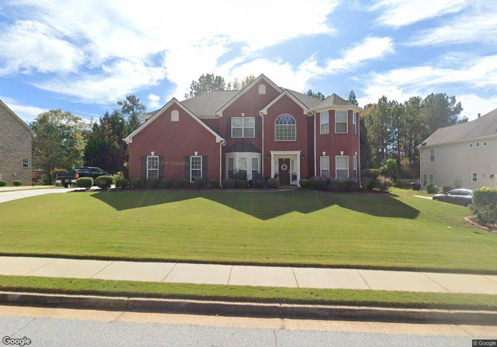
1404 Manston Ct Unit 3 Conyers, GA 30013
Estimated Value: $400,788 - $520,000
5
Beds
3
Baths
3,213
Sq Ft
$137/Sq Ft
Est. Value
About This Home
This home is located at 1404 Manston Ct Unit 3, Conyers, GA 30013 and is currently estimated at $441,697, approximately $137 per square foot. 1404 Manston Ct Unit 3 is a home located in Rockdale County with nearby schools including Honey Creek Elementary School, Memorial Middle School, and Salem High School.
Ownership History
Date
Name
Owned For
Owner Type
Purchase Details
Closed on
May 13, 2016
Sold by
Shurma
Bought by
Pitt Shurma M and Pitt Jerome A
Current Estimated Value
Home Financials for this Owner
Home Financials are based on the most recent Mortgage that was taken out on this home.
Original Mortgage
$239,026
Outstanding Balance
$188,463
Interest Rate
3.37%
Mortgage Type
FHA
Estimated Equity
$253,234
Purchase Details
Closed on
May 25, 2006
Sold by
The Ryland Grp Inc
Bought by
Pitt Shurma
Home Financials for this Owner
Home Financials are based on the most recent Mortgage that was taken out on this home.
Original Mortgage
$268,250
Interest Rate
6.44%
Purchase Details
Closed on
Nov 28, 2005
Sold by
Circle T Investors Llc
Bought by
The Ryland Grp Inc
Create a Home Valuation Report for This Property
The Home Valuation Report is an in-depth analysis detailing your home's value as well as a comparison with similar homes in the area
Home Values in the Area
Average Home Value in this Area
Purchase History
| Date | Buyer | Sale Price | Title Company |
|---|---|---|---|
| Pitt Shurma M | -- | -- | |
| Pitt Shurma | $335,800 | -- | |
| The Ryland Grp Inc | $200,000 | -- |
Source: Public Records
Mortgage History
| Date | Status | Borrower | Loan Amount |
|---|---|---|---|
| Open | Pitt Shurma M | $239,026 | |
| Previous Owner | Pitt Shurma | $268,250 |
Source: Public Records
Tax History Compared to Growth
Tax History
| Year | Tax Paid | Tax Assessment Tax Assessment Total Assessment is a certain percentage of the fair market value that is determined by local assessors to be the total taxable value of land and additions on the property. | Land | Improvement |
|---|---|---|---|---|
| 2024 | $4,517 | $179,040 | $32,520 | $146,520 |
| 2023 | $4,551 | $186,160 | $36,080 | $150,080 |
| 2022 | $3,986 | $164,160 | $31,880 | $132,280 |
| 2021 | $3,171 | $124,160 | $23,800 | $100,360 |
| 2020 | $3,240 | $121,560 | $21,200 | $100,360 |
| 2019 | $2,445 | $93,080 | $13,360 | $79,720 |
| 2018 | $2,460 | $93,080 | $13,360 | $79,720 |
| 2017 | $2,625 | $97,280 | $13,360 | $83,920 |
| 2016 | $2,425 | $97,280 | $13,360 | $83,920 |
| 2015 | $2,032 | $83,560 | $12,240 | $71,320 |
| 2014 | $2,161 | $96,880 | $12,960 | $83,920 |
| 2013 | -- | $106,400 | $19,000 | $87,400 |
Source: Public Records
Map
Nearby Homes
- 1115 Fountain Crest Dr
- 1388 Fall River Dr
- 1613 Brolington Ct
- 3180 Highway 20 SE
- 464 Reflection Creek Dr
- 440 Reflection Creek Dr
- 452 Reflection Creek Dr
- 2513 Riverton Dr
- 820 Bridgewater Way SE
- 1813 Holmsey Cir
- 812 Raintree Way SE
- 2923 Raintree Dr SE
- 917 Curry Cir SE
- 2924 Raintree Dr SE
- 2754 Harvest Dr SE
- 2304 Northglenn Ct
- 3265 Highway 20 SE
- 832 Virginia Ct SE
- 2405 Brisbane Dr
- 1001 Fox St SE
- 1408 Manston Ct
- 1400 Manston Ct Unit 3
- 1221 Bracknell Ct Unit 3
- 1231 Bracknell Ct
- 1231 Bracknell Ct SE
- 1405 Manston Ct
- 1412 Manston Ct
- 1235 Bracknell Ct Unit 3
- 1401 Manston Ct Unit 3
- 1409 Manston Ct
- 1208 Bracknell Ct
- 1212 Bracknell Ct
- 1413 Manston Ct Unit 248
- 1413 Manston Ct
- 1220 Bracknell Ct Unit 3
- 1239 Bracknell Ct Unit 3
- 1416 Manston Ct Unit 3
- 1224 Bracknell Ct
- 1216 Bracknell Ct
- 1204 Bracknell Ct