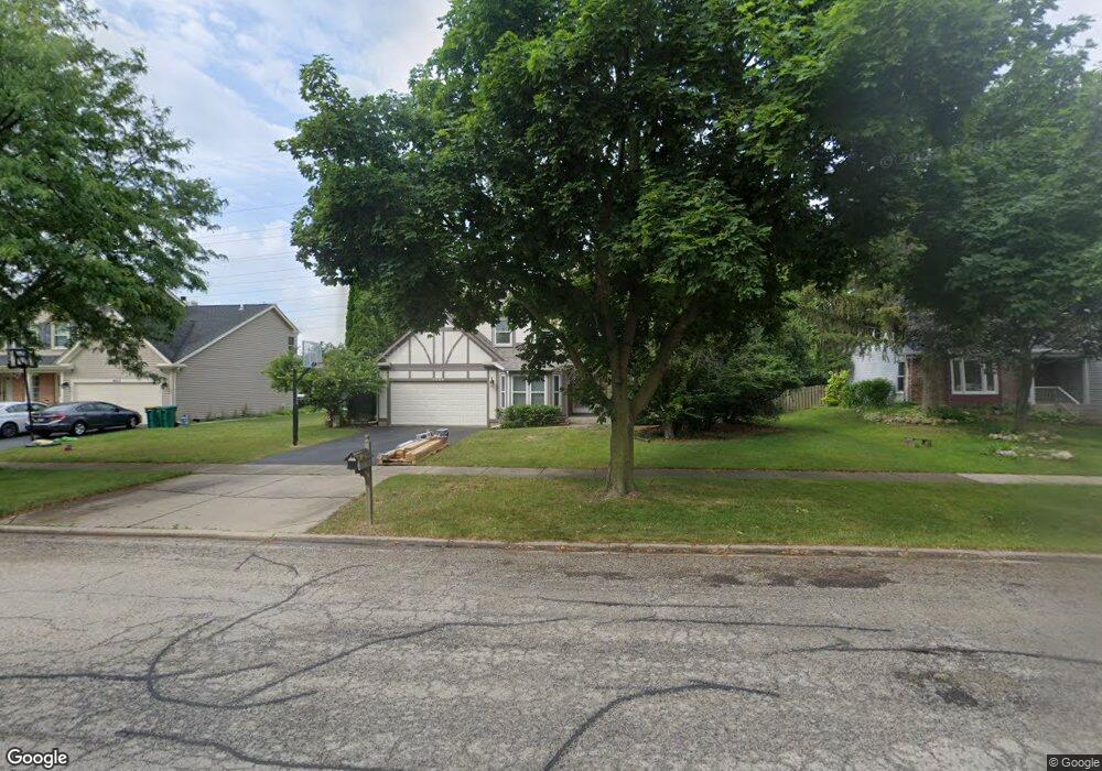
1404 Margate Dr Buffalo Grove, IL 60089
Estimated Value: $567,169 - $604,000
3
Beds
3
Baths
2,096
Sq Ft
$283/Sq Ft
Est. Value
About This Home
This home is located at 1404 Margate Dr, Buffalo Grove, IL 60089 and is currently estimated at $593,042, approximately $282 per square foot. 1404 Margate Dr is a home located in Lake County with nearby schools including Meridian Middle School, Tripp Elementary School, and Aptakisic Junior High School.
Ownership History
Date
Name
Owned For
Owner Type
Purchase Details
Closed on
Jul 11, 2022
Sold by
Cimino Lawrence P and Cimino Christine
Bought by
Lawrence P Cimino Living Trust and Christine K Cimino Living Trust
Current Estimated Value
Purchase Details
Closed on
Aug 31, 2003
Sold by
Deiter Jonathan W and Deiter Julie A
Bought by
Cimino Lawrence P and Cimino Christine
Home Financials for this Owner
Home Financials are based on the most recent Mortgage that was taken out on this home.
Original Mortgage
$250,000
Interest Rate
6.43%
Mortgage Type
Purchase Money Mortgage
Create a Home Valuation Report for This Property
The Home Valuation Report is an in-depth analysis detailing your home's value as well as a comparison with similar homes in the area
Home Values in the Area
Average Home Value in this Area
Purchase History
| Date | Buyer | Sale Price | Title Company |
|---|---|---|---|
| Lawrence P Cimino Living Trust | -- | None Listed On Document | |
| Cimino Lawrence P | $395,000 | 1St American Title |
Source: Public Records
Mortgage History
| Date | Status | Borrower | Loan Amount |
|---|---|---|---|
| Previous Owner | Cimino Lawrence P | $250,000 |
Source: Public Records
Tax History Compared to Growth
Tax History
| Year | Tax Paid | Tax Assessment Tax Assessment Total Assessment is a certain percentage of the fair market value that is determined by local assessors to be the total taxable value of land and additions on the property. | Land | Improvement |
|---|---|---|---|---|
| 2024 | $14,710 | $166,236 | $30,418 | $135,818 |
| 2023 | $12,880 | $150,823 | $27,598 | $123,225 |
| 2022 | $12,880 | $137,832 | $25,221 | $112,611 |
| 2021 | $12,423 | $136,346 | $24,949 | $111,397 |
| 2020 | $12,181 | $136,811 | $25,034 | $111,777 |
| 2019 | $11,859 | $136,307 | $24,942 | $111,365 |
| 2018 | $12,274 | $140,634 | $27,114 | $113,520 |
| 2017 | $12,114 | $137,351 | $26,481 | $110,870 |
| 2016 | $11,692 | $131,525 | $25,358 | $106,167 |
| 2015 | $11,460 | $123,001 | $23,715 | $99,286 |
| 2014 | $10,260 | $109,573 | $25,470 | $84,103 |
| 2012 | $10,184 | $109,793 | $25,521 | $84,272 |
Source: Public Records
Map
Nearby Homes
- 276 Stanton Dr
- 15 Thompson Ct
- 16202 W Aptakisic Rd
- 22118 N Prairie Rd
- 1012 Hobson Dr
- 913 Hobson Dr
- 381 Bentley Place
- 437 Caren Dr
- 51 W Fabish Dr
- 1113 Lockwood Dr
- 938 Hidden Lake Dr
- 2033 Olive Hill Dr
- 538 Lasalle Ct
- 268 Hoffmann Dr
- 2071 Wright Blvd
- 361 Hoffmann Dr
- 12 Aberdeen Ct
- 720 Dunhill Dr
- 333 Didier Ct
- 670 Dunhill Dr
- 1402 Margate Dr
- 1406 Margate Dr
- 1408 Margate Dr
- 1400 Margate Dr
- 1405 Margate Dr Unit 7
- 1403 Margate Dr
- 1407 Margate Dr
- 1410 Margate Dr
- 1401 Margate Dr
- 1409 Margate Dr
- 1402 Village Ct
- 1342 Devonwood Ct
- 1404 Village Ct
- 1334 Devonwood Ct
- 1412 Margate Dr
- 142 Thompson Blvd
- 181 Thompson Blvd
- 183 Thompson Blvd
- 1350 Devonwood Ct
- 203 Stanton Dr