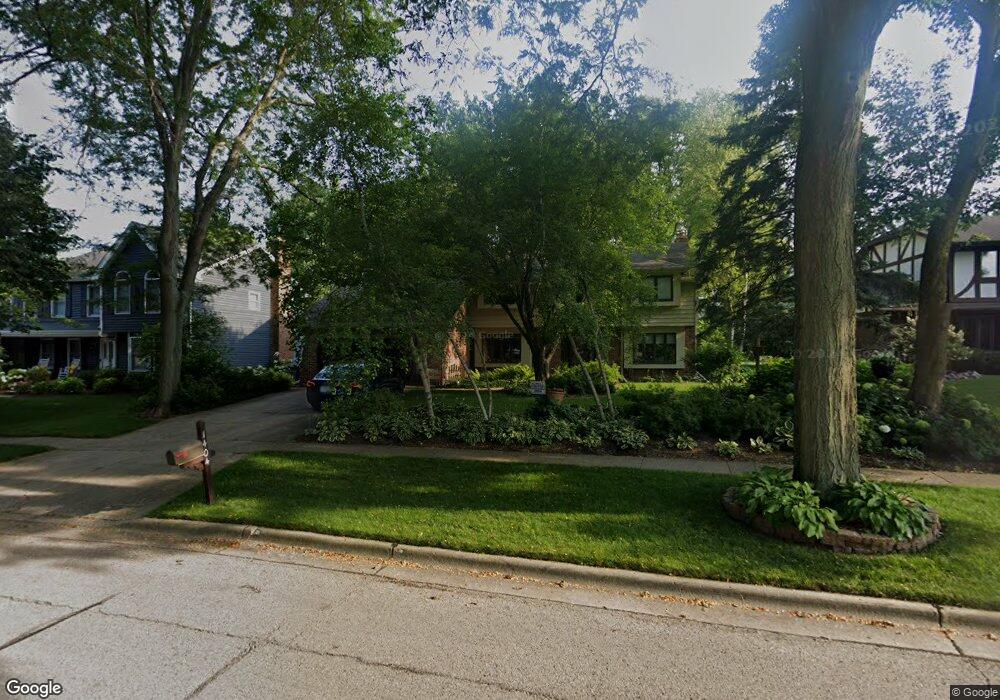
1404 Stevenson Dr Libertyville, IL 60048
South Libertyville NeighborhoodEstimated Value: $663,690 - $819,000
--
Bed
3
Baths
2,796
Sq Ft
$268/Sq Ft
Est. Value
About This Home
This home is located at 1404 Stevenson Dr, Libertyville, IL 60048 and is currently estimated at $748,173, approximately $267 per square foot. 1404 Stevenson Dr is a home located in Lake County with nearby schools including Copeland Manor Elementary School, Highland Middle School, and Libertyville High School.
Ownership History
Date
Name
Owned For
Owner Type
Purchase Details
Closed on
Jun 30, 2006
Sold by
Stewart James Lawrence and Miller Stewart Beverly Ann
Bought by
Field David E and Olson Christine D
Current Estimated Value
Home Financials for this Owner
Home Financials are based on the most recent Mortgage that was taken out on this home.
Original Mortgage
$235,000
Interest Rate
6.73%
Mortgage Type
Purchase Money Mortgage
Purchase Details
Closed on
Mar 27, 2000
Sold by
Stewart James Lawrence and Miller Stewart Beverly Ann
Bought by
Stewart James Lawrence and Miller Stewart Beverly Ann
Purchase Details
Closed on
Sep 12, 1996
Sold by
Markwell Nancy K and Nancy K Markwell Living Trust
Bought by
Stewart James L and Miller Stewart Beverly A
Home Financials for this Owner
Home Financials are based on the most recent Mortgage that was taken out on this home.
Original Mortgage
$250,000
Interest Rate
7.58%
Purchase Details
Closed on
Apr 12, 1995
Sold by
Markwell Warren D and Markwell Nancy K
Bought by
Markwell Nancy K and Nancy K Markwell Living Trust
Create a Home Valuation Report for This Property
The Home Valuation Report is an in-depth analysis detailing your home's value as well as a comparison with similar homes in the area
Home Values in the Area
Average Home Value in this Area
Purchase History
| Date | Buyer | Sale Price | Title Company |
|---|---|---|---|
| Field David E | $635,000 | 1St American Title | |
| Stewart James Lawrence | -- | -- | |
| Stewart James L | $345,000 | Chicago Title Insurance Co | |
| Markwell Nancy K | -- | -- |
Source: Public Records
Mortgage History
| Date | Status | Borrower | Loan Amount |
|---|---|---|---|
| Closed | Field David E | $235,000 | |
| Previous Owner | Stewart James L | $250,000 |
Source: Public Records
Tax History Compared to Growth
Tax History
| Year | Tax Paid | Tax Assessment Tax Assessment Total Assessment is a certain percentage of the fair market value that is determined by local assessors to be the total taxable value of land and additions on the property. | Land | Improvement |
|---|---|---|---|---|
| 2024 | $11,918 | $177,791 | $63,464 | $114,327 |
| 2023 | $12,802 | $163,983 | $58,535 | $105,448 |
| 2022 | $12,802 | $171,073 | $56,263 | $114,810 |
| 2021 | $12,711 | $167,391 | $55,052 | $112,339 |
| 2020 | $12,233 | $164,576 | $54,126 | $110,450 |
| 2019 | $11,929 | $163,011 | $53,611 | $109,400 |
| 2018 | $11,162 | $171,600 | $53,339 | $118,261 |
| 2017 | $11,996 | $166,182 | $51,655 | $114,527 |
| 2016 | $11,599 | $157,563 | $48,976 | $108,587 |
| 2015 | $11,495 | $147,269 | $45,776 | $101,493 |
| 2014 | $11,746 | $147,393 | $45,164 | $102,229 |
| 2012 | $11,289 | $148,672 | $45,556 | $103,116 |
Source: Public Records
Map
Nearby Homes
- 20924 & 20902 W Park Ave
- 1330 W Park Ave
- 1137 Pine Tree Ln
- 223 Kenloch Ave
- 847 Mckinley Ave
- 328 Brice Ave
- 422 James Ave
- 2245 Hazeltime Dr
- 659 E Maple Ave
- 422 Shadow Creek Dr
- 841 Wilcox St
- 215 Brice Ave
- 261 N Shaddle Ave
- 535 E Maple Ave
- 0 Ames St
- 423 Ames St
- 1017 Juniper Pkwy
- 551 W Park Ave Unit E
- 777 Garfield Ave Unit A
- 31 Washington Blvd Unit 108
- 1408 Stevenson Dr
- 1400 Stevenson Dr
- 1412 Stevenson Dr
- 501 Stevenson Dr
- 1316 Canterbury Cir
- 1401 Stevenson Dr
- 1320 Canterbury Cir
- 511 Stevenson Dr
- 1312 Canterbury Cir
- 1416 Stevenson Dr
- 1411 Stevenson Dr
- 1407 Stevenson Dr
- 1403 Stevenson Dr
- 1415 Stevenson Dr
- 521 Stevenson Dr
- 1324 Canterbury Cir
- 1405 Stevenson Dr
- 1419 Stevenson Dr
- 512 Stevenson Dr
- 527 Lothair Dr