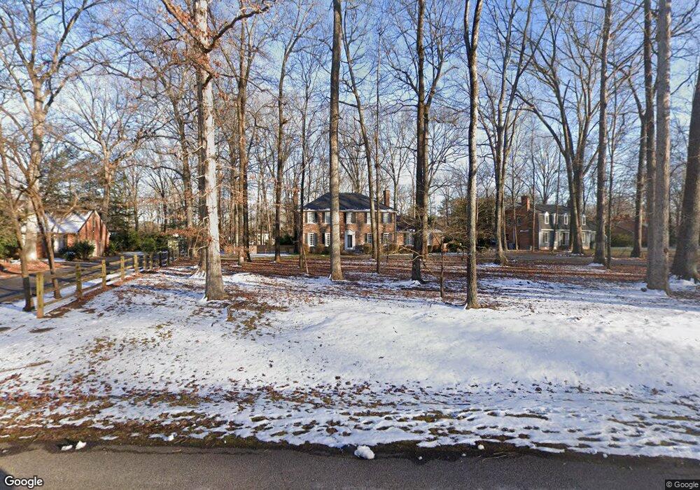
14041 Netherfield Dr Midlothian, VA 23113
Salisbury NeighborhoodEstimated Value: $579,000 - $710,000
4
Beds
3
Baths
2,696
Sq Ft
$243/Sq Ft
Est. Value
About This Home
This home is located at 14041 Netherfield Dr, Midlothian, VA 23113 and is currently estimated at $656,273, approximately $243 per square foot. 14041 Netherfield Dr is a home located in Chesterfield County with nearby schools including Bettie Weaver Elementary School, Midlothian Middle School, and Midlothian High School.
Ownership History
Date
Name
Owned For
Owner Type
Purchase Details
Closed on
Mar 22, 2022
Sold by
Michael Martha B
Bought by
Ellmore Victoria Rollins
Current Estimated Value
Home Financials for this Owner
Home Financials are based on the most recent Mortgage that was taken out on this home.
Original Mortgage
$428,000
Outstanding Balance
$400,956
Interest Rate
4.16%
Mortgage Type
Balloon
Estimated Equity
$255,317
Purchase Details
Closed on
Jan 26, 2001
Bought by
Michael Jack A and Michael Martha B
Home Financials for this Owner
Home Financials are based on the most recent Mortgage that was taken out on this home.
Original Mortgage
$100,000
Interest Rate
7.39%
Mortgage Type
New Conventional
Create a Home Valuation Report for This Property
The Home Valuation Report is an in-depth analysis detailing your home's value as well as a comparison with similar homes in the area
Home Values in the Area
Average Home Value in this Area
Purchase History
| Date | Buyer | Sale Price | Title Company |
|---|---|---|---|
| Ellmore Victoria Rollins | $535,000 | First American Title | |
| Michael Jack A | -- | -- |
Source: Public Records
Mortgage History
| Date | Status | Borrower | Loan Amount |
|---|---|---|---|
| Open | Ellmore Victoria Rollins | $428,000 | |
| Previous Owner | Michael Jack A | $100,000 |
Source: Public Records
Tax History Compared to Growth
Tax History
| Year | Tax Paid | Tax Assessment Tax Assessment Total Assessment is a certain percentage of the fair market value that is determined by local assessors to be the total taxable value of land and additions on the property. | Land | Improvement |
|---|---|---|---|---|
| 2025 | $5,150 | $575,800 | $131,000 | $444,800 |
| 2024 | $5,150 | $531,900 | $111,000 | $420,900 |
| 2023 | $4,513 | $495,900 | $106,000 | $389,900 |
| 2022 | $4,330 | $470,700 | $103,000 | $367,700 |
| 2021 | $4,119 | $430,900 | $101,000 | $329,900 |
| 2020 | $3,987 | $417,000 | $101,000 | $316,000 |
| 2019 | $3,962 | $417,000 | $101,000 | $316,000 |
| 2018 | $3,808 | $403,900 | $101,000 | $302,900 |
| 2017 | $3,755 | $388,500 | $100,000 | $288,500 |
| 2016 | $3,699 | $385,300 | $96,000 | $289,300 |
| 2015 | $3,550 | $369,800 | $96,000 | $273,800 |
| 2014 | $3,462 | $360,600 | $96,000 | $264,600 |
Source: Public Records
Map
Nearby Homes
- 14110 Netherfield Dr
- 13901 Dunkeld Terrace
- 3020 Mount Hill Dr
- 14100 Worchester Ct
- 16037 Aspect Way
- 16033 Aspect Way
- 16112 Esteem Way
- 1175 Cardinal Crest Terrace
- 16116 Esteem Way
- 3200 Queens Grant Dr
- 14560 Kenmont Dr
- 14335 Lander Rd
- 16106 Swallowtail Place
- 3231 Queens Grant Dr
- 2360 Castlebridge Rd
- 2725 Stonegate Ct
- 521 Bel Crest Terrace
- 2141 Chepstow Terrace
- 816 Founders Grant Place
- 13449 Glendower Rd
- 2831 Queenswood Rd
- 14031 Netherfield Dr
- 2821 Queenswood Rd
- 2901 Queenswood Rd
- 2860 W Brigstock Rd
- 14021 Netherfield Dr
- 2900 W Brigstock Rd
- 2850 W Brigstock Rd
- 2830 Queenswood Rd
- 2811 Queenswood Rd
- 2820 Queenswood Rd
- 14020 Netherfield Dr
- 2900 Queenswood Rd
- 2840 W Brigstock Rd
- 2911 Queenswood Rd
- 2920 W Brigstock Rd
- 2810 Queenswood Rd
- 2940 W Brigstock Rd
- 2801 Queenswood Rd