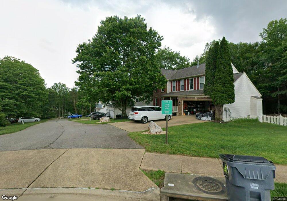
14043 Sable Ct Woodbridge, VA 22193
Lindendale NeighborhoodEstimated Value: $667,884 - $709,000
4
Beds
3
Baths
2,464
Sq Ft
$276/Sq Ft
Est. Value
About This Home
This home is located at 14043 Sable Ct, Woodbridge, VA 22193 and is currently estimated at $681,221, approximately $276 per square foot. 14043 Sable Ct is a home located in Prince William County with nearby schools including Enterprise Elementary School, C.D. Hylton High School, and Stuart M. Beville Middle School.
Ownership History
Date
Name
Owned For
Owner Type
Purchase Details
Closed on
Mar 31, 1999
Sold by
Washington Homes Inc Of V
Bought by
Mcgee Charles L
Current Estimated Value
Home Financials for this Owner
Home Financials are based on the most recent Mortgage that was taken out on this home.
Original Mortgage
$199,226
Outstanding Balance
$49,358
Interest Rate
6.78%
Estimated Equity
$631,863
Create a Home Valuation Report for This Property
The Home Valuation Report is an in-depth analysis detailing your home's value as well as a comparison with similar homes in the area
Home Values in the Area
Average Home Value in this Area
Purchase History
| Date | Buyer | Sale Price | Title Company |
|---|---|---|---|
| Mcgee Charles L | $207,000 | -- |
Source: Public Records
Mortgage History
| Date | Status | Borrower | Loan Amount |
|---|---|---|---|
| Open | Mcgee Charles L | $199,226 |
Source: Public Records
Tax History Compared to Growth
Tax History
| Year | Tax Paid | Tax Assessment Tax Assessment Total Assessment is a certain percentage of the fair market value that is determined by local assessors to be the total taxable value of land and additions on the property. | Land | Improvement |
|---|---|---|---|---|
| 2025 | $6,114 | $625,700 | $238,800 | $386,900 |
| 2024 | $6,114 | $614,800 | $234,100 | $380,700 |
| 2023 | $6,010 | $577,600 | $218,800 | $358,800 |
| 2022 | $5,837 | $527,000 | $198,900 | $328,100 |
| 2021 | $5,341 | $436,900 | $164,300 | $272,600 |
| 2020 | $6,632 | $427,900 | $161,100 | $266,800 |
| 2019 | $6,398 | $412,800 | $156,400 | $256,400 |
| 2018 | $4,852 | $401,800 | $150,400 | $251,400 |
| 2017 | $4,754 | $384,900 | $143,200 | $241,700 |
| 2016 | $4,879 | $399,100 | $147,600 | $251,500 |
| 2015 | $4,509 | $369,400 | $136,200 | $233,200 |
| 2014 | $4,509 | $360,400 | $132,300 | $228,100 |
Source: Public Records
Map
Nearby Homes
- 14072 Oxbridge Inn Ct
- 13918 Lynhurst Dr
- 4690 Pearson Dr
- 14160 Landon Ln
- 14591 Estate Dr
- 13871 Langstone Dr
- 14297 Felty Place
- 4700 Korvett Dr
- 13652 Kingsman Rd
- 14010 Mapledale Ave
- 14435 Delaney Rd
- 13626 Kingsman Rd
- 13737 Moccasin Ct
- 13546 Kaslo Dr
- 13612 Kerrydale Rd
- 14341 N Park Ct
- 4612 Central Park Dr
- 4722 Dane Ridge Cir
- 4903 Kenyon Ct
- 14536 General Washington Dr
- 14039 Sable Ct
- 14047 Sable Ct
- 14035 Sable Ct
- 14031 Sable Ct
- 14034 Sable Ct
- 13912 Mipalsal Ct
- 13908 Mipalsal Ct
- 14030 Sable Ct
- 4823 Pearson Dr
- 4819 Pearson Dr
- 13904 Mipalsal Ct
- 4815 Pearson Dr
- 13915 Mipalsal Ct
- 14026 Sable Ct
- 4791 Pearson Dr
- 4835 Pearson Dr
- 14037 Sable Ct
- 4787 Pearson Dr
- 13900 Mipalsal Ct
- 4824 Pearson Dr