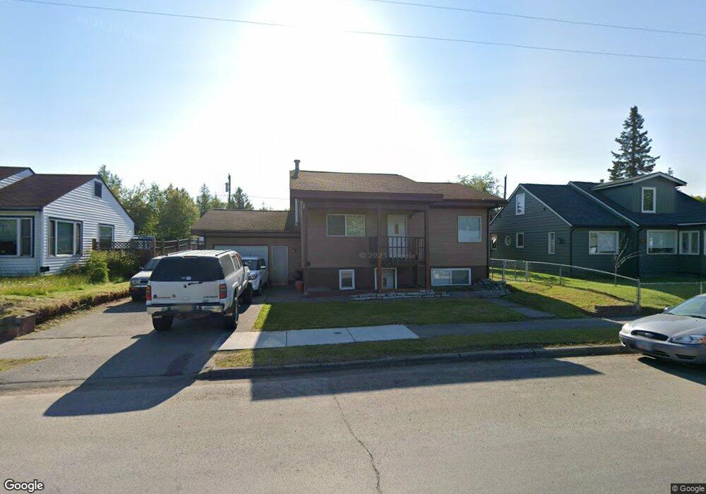
1405 Airport Heights Dr Anchorage, AK 99508
Airport Heights NeighborhoodEstimated Value: $202,000 - $384,922
4
Beds
2
Baths
900
Sq Ft
$334/Sq Ft
Est. Value
About This Home
This home is located at 1405 Airport Heights Dr, Anchorage, AK 99508 and is currently estimated at $300,231, approximately $333 per square foot. 1405 Airport Heights Dr is a home located in Anchorage Municipality with nearby schools including Airport Heights Elementary School, Wendler Middle School, and Bettye Davis East Anchorage High School.
Ownership History
Date
Name
Owned For
Owner Type
Purchase Details
Closed on
Nov 13, 2017
Sold by
Aumua Faletolu A and Aumua Lattie
Bought by
Aumua Faletolu A and Aumua Lattie
Current Estimated Value
Home Financials for this Owner
Home Financials are based on the most recent Mortgage that was taken out on this home.
Original Mortgage
$205,000
Outstanding Balance
$171,236
Interest Rate
3.91%
Mortgage Type
VA
Estimated Equity
$128,995
Purchase Details
Closed on
Apr 21, 1997
Sold by
Aumua Faletolu A and Fernandez Lattie
Bought by
Aumua Faletolu A and Aumua Lattie
Home Financials for this Owner
Home Financials are based on the most recent Mortgage that was taken out on this home.
Original Mortgage
$45,000
Interest Rate
7.86%
Mortgage Type
New Conventional
Purchase Details
Closed on
Nov 6, 1990
Sold by
Alaska Housing Finance Corp
Bought by
Aumua Faletolu A and Fernandez Lattie
Home Financials for this Owner
Home Financials are based on the most recent Mortgage that was taken out on this home.
Original Mortgage
$75,363
Interest Rate
10.37%
Mortgage Type
FHA
Create a Home Valuation Report for This Property
The Home Valuation Report is an in-depth analysis detailing your home's value as well as a comparison with similar homes in the area
Home Values in the Area
Average Home Value in this Area
Purchase History
| Date | Buyer | Sale Price | Title Company |
|---|---|---|---|
| Aumua Faletolu A | -- | Servicelink | |
| Aumua Faletolu A | -- | -- | |
| Aumua Faletolu A | -- | -- | |
| Aumua Faletolu A | -- | -- | |
| Aumua Faletolu A | -- | -- | |
| Aumua Faletolu A | -- | -- |
Source: Public Records
Mortgage History
| Date | Status | Borrower | Loan Amount |
|---|---|---|---|
| Open | Aumua Faletolu A | $205,000 | |
| Closed | Aumua Faletolu A | $45,000 | |
| Previous Owner | Aumua Faletolu A | $75,363 |
Source: Public Records
Tax History Compared to Growth
Tax History
| Year | Tax Paid | Tax Assessment Tax Assessment Total Assessment is a certain percentage of the fair market value that is determined by local assessors to be the total taxable value of land and additions on the property. | Land | Improvement |
|---|---|---|---|---|
| 2025 | $4,269 | $360,200 | $94,600 | $265,600 |
| 2024 | $4,269 | $339,400 | $94,600 | $244,800 |
| 2023 | $4,767 | $279,900 | $94,600 | $185,300 |
| 2022 | $3,695 | $269,400 | $94,600 | $174,800 |
| 2021 | $4,588 | $254,600 | $94,600 | $160,000 |
| 2020 | $3,419 | $251,400 | $94,600 | $156,800 |
| 2019 | $3,274 | $250,100 | $94,600 | $155,500 |
| 2018 | $3,282 | $250,100 | $94,600 | $155,500 |
| 2017 | $3,688 | $255,500 | $94,600 | $160,900 |
| 2016 | $2,620 | $237,800 | $81,200 | $156,600 |
| 2015 | $2,620 | $230,300 | $81,200 | $149,100 |
| 2014 | $2,620 | $230,000 | $77,000 | $153,000 |
Source: Public Records
Map
Nearby Homes
- 1414 Airport Heights Dr
- 1430 Columbine St
- 3401 E 15th Ave
- 1701 Aleutian St
- 1811 Talkeetna St
- 2215 Sunburst Cir
- 4011 San Roberto Ave
- 1760 Eastridge Dr
- 000 Tr A Thurston
- 3964 Reka Dr Unit D3
- 611 Bragaw St
- 550 Bragaw St
- 1625 Sitka St Unit 103
- 1833 Parkside Dr
- 4075 E 20th Ave Unit B44
- 4026 E 6th Ave
- 4333 San Ernesto Ave Unit W208
- 4333 San Ernesto Ave Unit 207A
- 1803 Parkside Dr
- 4330 San Roberto Ave
- 1335 Airport Heights Dr
- 1417 Airport Heights Dr
- 1327 Airport Heights Dr
- 1419 Airport Heights Dr
- 1404 Kinnikinnick St
- 1336 Kinnikinnick St
- 1412 Kinnikinnick St
- 1325 Airport Heights Dr
- 1427 Airport Heights Dr
- 1400 Airport Heights Dr
- 1328 Kinnikinnick St
- 1420 Kinnikinnick St
- 1340 Airport Heights Dr
- 1318 Kinnikinnick St
- 1426 Kinnikinnick St
- 1313 Airport Heights Dr
- 1435 Airport Heights Dr
- 1424 Airport Heights Dr
- 1312 Kinnikinnick St
- 1434 Kinnikinnick St