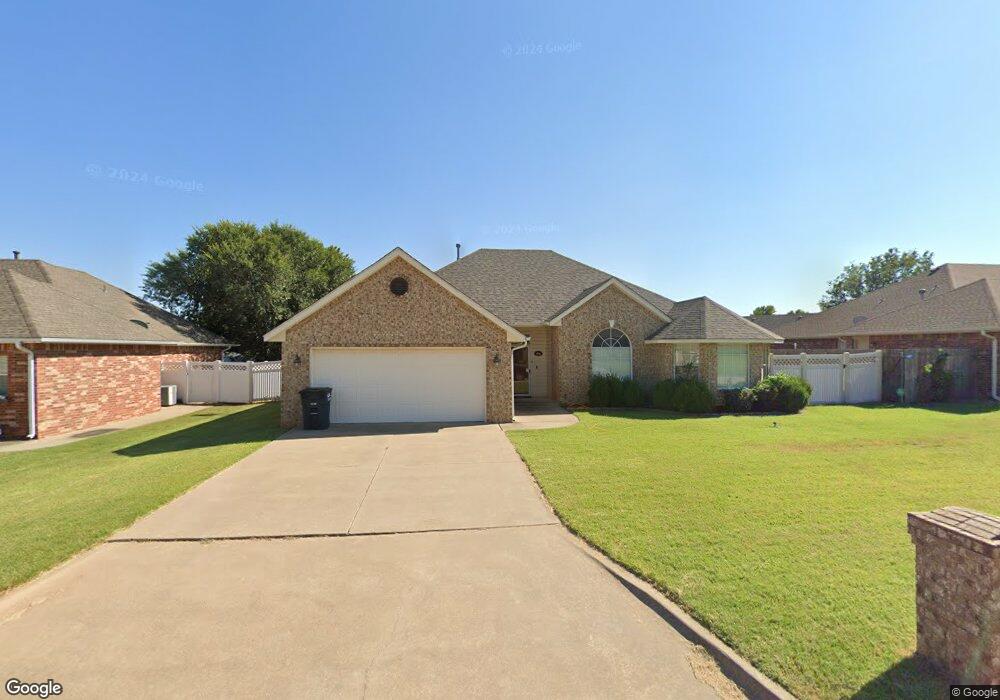
1405 Berkshire Place Shawnee, OK 74804
Estimated Value: $274,951 - $293,000
3
Beds
2
Baths
1,933
Sq Ft
$146/Sq Ft
Est. Value
About This Home
This home is located at 1405 Berkshire Place, Shawnee, OK 74804 and is currently estimated at $282,988, approximately $146 per square foot. 1405 Berkshire Place is a home located in Pottawatomie County.
Ownership History
Date
Name
Owned For
Owner Type
Purchase Details
Closed on
Jan 31, 2008
Sold by
Robertson Wynnell and Robertson Ted
Bought by
Farmer Tommy and Farmer Sharon L
Current Estimated Value
Home Financials for this Owner
Home Financials are based on the most recent Mortgage that was taken out on this home.
Original Mortgage
$130,800
Outstanding Balance
$82,893
Interest Rate
6.15%
Mortgage Type
Purchase Money Mortgage
Estimated Equity
$200,095
Purchase Details
Closed on
Mar 12, 2001
Sold by
Sha Development Corp
Bought by
Tom Brown Homes Inc
Create a Home Valuation Report for This Property
The Home Valuation Report is an in-depth analysis detailing your home's value as well as a comparison with similar homes in the area
Home Values in the Area
Average Home Value in this Area
Purchase History
| Date | Buyer | Sale Price | Title Company |
|---|---|---|---|
| Farmer Tommy | $163,500 | None Available | |
| Tom Brown Homes Inc | $25,000 | -- |
Source: Public Records
Mortgage History
| Date | Status | Borrower | Loan Amount |
|---|---|---|---|
| Open | Farmer Tommy | $130,800 |
Source: Public Records
Tax History Compared to Growth
Tax History
| Year | Tax Paid | Tax Assessment Tax Assessment Total Assessment is a certain percentage of the fair market value that is determined by local assessors to be the total taxable value of land and additions on the property. | Land | Improvement |
|---|---|---|---|---|
| 2024 | $1,927 | $21,913 | $2,943 | $18,970 |
| 2023 | $1,927 | $21,275 | $2,940 | $18,335 |
| 2022 | $1,890 | $21,275 | $2,940 | $18,335 |
| 2021 | $1,908 | $21,275 | $2,940 | $18,335 |
| 2020 | $1,948 | $21,734 | $2,940 | $18,794 |
| 2019 | $1,991 | $21,963 | $2,940 | $19,023 |
| 2018 | $2,006 | $21,996 | $2,940 | $19,056 |
| 2017 | $1,998 | $22,083 | $2,892 | $19,191 |
| 2016 | $1,958 | $21,440 | $2,780 | $18,660 |
| 2015 | $1,676 | $20,815 | $2,715 | $18,100 |
| 2014 | $1,625 | $20,209 | $2,649 | $17,560 |
Source: Public Records
Map
Nearby Homes
- 1301 Manchester
- 1309 Nottingham Cir
- 0000 N Rd
- 0000 N Ridge Road Block 1 Lot 3 Rd
- 0000 N Ridge Road Block 2 Lot 4 Rd
- 0000 N Ridge Road Block 1 Lot 4 Rd
- 0000 N Rd
- 0000 N Rd
- 0000 Maple Grove Avenue Block 2 Lot 29 Ave
- 0000 N Ridge Road Block 2 Lot 6 Rd
- 0000 Maple Grove Avenue Block 2 Lot 28 Ave
- 0000 Maple Grove Avenue Block 2 Lot 27 Ave
- 1221 E 42nd St
- 0000 N Ridge Road Block 1 Lot 6 Rd
- 1305 Castle Creek St
- 1104 Adeline
- 1101 Magnolia Dr
- 3930 Maple Grove Ave
- 13 Brentwood Place
- 00 N Bryan - 100 Acres Ave
- 3006 Kensington Place
- 1403 Berkshire Place
- 3005 Crown Point
- 3007 Crown Point
- 3003 Crown Point
- 3004 Kensington Place
- 1407 Berkshire Place
- 1408 Berkshire Place
- 1501 Berkshire Place
- 1500 Berkshire Place
- 1502 Berkshire Place
- 1504 Berkshire Place
- 3000 Kensington Place
- 3007 Kensington Place
- 1503 Berkshire Place
- 3002 Kensington Place
- 1406 Berkshire Place
- 1404 Berkshire Place
- 1402 Berkshire Place
- 1305 Berkshire Place