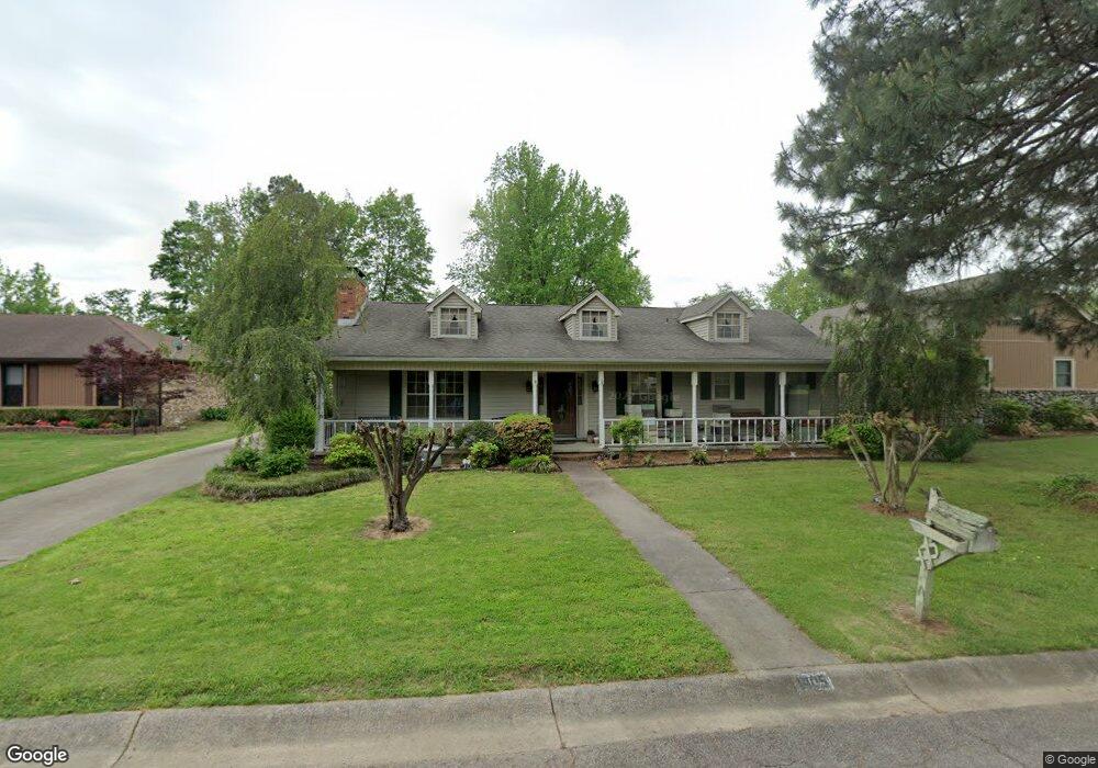
1405 Cornflower Ln Sherwood, AR 72120
Estimated Value: $227,359 - $263,000
--
Bed
2
Baths
1,815
Sq Ft
$134/Sq Ft
Est. Value
About This Home
This home is located at 1405 Cornflower Ln, Sherwood, AR 72120 and is currently estimated at $243,840, approximately $134 per square foot. 1405 Cornflower Ln is a home located in Pulaski County with nearby schools including Sherwood Elementary School, Sylvan Hills Middle School, and Sylvan Hills High School.
Ownership History
Date
Name
Owned For
Owner Type
Purchase Details
Closed on
Sep 20, 2006
Sold by
Clark Max E
Bought by
Graham Ronnie and Graham Tracy
Current Estimated Value
Home Financials for this Owner
Home Financials are based on the most recent Mortgage that was taken out on this home.
Original Mortgage
$32,900
Outstanding Balance
$19,542
Interest Rate
6.47%
Mortgage Type
Stand Alone Second
Estimated Equity
$224,298
Create a Home Valuation Report for This Property
The Home Valuation Report is an in-depth analysis detailing your home's value as well as a comparison with similar homes in the area
Home Values in the Area
Average Home Value in this Area
Purchase History
| Date | Buyer | Sale Price | Title Company |
|---|---|---|---|
| Graham Ronnie | $165,000 | American Abstract & Title Co |
Source: Public Records
Mortgage History
| Date | Status | Borrower | Loan Amount |
|---|---|---|---|
| Open | Graham Ronnie | $32,900 | |
| Open | Graham Ronnie | $131,600 |
Source: Public Records
Tax History Compared to Growth
Tax History
| Year | Tax Paid | Tax Assessment Tax Assessment Total Assessment is a certain percentage of the fair market value that is determined by local assessors to be the total taxable value of land and additions on the property. | Land | Improvement |
|---|---|---|---|---|
| 2025 | $1,875 | $38,662 | $7,800 | $30,862 |
| 2024 | $1,718 | $38,662 | $7,800 | $30,862 |
| 2023 | $1,718 | $38,662 | $7,800 | $30,862 |
| 2022 | $1,830 | $38,662 | $7,800 | $30,862 |
| 2021 | $1,699 | $29,980 | $7,600 | $22,380 |
| 2020 | $1,324 | $29,980 | $7,600 | $22,380 |
| 2019 | $1,324 | $29,980 | $7,600 | $22,380 |
| 2018 | $1,349 | $29,980 | $7,600 | $22,380 |
| 2017 | $1,349 | $29,980 | $7,600 | $22,380 |
| 2016 | $1,494 | $32,760 | $6,800 | $25,960 |
| 2015 | $1,501 | $32,222 | $6,800 | $25,422 |
| 2014 | $1,501 | $29,542 | $6,800 | $22,742 |
Source: Public Records
Map
Nearby Homes
- 1406 Coolhurst Ave
- 609 Newcastle Dr
- 615 & 617 Brierly Dr
- 615 Brierly Dr
- 618 & 620 Newcastle Dr
- 619 Newcastle Dr
- 622 Newcastle Dr
- 1300 Stafford Rd
- 626 Newcastle Dr
- 1301 Stafford Rd
- 300 Burntwood Rd
- +/- 21.56 Acres Stafford Rd
- 1419 Stafford Rd
- 1423 Stafford Rd
- 1415 Stafford Rd
- 1501 Stafford Rd
- +/- 8.16 Acres Windchime Ave
- 1800 Palomino Dr
- 11 Daniel Dr
- 503 Brent Dr
- 1409 Cornflower Ln
- 1401 Cornflower Ln
- 212 Calva Rd
- 1413 Cornflower Ln
- 1404 Cornflower Ln
- 1408 Cornflower Ln
- 12 Dovecote Ct
- 16 Dovecote Ct
- 1400 Cornflower Ln
- 208 Calva Rd
- 1417 Cornflower Ln
- 1412 Cornflower Ln
- 209 Calva Rd
- 1308 Cornflower Ln
- 204 Calva Rd
- 8 Dovecote Ct
- 1416 Cornflower Ln
- 20 Dovecote Ct
- 1425 Cornflower Ln
- 205 Calva Rd