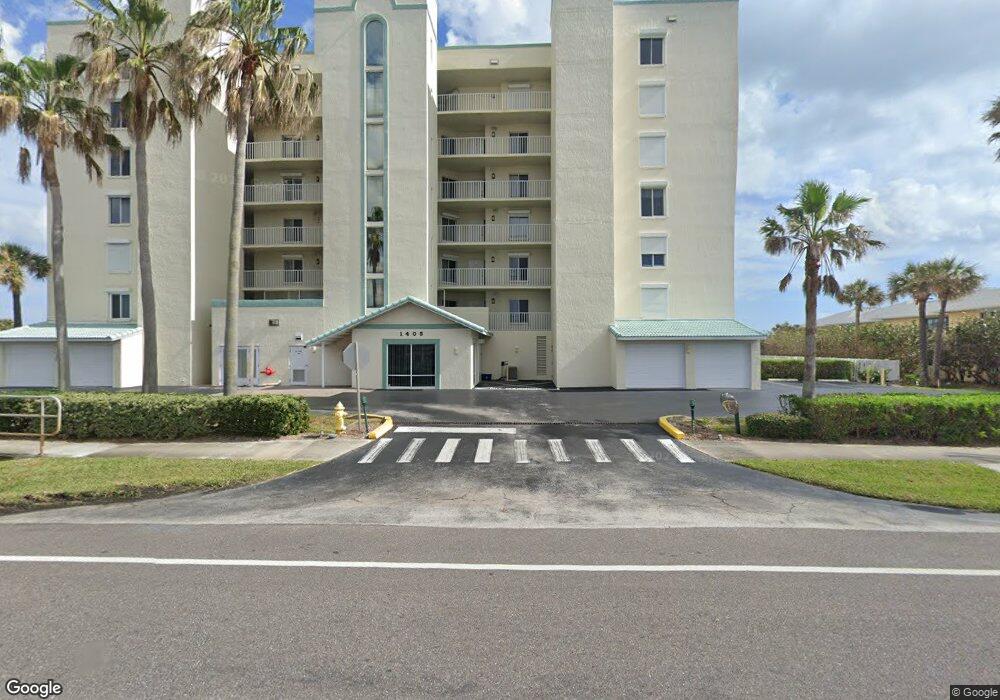
1405 Highway A1a Satellite Beach, FL 32937
Estimated Value: $515,000 - $635,229
--
Bed
--
Bath
1,638
Sq Ft
$340/Sq Ft
Est. Value
About This Home
This home is located at 1405 Highway A1a, Satellite Beach, FL 32937 and is currently estimated at $556,557, approximately $339 per square foot. 1405 Highway A1a is a home located in Brevard County with nearby schools including Surfside Elementary School, Satellite Senior High School, and DeLaura Middle School.
Ownership History
Date
Name
Owned For
Owner Type
Purchase Details
Closed on
Sep 1, 2020
Sold by
Lowry Paul Dennis
Bought by
Lowry Paul Dennis
Current Estimated Value
Purchase Details
Closed on
Dec 19, 2017
Sold by
Brill Robert M and Brill Christine
Bought by
Lowry Paul Dennis
Purchase Details
Closed on
Feb 21, 1995
Sold by
Emeral Shores Dev Inc
Bought by
Brill Robert M and Brill Christine
Home Financials for this Owner
Home Financials are based on the most recent Mortgage that was taken out on this home.
Original Mortgage
$133,600
Interest Rate
9.18%
Mortgage Type
Purchase Money Mortgage
Create a Home Valuation Report for This Property
The Home Valuation Report is an in-depth analysis detailing your home's value as well as a comparison with similar homes in the area
Home Values in the Area
Average Home Value in this Area
Purchase History
| Date | Buyer | Sale Price | Title Company |
|---|---|---|---|
| Lowry Paul Dennis | -- | Attorney | |
| Lowry Paul Dennis | $445,000 | Attorney | |
| Brill Robert M | $167,000 | -- |
Source: Public Records
Mortgage History
| Date | Status | Borrower | Loan Amount |
|---|---|---|---|
| Previous Owner | Brill Robert M | $133,600 |
Source: Public Records
Tax History Compared to Growth
Tax History
| Year | Tax Paid | Tax Assessment Tax Assessment Total Assessment is a certain percentage of the fair market value that is determined by local assessors to be the total taxable value of land and additions on the property. | Land | Improvement |
|---|---|---|---|---|
| 2025 | $5,992 | $372,830 | -- | -- |
| 2024 | $5,919 | $362,330 | -- | -- |
| 2023 | $5,919 | $351,780 | $0 | $0 |
| 2022 | $5,569 | $341,540 | $0 | $0 |
| 2021 | $5,785 | $331,600 | $0 | $0 |
| 2020 | $5,777 | $327,030 | $0 | $327,030 |
| 2019 | $5,904 | $327,030 | $0 | $327,030 |
| 2018 | $6,714 | $358,900 | $0 | $358,900 |
| 2017 | $7,418 | $355,040 | $0 | $355,040 |
| 2016 | $7,114 | $330,430 | $0 | $0 |
| 2015 | $6,943 | $311,730 | $0 | $0 |
| 2014 | $6,698 | $296,890 | $0 | $0 |
Source: Public Records
Map
Nearby Homes
- 1455 Highway A1a Unit 507
- 1369 Highway A1a Unit 8
- 1369 Highway A1a Unit 7
- 1465 Jimmy Buffett Memorial Hwy Unit 101
- 0 Cassia Blvd
- 189 Kings Way
- 204 Queens Ct
- 210 Queens Ct
- 170 Norwood Ave
- 199 Skyline Ct
- 1326 Highway A1a
- 1303 Highway A1a Unit 401
- 230 Harwood Ave
- 484 Greenway Ave
- 1273 Highway A1a Unit 308
- 155 Elm Ave
- 295 Cinnamon Dr
- 298 Harwood Ave
- 110 Desoto Pkwy Unit 5
- 105 Carissa Dr
- 1405 Highway A1a Unit 302
- 1405 Highway A1a Unit 201
- 1405 Highway A1a Unit 701
- 1405 Highway A1a Unit 203
- 1405 Highway A1a Unit 602
- 1405 Highway A1a
- 1405 Highway A1a
- 1405 Highway A1a Unit 604
- 1405 Highway A1a
- 1405 Highway A1a Unit 601
- 1405 Highway A1a
- 1405 Highway A1a
- 1405 Highway A1a Unit 502
- 1405 Highway A1a Unit 501
- 1405 Highway A1a Unit 404
- 1405 Highway A1a Unit 403
- 1405 Highway A1a
- 1405 Highway A1a
- 1405 Highway A1a Unit 304
- 1405 Highway A1a