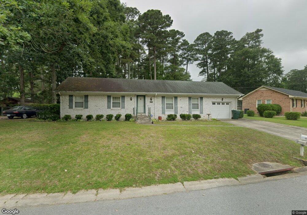
1405 Planters Dr Suffolk, VA 23434
Holy Neck NeighborhoodEstimated Value: $301,000 - $338,000
3
Beds
2
Baths
1,586
Sq Ft
$198/Sq Ft
Est. Value
About This Home
This home is located at 1405 Planters Dr, Suffolk, VA 23434 and is currently estimated at $313,368, approximately $197 per square foot. 1405 Planters Dr is a home located in Suffolk City with nearby schools including Kilby Shores Elementary School, King's Fork Middle School, and Lakeland High School.
Ownership History
Date
Name
Owned For
Owner Type
Purchase Details
Closed on
Jun 26, 2017
Sold by
Russell Dalton G and Russell Moreen M
Bought by
Ralston Kyle Anthony and Ralston Nicole Elizabeth
Current Estimated Value
Home Financials for this Owner
Home Financials are based on the most recent Mortgage that was taken out on this home.
Original Mortgage
$183,048
Outstanding Balance
$151,156
Interest Rate
4.02%
Mortgage Type
New Conventional
Estimated Equity
$162,212
Create a Home Valuation Report for This Property
The Home Valuation Report is an in-depth analysis detailing your home's value as well as a comparison with similar homes in the area
Home Values in the Area
Average Home Value in this Area
Purchase History
| Date | Buyer | Sale Price | Title Company |
|---|---|---|---|
| Ralston Kyle Anthony | $179,900 | Attorney |
Source: Public Records
Mortgage History
| Date | Status | Borrower | Loan Amount |
|---|---|---|---|
| Open | Ralston Kyle Anthony | $183,048 |
Source: Public Records
Tax History
| Year | Tax Paid | Tax Assessment Tax Assessment Total Assessment is a certain percentage of the fair market value that is determined by local assessors to be the total taxable value of land and additions on the property. | Land | Improvement |
|---|---|---|---|---|
| 2025 | $3,297 | $266,100 | $70,000 | $196,100 |
| 2024 | $3,297 | $240,300 | $70,000 | $170,300 |
| 2023 | $2,964 | $232,200 | $70,000 | $162,200 |
| 2022 | $2,642 | $242,400 | $70,000 | $172,400 |
| 2021 | $2,100 | $189,200 | $61,900 | $127,300 |
| 2020 | $2,054 | $185,000 | $61,900 | $123,100 |
| 2019 | $1,918 | $172,800 | $61,900 | $110,900 |
| 2018 | $1,148 | $182,600 | $61,900 | $120,700 |
| 2017 | $1,716 | $160,400 | $61,900 | $98,500 |
| 2016 | $1,716 | $160,400 | $61,900 | $98,500 |
| 2015 | $136 | $156,300 | $61,900 | $94,400 |
| 2014 | $136 | $156,300 | $61,900 | $94,400 |
Source: Public Records
Map
Nearby Homes
- 103 Tupelo Way
- 1323 Pheasant Cir
- 2011 Carroll Brinkley Way
- 5001 Melanie Ct
- 3027 Brett Dr
- 5003 Melanie Ct
- 5009 Melanie Ct
- 320 Tarn Ct
- 326 Tarn Ct
- 335 Tarn Ct
- 322 Tarn Ct
- 218 Mill Stream Dr
- 325 Tarn Ct
- 323 Tarn Ct
- 321 Tarn Ct
- 29-57 Suffolk St
- MM Everest
- MM Charleston Expy
- .40-AC Holland Rd
- MM Hawthorne
- 1409 Planters Dr
- 1403 Planters Dr
- 1318 Planters Dr
- 404 Locust Ct
- 1320 Planters Dr
- 406 Locust Ct
- 1402 Planters Dr
- 1400 Planters Dr
- 1404 Planters Dr
- 1411 Planters Dr
- 1406 Planters Dr
- 412 Locust Ct
- 1408 Planters Dr
- 102 Tanoak Ct
- 414 Locust Ct
- 401 Locust Ct
- 1415 Planters Dr
- 1321 Planters Dr
- 1317 Planters Dr
- 403 Locust Ct
Your Personal Tour Guide
Ask me questions while you tour the home.