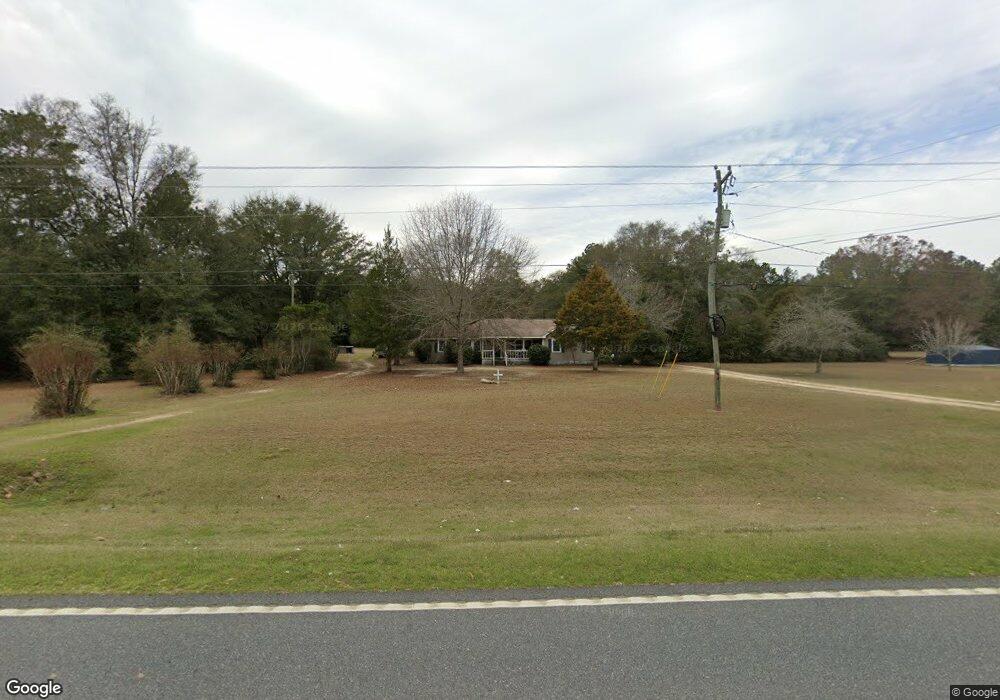
1405 State Route 128 Rd Oglethorpe, GA 31068
Estimated Value: $162,000 - $219,000
3
Beds
2
Baths
1,637
Sq Ft
$114/Sq Ft
Est. Value
About This Home
This home is located at 1405 State Route 128 Rd, Oglethorpe, GA 31068 and is currently estimated at $187,368, approximately $114 per square foot. 1405 State Route 128 Rd is a home with nearby schools including Macon County Elementary School, Macon County Middle School, and Macon County High School.
Ownership History
Date
Name
Owned For
Owner Type
Purchase Details
Closed on
Jul 16, 2007
Sold by
Wall William W
Bought by
Braswell Moneka S
Current Estimated Value
Home Financials for this Owner
Home Financials are based on the most recent Mortgage that was taken out on this home.
Original Mortgage
$92,022
Outstanding Balance
$58,145
Interest Rate
6.71%
Mortgage Type
FHA
Estimated Equity
$129,223
Purchase Details
Closed on
Jan 26, 2006
Sold by
Hunt Lindon E
Bought by
Wall William M
Purchase Details
Closed on
Mar 22, 2002
Sold by
Hunt Lindon E
Bought by
Hunt Lindon E
Purchase Details
Closed on
Nov 12, 1993
Sold by
Hunt Wynelle C Etal
Bought by
Hunt Lindon E
Purchase Details
Closed on
Mar 15, 1989
Sold by
Hunt Robert B
Bought by
Hunt Wynelle C Etal
Purchase Details
Closed on
Jan 1, 1946
Bought by
Hunt Robert B
Create a Home Valuation Report for This Property
The Home Valuation Report is an in-depth analysis detailing your home's value as well as a comparison with similar homes in the area
Home Values in the Area
Average Home Value in this Area
Purchase History
| Date | Buyer | Sale Price | Title Company |
|---|---|---|---|
| Braswell Moneka S | $92,750 | -- | |
| Wall William M | $69,000 | -- | |
| Hunt Lindon E | -- | -- | |
| Hunt Lindon E | -- | -- | |
| Hunt Wynelle C Etal | -- | -- | |
| Hunt Robert B | -- | -- |
Source: Public Records
Mortgage History
| Date | Status | Borrower | Loan Amount |
|---|---|---|---|
| Open | Braswell Moneka S | $92,022 |
Source: Public Records
Tax History Compared to Growth
Tax History
| Year | Tax Paid | Tax Assessment Tax Assessment Total Assessment is a certain percentage of the fair market value that is determined by local assessors to be the total taxable value of land and additions on the property. | Land | Improvement |
|---|---|---|---|---|
| 2024 | $1,614 | $59,474 | $4,550 | $54,924 |
| 2023 | $1,614 | $59,474 | $4,550 | $54,924 |
| 2022 | $1,171 | $43,706 | $4,550 | $39,156 |
| 2021 | $928 | $32,010 | $4,050 | $27,960 |
| 2020 | $870 | $32,010 | $4,050 | $27,960 |
| 2019 | $928 | $32,010 | $4,050 | $27,960 |
| 2018 | $872 | $32,010 | $4,050 | $27,960 |
| 2017 | $879 | $32,010 | $4,050 | $27,960 |
| 2016 | $880 | $32,010 | $4,050 | $27,960 |
| 2015 | -- | $34,386 | $4,050 | $30,336 |
| 2014 | -- | $34,386 | $4,050 | $30,336 |
| 2013 | -- | $34,386 | $4,050 | $30,336 |
Source: Public Records
Map
Nearby Homes
- 45 Oakwood Dr
- 204 Jordan St
- 311 Overlook Dr
- 0 Georgia 49
- 562 W Anderson St
- Whitewater Rd
- Whitewater Rd
- 100 Minor Ave
- 601 Engram St
- 505 Engram St
- 326 N Dooly St
- 103 E Artesian Ave
- 202 Minor Ave
- 416 Engram St
- 432 Clifton Bradley Dr
- 2668 Coogle Rd
- 511 Forsyth St
- 504 Patricia Dr
- 510 Patricia Dr
- 514 Patricia Dr
- 1457 Georgia 128
- 1402 State Route 128 Rd
- 1370 State Route 128 Rd
- 1464 State Route 128 Rd
- 1529 State Route 128 Rd
- 1653 State Route 128 Rd
- 1717 State Route 128 Rd
- 1062 State Route 128 Rd
- 1775 State Route 128 Rd
- 156 Kelley Bottom
- 1457 State Rd 128
- 960 State Route 128 Rd
- 1953 State Route 128 Rd
- 910 State Route 128 Rd
- 670 Martin Rd
- 690 Martin Rd
- 747 State Route 128 Rd
- 641 Kelley Bottom
- 890 Martin Rd
- 700 Kelley Bottom