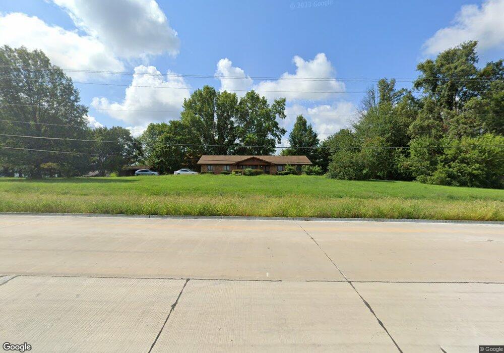
1405 Thouvenot Ln O Fallon, IL 62269
Estimated Value: $372,000 - $469,000
--
Bed
--
Bath
1,839
Sq Ft
$223/Sq Ft
Est. Value
About This Home
This home is located at 1405 Thouvenot Ln, O Fallon, IL 62269 and is currently estimated at $409,452, approximately $222 per square foot. 1405 Thouvenot Ln is a home located in St. Clair County with nearby schools including Whiteside Elementary School, Whiteside Middle School, and Berean Christian School.
Ownership History
Date
Name
Owned For
Owner Type
Purchase Details
Closed on
Apr 21, 2022
Sold by
Mohammad Rami
Bought by
Mohammad Kifah
Current Estimated Value
Purchase Details
Closed on
Aug 9, 2007
Sold by
Weir Robert W
Bought by
Mohammad Rami and Mohammad Kifah
Home Financials for this Owner
Home Financials are based on the most recent Mortgage that was taken out on this home.
Original Mortgage
$284,000
Interest Rate
6.87%
Mortgage Type
New Conventional
Create a Home Valuation Report for This Property
The Home Valuation Report is an in-depth analysis detailing your home's value as well as a comparison with similar homes in the area
Home Values in the Area
Average Home Value in this Area
Purchase History
| Date | Buyer | Sale Price | Title Company |
|---|---|---|---|
| Mohammad Kifah | -- | None Available | |
| Mohammad Rami | $299,000 | Chicago Title |
Source: Public Records
Mortgage History
| Date | Status | Borrower | Loan Amount |
|---|---|---|---|
| Previous Owner | Mohammad Rami | $284,000 |
Source: Public Records
Tax History Compared to Growth
Tax History
| Year | Tax Paid | Tax Assessment Tax Assessment Total Assessment is a certain percentage of the fair market value that is determined by local assessors to be the total taxable value of land and additions on the property. | Land | Improvement |
|---|---|---|---|---|
| 2024 | $4,749 | $69,931 | $10,692 | $59,239 |
| 2023 | $4,738 | $67,508 | $10,544 | $56,964 |
| 2022 | $4,148 | $61,483 | $9,603 | $51,880 |
| 2021 | $4,031 | $58,960 | $9,209 | $49,751 |
| 2020 | $3,926 | $54,909 | $8,576 | $46,333 |
| 2019 | $3,958 | $56,343 | $9,364 | $46,979 |
| 2018 | $3,895 | $54,905 | $9,125 | $45,780 |
| 2017 | $3,716 | $53,444 | $8,882 | $44,562 |
| 2016 | $3,478 | $51,602 | $8,576 | $43,026 |
| 2014 | $3,129 | $50,669 | $3,859 | $46,810 |
| 2013 | $3,021 | $50,669 | $3,859 | $46,810 |
Source: Public Records
Map
Nearby Homes
- 2024 Ravenel
- 5025 Bristol Hill Dr
- 1433 Victoria Square Ct
- 4783 Katrina
- 1453 Winchester Grove Ct
- 1214 Carleton Ln
- 1232 Carleton Ln
- 0 Hartman Ln
- 1230 Three Rivers Dr Unit 6B
- 980 Clemson Ave
- 2268 Haverford Dr
- 906 Powell Dr
- 517 E Waters Edge Dr
- 210 Meadowbrook Dr
- 923 Millikin Dr
- 762 Kelley Dr
- 208 Ellen Ln
- 21 Raven Oak Dr
- 1513 Pasteur Ln
- 509 Long Dr
- 1413 Thouvenot Ln
- 2053 Cedarwood Trail
- 2049 Cedarwood Trail
- 1423 Thouvenot Ln
- 2045 Cedarwood Trail
- 1422 Thouvenot Ln
- 2052 Cedarwood Trail
- 4410 Green Ash Ct
- 2048 Cedarwood Trail
- 4406 Green Ash Ct
- 2041 Cedarwood Trail
- 2044 Cedarwood Trail
- 1429 Thouvenot Ln
- 4414 Green Ash Ct
- 1129 Chatham Dr
- 4411 Green Ash Ct
- 4407 Green Ash Ct
- 2035 Cedarwood Trail
- 4418 Green Ash Ct
- 1133 Chatham Dr