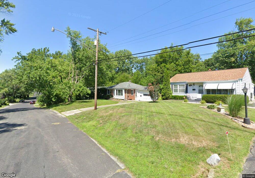
1405 W Aire Ave Peoria, IL 61614
North Peoria NeighborhoodEstimated Value: $106,000 - $151,000
2
Beds
1
Bath
1,398
Sq Ft
$88/Sq Ft
Est. Value
About This Home
This home is located at 1405 W Aire Ave, Peoria, IL 61614 and is currently estimated at $122,514, approximately $87 per square foot. 1405 W Aire Ave is a home located in Peoria County with nearby schools including Dr. C. T. Vivian Primary School, Rolling Acres Middle School, and Peoria High School.
Ownership History
Date
Name
Owned For
Owner Type
Purchase Details
Closed on
Jun 9, 2022
Sold by
Barry Belshaw
Bought by
Kalmes Joshua L
Current Estimated Value
Home Financials for this Owner
Home Financials are based on the most recent Mortgage that was taken out on this home.
Original Mortgage
$84,632
Outstanding Balance
$80,686
Interest Rate
5.5%
Mortgage Type
New Conventional
Estimated Equity
$41,828
Purchase Details
Closed on
Oct 26, 2009
Bought by
Belshaw Derek
Create a Home Valuation Report for This Property
The Home Valuation Report is an in-depth analysis detailing your home's value as well as a comparison with similar homes in the area
Home Values in the Area
Average Home Value in this Area
Purchase History
| Date | Buyer | Sale Price | Title Company |
|---|---|---|---|
| Kalmes Joshua L | $87,250 | Hasselberg Rock Bell & Kuppler | |
| Belshaw Derek | $95,000 | -- |
Source: Public Records
Mortgage History
| Date | Status | Borrower | Loan Amount |
|---|---|---|---|
| Open | Kalmes Joshua L | $84,632 |
Source: Public Records
Tax History Compared to Growth
Tax History
| Year | Tax Paid | Tax Assessment Tax Assessment Total Assessment is a certain percentage of the fair market value that is determined by local assessors to be the total taxable value of land and additions on the property. | Land | Improvement |
|---|---|---|---|---|
| 2024 | $2,984 | $32,990 | $7,440 | $25,550 |
| 2023 | $2,848 | $30,270 | $6,830 | $23,440 |
| 2022 | $2,398 | $30,860 | $6,240 | $24,620 |
| 2021 | $2,325 | $29,390 | $5,940 | $23,450 |
| 2020 | $2,315 | $29,100 | $5,880 | $23,220 |
| 2019 | $2,360 | $29,690 | $6,000 | $23,690 |
| 2018 | $2,510 | $31,770 | $6,060 | $25,710 |
| 2017 | $2,515 | $32,090 | $6,120 | $25,970 |
| 2016 | $2,434 | $32,090 | $6,120 | $25,970 |
| 2015 | $2,198 | $31,460 | $6,000 | $25,460 |
| 2014 | $2,205 | $29,880 | $5,700 | $24,180 |
| 2013 | -- | $30,240 | $5,770 | $24,470 |
Source: Public Records
Map
Nearby Homes
- 1413 W Aire Ave
- 4023 N University St
- 4212 N Keenland Ave
- 1123 W Purtscher Dr
- 930 W Willow Ln
- 937 W Kenwick Ln
- 821 W Purtscher Dr
- 817 W Ridge Rd
- 716 W Purtscher Dr
- 656 W Knoll Crest Dr
- 3720 N Saint Michael Ave
- 1412 W Glen Ave
- 502 W Crestwood Dr
- 2011 W Richwoods Blvd
- 4107 N Hollyridge Cir
- 3121 N Isabell Ave
- 4808 N Glen Ct
- 2036 W Richwoods Blvd
- 411 W Knoll Crest Dr
- 4207 N Hollyridge Cir
- 1405 W Westaire Ave
- 1409 W Aire Ave
- 1409 W Westaire Ave
- 1401 W Westaire Ave
- 1401 W Aire Ave
- 1413 W Westaire Ave
- 1319 W Westaire Ave
- 1406 W Westaire Ave
- 1408 W Westaire Ave
- 1313 W Westaire Ave
- 1313 W Aire Ave
- 1410 W Westaire Ave
- 4021 N Jacqualine St
- 1316 W Westaire Ave
- 1316 W Aire Ave
- 4020 N Jacqualine St
- 4109 N University St
- 4115 N University St
- 4115 N University St Unit 1
- 1427 W Westaire Ave