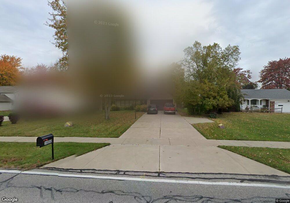
14050 Whitney Rd Strongsville, OH 44136
Estimated Value: $342,977 - $418,000
4
Beds
3
Baths
2,142
Sq Ft
$174/Sq Ft
Est. Value
About This Home
This home is located at 14050 Whitney Rd, Strongsville, OH 44136 and is currently estimated at $372,244, approximately $173 per square foot. 14050 Whitney Rd is a home located in Cuyahoga County with nearby schools including Strongsville High School, Bethel Christian Academy, and The Academy of St. Bartholomew.
Ownership History
Date
Name
Owned For
Owner Type
Purchase Details
Closed on
Sep 6, 2017
Sold by
Strojny Andrew P
Bought by
Bolea Nicoleta Valentina
Current Estimated Value
Purchase Details
Closed on
Apr 12, 2017
Sold by
Strojny Ann
Bought by
Strojny Andrew P
Purchase Details
Closed on
May 6, 1999
Sold by
Strojny Andrew P
Bought by
Strojny Andrew P and Strojny Ann
Purchase Details
Closed on
Apr 24, 1986
Sold by
Strojny Andrew P and Strojny Lori A
Bought by
Strojny Andrew P
Purchase Details
Closed on
Jan 1, 1983
Bought by
Strojny Andrew P and Strojny Lori A
Create a Home Valuation Report for This Property
The Home Valuation Report is an in-depth analysis detailing your home's value as well as a comparison with similar homes in the area
Home Values in the Area
Average Home Value in this Area
Purchase History
| Date | Buyer | Sale Price | Title Company |
|---|---|---|---|
| Bolea Nicoleta Valentina | -- | None Available | |
| Strojny Andrew P | -- | None Available | |
| Strojny Andrew P | -- | -- | |
| Strojny Andrew P | -- | -- | |
| Strojny Andrew P | -- | -- |
Source: Public Records
Tax History Compared to Growth
Tax History
| Year | Tax Paid | Tax Assessment Tax Assessment Total Assessment is a certain percentage of the fair market value that is determined by local assessors to be the total taxable value of land and additions on the property. | Land | Improvement |
|---|---|---|---|---|
| 2024 | $4,974 | $105,945 | $11,690 | $94,255 |
| 2023 | $5,236 | $83,620 | $15,050 | $68,570 |
| 2022 | $5,198 | $83,620 | $15,050 | $68,570 |
| 2021 | $5,157 | $83,620 | $15,050 | $68,570 |
| 2020 | $4,897 | $70,250 | $12,640 | $57,610 |
| 2019 | $4,753 | $200,700 | $36,100 | $164,600 |
| 2018 | $4,240 | $70,250 | $12,640 | $57,610 |
| 2017 | $4,225 | $63,950 | $9,940 | $54,010 |
| 2016 | $4,208 | $63,950 | $9,940 | $54,010 |
| 2015 | $6,389 | $63,950 | $9,940 | $54,010 |
| 2014 | $6,389 | $62,090 | $9,660 | $52,430 |
Source: Public Records
Map
Nearby Homes
- 9531 Nicole Cir
- Buchanan Plan at The Enclave at Pine Lakes Crossing
- Belleville Plan at The Enclave at Pine Lakes Crossing
- 13976 W Sprague Rd
- 8761 Windfall Ct
- 14015 Byron Blvd
- 10010 Chevy Chase
- 9890 Webster Rd
- 9129 Tahoe Cir
- 14069 Basswood Cir
- 12721 Patricia Dr
- 12972 W Sprague Rd
- 12631 Pinebrook Dr
- 0 Webster Rd
- 7664 Gerald Dr
- 7685 Saratoga Rd
- 12658 Gardenside Dr
- 13402 Bridgecreek Cir
- 8963 Abbey Rd
- 13541 Indian Creek Dr
- 14066 Whitney Rd
- 14010 Whitney Rd
- 14098 Whitney Rd
- 13970 Whitney Rd
- 13935 Cartwright Pkwy
- 13911 Cartwright Pkwy
- 13959 Cartwright Pkwy
- 14136 Whitney Rd
- 13930 Whitney Rd
- 13887 Cartwright Pkwy
- 13983 Cartwright Pkwy
- 14051 Whitney Rd
- 14011 Whitney Rd
- 14174 Whitney Rd
- 14007 Cartwright Pkwy
- 13926 Whitney Rd
- 13839 Cartwright Pkwy
- 13927 Whitney Rd
- 14218 Whitney Rd
- 14179 Whitney Rd