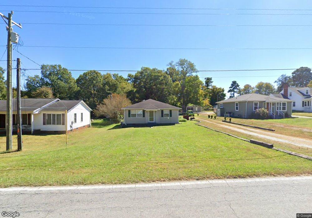
1406 E Fairfield Rd High Point, NC 27263
Greater High Point NeighborhoodEstimated Value: $155,000 - $178,668
2
Beds
1
Bath
1,020
Sq Ft
$162/Sq Ft
Est. Value
About This Home
This home is located at 1406 E Fairfield Rd, High Point, NC 27263 and is currently estimated at $165,667, approximately $162 per square foot. 1406 E Fairfield Rd is a home located in Guilford County with nearby schools including Allen Jay Elementary School, Southern Guilford Middle, and Southern Guilford High School.
Ownership History
Date
Name
Owned For
Owner Type
Purchase Details
Closed on
Sep 15, 2006
Sold by
Hud
Bought by
Mixon John D
Current Estimated Value
Purchase Details
Closed on
Dec 19, 2005
Sold by
North Carolina Housing Finance Agency
Bought by
Hud
Purchase Details
Closed on
Oct 24, 2005
Sold by
Hobbs Linda C
Bought by
North Carolina Housing Finance Agency
Purchase Details
Closed on
Dec 30, 1999
Sold by
Madden Smith Starlin Dwayne
Bought by
Hobbs Linda C
Home Financials for this Owner
Home Financials are based on the most recent Mortgage that was taken out on this home.
Original Mortgage
$74,882
Interest Rate
7.68%
Mortgage Type
FHA
Create a Home Valuation Report for This Property
The Home Valuation Report is an in-depth analysis detailing your home's value as well as a comparison with similar homes in the area
Home Values in the Area
Average Home Value in this Area
Purchase History
| Date | Buyer | Sale Price | Title Company |
|---|---|---|---|
| Mixon John D | -- | None Available | |
| Hud | -- | None Available | |
| North Carolina Housing Finance Agency | $80,789 | None Available | |
| Hobbs Linda C | $75,500 | -- |
Source: Public Records
Mortgage History
| Date | Status | Borrower | Loan Amount |
|---|---|---|---|
| Previous Owner | Hobbs Linda C | $74,882 | |
| Closed | Hobbs Linda C | $3,500 |
Source: Public Records
Tax History Compared to Growth
Tax History
| Year | Tax Paid | Tax Assessment Tax Assessment Total Assessment is a certain percentage of the fair market value that is determined by local assessors to be the total taxable value of land and additions on the property. | Land | Improvement |
|---|---|---|---|---|
| 2025 | $706 | $80,500 | $25,000 | $55,500 |
| 2024 | $706 | $80,500 | $25,000 | $55,500 |
| 2023 | $706 | $80,500 | $25,000 | $55,500 |
| 2022 | $706 | $80,500 | $25,000 | $55,500 |
| 2021 | $533 | $60,800 | $13,500 | $47,300 |
| 2020 | $533 | $60,800 | $13,500 | $47,300 |
| 2019 | $533 | $60,800 | $0 | $0 |
| 2018 | $531 | $60,800 | $0 | $0 |
| 2017 | $515 | $60,800 | $0 | $0 |
| 2016 | $527 | $60,200 | $0 | $0 |
| 2015 | $530 | $60,200 | $0 | $0 |
| 2014 | $536 | $60,200 | $0 | $0 |
Source: Public Records
Map
Nearby Homes
- 1846 Sechrest Cir
- 2616 Ingram Rd
- 2716 Allen Jay Rd
- 1103 Pegram Ave
- 2708 Ernest St
- 914 Nance Ave
- 1640 Kersey Valley Rd
- 510 Aldridge Rd
- 706 E Fairfield Rd
- 600 E Fairfield Rd
- 926 Norton St
- 921 Norton St
- 1843 Weant Rd
- 825 Hopewell St
- 10812, 10822, 10828 N Main St
- 105 Oak Ridge Dr
- 10844 N Main St
- 2719 Granville St
- 202 Oak Ridge Dr
- 301 Oak Ridge Dr
- 1408 E Fairfield Rd
- 1404 E Fairfield Rd
- 1402 E Fairfield Rd
- 1412 E Fairfield Rd
- 1863 Sechrest Cir
- 1803 Sechrest Cir
- 1809 Sechrest Cir
- 1817 Sechrest Cir
- 1765 Jackson Lake Rd
- 1327 E Fairfield Rd
- 1816 Sechrest Cir
- 1419 E Fairfield Rd
- 1821 Sechrest Cir
- 1878 Sechrest Cir Unit R3
- 1878 Sechrest Cir
- 1884 Sechrest Cir
- 1870 Sechrest Cir
- 1853 Sechrest Cir
- 1825 Sechrest Cir
- 1323 E Fairfield Rd