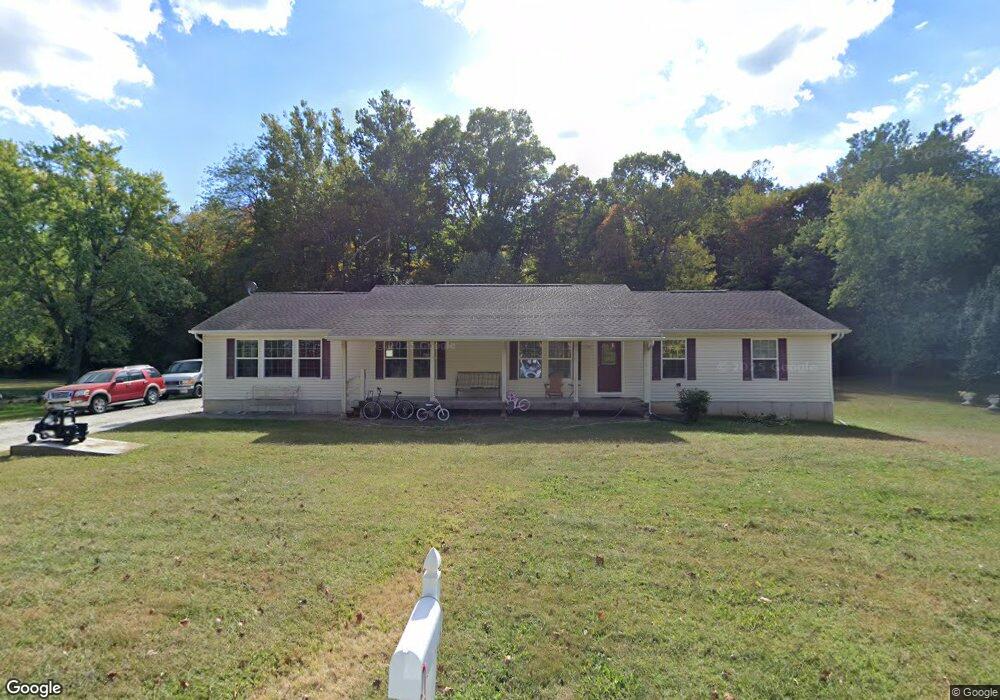
1406 Frank Dr Barnhart, MO 63012
Estimated Value: $267,631 - $445,000
--
Bed
--
Bath
2,128
Sq Ft
$165/Sq Ft
Est. Value
About This Home
This home is located at 1406 Frank Dr, Barnhart, MO 63012 and is currently estimated at $351,408, approximately $165 per square foot. 1406 Frank Dr is a home located in Jefferson County with nearby schools including Pevely Elementary School, Senn-Thomas Middle School, and Herculaneum High School.
Ownership History
Date
Name
Owned For
Owner Type
Purchase Details
Closed on
Oct 30, 2015
Sold by
Boxdorfer Chad W and Thomas Wendy R
Bought by
Boxdorfer Chad W
Current Estimated Value
Home Financials for this Owner
Home Financials are based on the most recent Mortgage that was taken out on this home.
Original Mortgage
$123,500
Interest Rate
3.8%
Mortgage Type
New Conventional
Create a Home Valuation Report for This Property
The Home Valuation Report is an in-depth analysis detailing your home's value as well as a comparison with similar homes in the area
Home Values in the Area
Average Home Value in this Area
Purchase History
| Date | Buyer | Sale Price | Title Company |
|---|---|---|---|
| Boxdorfer Chad W | -- | Title Partners Agency Llc |
Source: Public Records
Mortgage History
| Date | Status | Borrower | Loan Amount |
|---|---|---|---|
| Closed | Boxdorfer Chad W | $123,500 |
Source: Public Records
Tax History Compared to Growth
Tax History
| Year | Tax Paid | Tax Assessment Tax Assessment Total Assessment is a certain percentage of the fair market value that is determined by local assessors to be the total taxable value of land and additions on the property. | Land | Improvement |
|---|---|---|---|---|
| 2025 | $2,149 | $30,600 | $2,700 | $27,900 |
| 2024 | $2,149 | $28,300 | $2,700 | $25,600 |
| 2023 | $2,149 | $28,300 | $2,700 | $25,600 |
| 2022 | $2,131 | $28,300 | $2,700 | $25,600 |
| 2021 | $2,131 | $28,300 | $2,700 | $25,600 |
| 2020 | $1,959 | $25,500 | $2,500 | $23,000 |
| 2019 | $1,962 | $25,500 | $2,500 | $23,000 |
| 2018 | $1,960 | $25,500 | $2,500 | $23,000 |
| 2017 | $1,869 | $25,500 | $2,500 | $23,000 |
| 2016 | $1,610 | $23,600 | $2,500 | $21,100 |
| 2015 | $1,609 | $23,600 | $2,500 | $21,100 |
| 2013 | -- | $23,900 | $2,300 | $21,600 |
Source: Public Records
Map
Nearby Homes
- 1670 Clover Ct
- 1022 Graystone Park
- 7255 Meriwether Ct
- 1728 Fairfax Dr
- 900 Bluff Rd
- 1299 Riesling Ln
- 7098 Ridge Dr
- 2030 Engle Ridge Rd
- 8286 Commercial Blvd
- 1298 Riesling Ln
- 112 Chardonnay Ct
- 7062 Tuckahoe Ct
- 2000 Lot 10 Crossroads Rd
- 2000 Lot 9 Crossroads Rd
- 2000 Lot 8 Crossroads Rd
- 2000 Lot 7 Crossroads Rd
- 2000 Lot 6 Crossroads Rd
- 2000 Lot 5 Crossroads Rd
- 2000 Lot 4 Crossroads Rd
- 2000 Lot 3 Crossroads Rd
- 1390 Frank Dr
- 1422 Frank Dr
- 0 Engle Creek Rd
- 1299 Rocky Meadows Dr
- 1299 Rocky Meadows Dr
- 1298 Rocky Meadows Dr
- 1440 Frank Dr
- 7854 Us Highway 61/67
- 7860 Us Highway 61/67
- 1269 Rocky Meadows Dr
- 0 1 62 Acres On Eagles Nest Rd
- 1225 Rocky Meadows Dr
- 7676 Schmidt Rd
- 1215 Rocky Meadows Dr
- 1313 Eagles Nest Rd
- 7653 Apple Tree Hill
- 1207 Rocky Meadows Dr
- 7650 Apple Tree Hill
- 7678 Oak Ln
- 7707 Us Highway 61/67