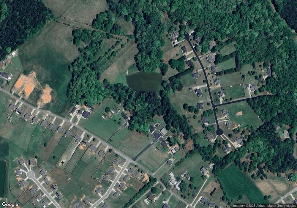
1406 Perkins Rd Winder, GA 30680
Estimated Value: $568,000 - $870,204
4
Beds
4
Baths
3,043
Sq Ft
$250/Sq Ft
Est. Value
About This Home
This home is located at 1406 Perkins Rd, Winder, GA 30680 and is currently estimated at $760,801, approximately $250 per square foot. 1406 Perkins Rd is a home located in Barrow County with nearby schools including Bethlehem Elementary School, Haymon-Morris Middle School, and Apalachee High School.
Ownership History
Date
Name
Owned For
Owner Type
Purchase Details
Closed on
May 2, 2022
Sold by
Garrett Raymond Todd
Bought by
Patrick William G and Patrick Doretta F
Current Estimated Value
Home Financials for this Owner
Home Financials are based on the most recent Mortgage that was taken out on this home.
Original Mortgage
$636,000
Outstanding Balance
$600,930
Interest Rate
4.67%
Mortgage Type
New Conventional
Estimated Equity
$159,871
Purchase Details
Closed on
Aug 23, 2000
Sold by
Garrett Raymond and Garrett Carol
Bought by
Crowe Keith
Purchase Details
Closed on
Jul 31, 2000
Sold by
Jones Clyde And
Bought by
And Garrett Raymond
Purchase Details
Closed on
May 10, 1995
Bought by
Jones Clyde And
Create a Home Valuation Report for This Property
The Home Valuation Report is an in-depth analysis detailing your home's value as well as a comparison with similar homes in the area
Home Values in the Area
Average Home Value in this Area
Purchase History
| Date | Buyer | Sale Price | Title Company |
|---|---|---|---|
| Patrick William G | -- | -- | |
| Patrick William G | $795,000 | -- | |
| Crowe Keith | -- | -- | |
| And Garrett Raymond | $164,500 | -- | |
| Jones Clyde And | -- | -- |
Source: Public Records
Mortgage History
| Date | Status | Borrower | Loan Amount |
|---|---|---|---|
| Open | Patrick William G | $636,000 | |
| Closed | Patrick William G | $636,000 |
Source: Public Records
Tax History Compared to Growth
Tax History
| Year | Tax Paid | Tax Assessment Tax Assessment Total Assessment is a certain percentage of the fair market value that is determined by local assessors to be the total taxable value of land and additions on the property. | Land | Improvement |
|---|---|---|---|---|
| 2024 | $6,900 | $286,255 | $62,713 | $223,542 |
| 2023 | $5,908 | $263,649 | $62,713 | $200,936 |
| 2022 | $5,094 | $195,196 | $62,713 | $132,483 |
| 2021 | $4,438 | $160,147 | $37,837 | $122,310 |
| 2020 | $3,884 | $137,891 | $26,943 | $110,948 |
| 2019 | $3,949 | $137,891 | $26,943 | $110,948 |
| 2018 | $3,905 | $137,891 | $26,943 | $110,948 |
| 2017 | $3,527 | $121,151 | $26,943 | $94,208 |
| 2016 | $3,614 | $125,554 | $38,490 | $87,064 |
| 2015 | $3,649 | $126,396 | $38,490 | $87,906 |
| 2014 | $3,227 | $107,609 | $18,860 | $88,749 |
| 2013 | -- | $101,711 | $18,860 | $82,851 |
Source: Public Records
Map
Nearby Homes
- 112 Shallow Way
- 0 Perkins Rd Unit 10623675
- 0 Perkins Rd Unit 7664605
- 1190 Foster Rd
- 0 Wall Rd Unit 10504981
- 0 Wall Rd Unit 7564754
- 572 Elder Rd SE
- 568 Elder Rd SE
- 564 Elder Rd SE
- 576 Elder Rd SE
- 223 Westlyn Way
- 63 Westlyn Way
- 66 Westlyn Way
- The Landon II Plan at Westlyn
- The Baxley Plan at Westlyn
- 163 Westlyn Way
- 61 Westlyn Ln
- 72 Westlyn Ln
- 71 Westlyn Ln
- 1406 Perkins Rd
- 1398 Perkins Rd
- 1422 Perkins Rd
- 1389 Perkins Rd
- 1371 Perkins Rd
- 1375 Perkins Rd
- 1385 Perkins Rd
- 1381 Perkins Rd
- 1349 Perkins Rd Unit 2
- 1353 Perkins Rd Unit 3
- 1345 Perkins Rd Unit 1
- 769 Appian Way
- 773 Appian Way
- 765 Appian Way
- 777 Appian Way
- 1432 Perkins Rd Unit 1
- 761 Appian Way Unit POPLAR
- 80 Brookland Ct
- 1436 Perkins Rd
- 1425 Perkins Rd
