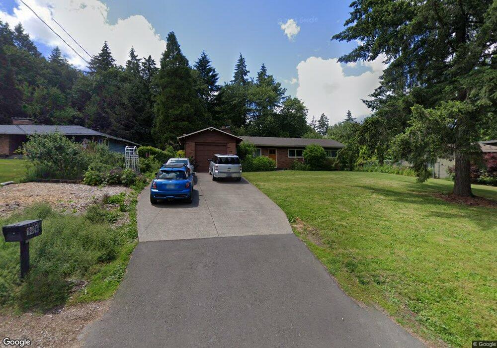
1406 SW Maplecrest Dr Portland, OR 97219
Marshall Park NeighborhoodEstimated Value: $566,563 - $710,000
3
Beds
1
Bath
1,204
Sq Ft
$518/Sq Ft
Est. Value
About This Home
This home is located at 1406 SW Maplecrest Dr, Portland, OR 97219 and is currently estimated at $623,891, approximately $518 per square foot. 1406 SW Maplecrest Dr is a home located in Multnomah County with nearby schools including Stephenson Elementary School, Jackson Middle School, and Ida B. Wells-Barnett High School.
Ownership History
Date
Name
Owned For
Owner Type
Purchase Details
Closed on
Jun 5, 2003
Sold by
Gardner Todd Irish
Bought by
Mahoney Michael R and Mahoney Kathryn L
Current Estimated Value
Home Financials for this Owner
Home Financials are based on the most recent Mortgage that was taken out on this home.
Original Mortgage
$192,000
Outstanding Balance
$82,960
Interest Rate
5.71%
Mortgage Type
Purchase Money Mortgage
Estimated Equity
$540,931
Create a Home Valuation Report for This Property
The Home Valuation Report is an in-depth analysis detailing your home's value as well as a comparison with similar homes in the area
Home Values in the Area
Average Home Value in this Area
Purchase History
| Date | Buyer | Sale Price | Title Company |
|---|---|---|---|
| Mahoney Michael R | $240,000 | First American |
Source: Public Records
Mortgage History
| Date | Status | Borrower | Loan Amount |
|---|---|---|---|
| Open | Mahoney Michael R | $192,000 | |
| Closed | Mahoney Michael R | $21,000 |
Source: Public Records
Tax History Compared to Growth
Tax History
| Year | Tax Paid | Tax Assessment Tax Assessment Total Assessment is a certain percentage of the fair market value that is determined by local assessors to be the total taxable value of land and additions on the property. | Land | Improvement |
|---|---|---|---|---|
| 2025 | $7,283 | $270,560 | -- | -- |
| 2024 | $7,022 | $262,680 | -- | -- |
| 2023 | $6,752 | $255,030 | $0 | $0 |
| 2022 | $6,606 | $247,610 | $0 | $0 |
| 2021 | $6,494 | $240,400 | $0 | $0 |
| 2020 | $5,957 | $233,400 | $0 | $0 |
| 2019 | $5,738 | $226,610 | $0 | $0 |
| 2018 | $5,569 | $220,010 | $0 | $0 |
| 2017 | $5,338 | $213,610 | $0 | $0 |
| 2016 | $4,885 | $207,390 | $0 | $0 |
| 2015 | $4,756 | $201,350 | $0 | $0 |
| 2014 | $4,685 | $195,490 | $0 | $0 |
Source: Public Records
Map
Nearby Homes
- 0 SW Lancaster Rd Unit 722439051
- 0 SW Lancaster Rd Unit 540028719
- 10850 SW Creightonwood Place
- 9855 SW 25th Ave
- 9375 SW 8th Ave
- 9341 SW 8th Ave
- 1845 SW Taylors Ferry Rd
- 0 SW Taylors Ferry Ct Unit 171663449
- 1345 SW Taylors Ferry Ct
- 2249 SW Taylors Ferry Rd
- 1035 SW Palatine St
- 9320 SW Boones Ferry Rd
- 9224 SW 26th Ave
- 8921 SW 7th Ave
- 2731 SW 28th Dr
- 1515 SW Carson St
- 1323 SW Carson St
- 9818 SW 34th Place
- 9822 SW 34th Place
- 9824 SW 34th Place
- 1424 SW Maplecrest Dr
- 1390 SW Maplecrest Dr
- 1444 SW Maplecrest Dr
- 1378 SW Maplecrest Dr
- 1409 SW Maplecrest Dr
- 1393 SW Maplecrest Dr
- 1616 SW Maplecrest Dr
- 1670 SW Maplecrest Dr
- 1387 SW Maplecrest Dr
- 1470 SW Maplecrest Dr
- 1640 SW Maplecrest Dr
- 1350 SW Maplecrest Dr
- 1620 SW Maplecrest Dr
- 1682 SW Maplecrest Dr
- 1600 SW Maplecrest Dr
- 1355 SW Maplecrest Dr
- 1465 SW Maplecrest Dr
- 1445 SW Maplecrest Dr
- 1610 SW Maplecrest Dr
- 1492 SW Maplecrest Dr