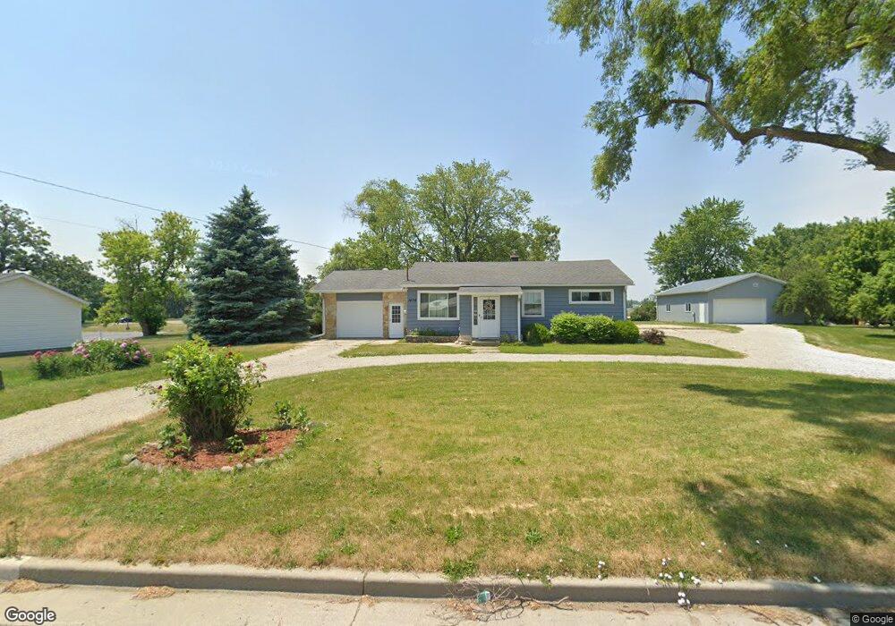
1406 York St Union Grove, WI 53182
Estimated Value: $337,698 - $388,000
3
Beds
1
Bath
1,330
Sq Ft
$268/Sq Ft
Est. Value
About This Home
This home is located at 1406 York St, Union Grove, WI 53182 and is currently estimated at $356,675, approximately $268 per square foot. 1406 York St is a home located in Racine County with nearby schools including Union Grove Elementary School, Union Grove High School, and Union Grove Christian School.
Ownership History
Date
Name
Owned For
Owner Type
Purchase Details
Closed on
Jul 24, 2020
Sold by
Michel Daniel J and Michel Linda E
Bought by
Wroblewski Aaron D
Current Estimated Value
Home Financials for this Owner
Home Financials are based on the most recent Mortgage that was taken out on this home.
Original Mortgage
$204,000
Outstanding Balance
$180,555
Interest Rate
3%
Mortgage Type
New Conventional
Estimated Equity
$176,120
Create a Home Valuation Report for This Property
The Home Valuation Report is an in-depth analysis detailing your home's value as well as a comparison with similar homes in the area
Home Values in the Area
Average Home Value in this Area
Purchase History
| Date | Buyer | Sale Price | Title Company |
|---|---|---|---|
| Wroblewski Aaron D | $240,000 | None Available |
Source: Public Records
Mortgage History
| Date | Status | Borrower | Loan Amount |
|---|---|---|---|
| Open | Wroblewski Aaron D | $204,000 |
Source: Public Records
Tax History Compared to Growth
Tax History
| Year | Tax Paid | Tax Assessment Tax Assessment Total Assessment is a certain percentage of the fair market value that is determined by local assessors to be the total taxable value of land and additions on the property. | Land | Improvement |
|---|---|---|---|---|
| 2024 | $3,834 | $241,000 | $35,500 | $205,500 |
| 2023 | $3,805 | $241,000 | $35,500 | $205,500 |
| 2022 | $3,999 | $241,000 | $35,500 | $205,500 |
| 2021 | $3,745 | $241,000 | $35,500 | $205,500 |
| 2020 | $3,759 | $192,200 | $33,700 | $158,500 |
| 2019 | $3,844 | $192,200 | $33,700 | $158,500 |
| 2018 | $3,711 | $193,100 | $33,700 | $159,400 |
| 2017 | $3,055 | $151,000 | $32,800 | $118,200 |
| 2016 | $3,051 | $151,000 | $32,800 | $118,200 |
| 2015 | $3,257 | $151,000 | $32,800 | $118,200 |
| 2014 | $3,201 | $151,000 | $32,800 | $118,200 |
| 2013 | $3,342 | $151,000 | $32,800 | $118,200 |
Source: Public Records
Map
Nearby Homes
- 1221 W Kiddle Ln
- 305 York St
- 319 York St Unit Lt64
- Lt7 10th Ave
- Lt5 10th Ave
- Lt3 10th Ave
- Lt1 10th Ave
- 1206 15th Ave
- Lt0 Durand Ave
- 1030 Main St
- 1020 Main St
- 1027 Main St
- 544 Kiddle Ln
- 528 Kiddle Ln
- Lt115 Hill Dr
- 1072 5th Ave
- Ashford Plan at Canopy Hill
- Weston Plan at Canopy Hill
- Geneva Plan at Canopy Hill
- Nicolet Plan at Canopy Hill
- 1400 York St
- 1350 York St
- 1304 York St
- 1375 Industrial Park Dr
- 1300 York St
- 1901 15th Ave
- 1240 York St
- 20321 Durand Ave
- 1414 15th Ave
- 20418 Durand Ave
- 20407 Durand Ave
- 1408 15th Ave
- 20506 Durand Ave
- 20501 Durand Ave
- 1340 West St
- 1400 15th Ave
- 1400 15th Ave Unit 1400
- 20516 Durand Ave
- 20700 Durand Ave
- 20602 Durand Ave