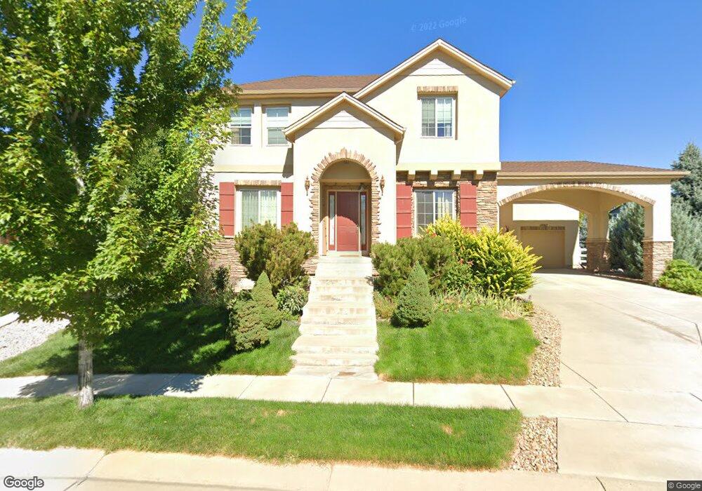
14067 Pinehurst Cir Broomfield, CO 80023
Broadlands NeighborhoodEstimated Value: $1,211,303 - $1,385,000
4
Beds
4
Baths
4,215
Sq Ft
$315/Sq Ft
Est. Value
About This Home
This home is located at 14067 Pinehurst Cir, Broomfield, CO 80023 and is currently estimated at $1,326,326, approximately $314 per square foot. 14067 Pinehurst Cir is a home located in Broomfield County with nearby schools including Meridian Elementary School, Westlake Middle School, and Legacy High School.
Ownership History
Date
Name
Owned For
Owner Type
Purchase Details
Closed on
Jun 23, 2010
Sold by
Toll Co Limited Partnership
Bought by
Liu Wenlong and Xiao Menghua
Current Estimated Value
Home Financials for this Owner
Home Financials are based on the most recent Mortgage that was taken out on this home.
Original Mortgage
$350,000
Outstanding Balance
$231,791
Interest Rate
4.73%
Mortgage Type
New Conventional
Estimated Equity
$1,094,535
Create a Home Valuation Report for This Property
The Home Valuation Report is an in-depth analysis detailing your home's value as well as a comparison with similar homes in the area
Home Values in the Area
Average Home Value in this Area
Purchase History
| Date | Buyer | Sale Price | Title Company |
|---|---|---|---|
| Liu Wenlong | $551,817 | Stewart Title |
Source: Public Records
Mortgage History
| Date | Status | Borrower | Loan Amount |
|---|---|---|---|
| Open | Liu Wenlong | $350,000 |
Source: Public Records
Tax History Compared to Growth
Tax History
| Year | Tax Paid | Tax Assessment Tax Assessment Total Assessment is a certain percentage of the fair market value that is determined by local assessors to be the total taxable value of land and additions on the property. | Land | Improvement |
|---|---|---|---|---|
| 2025 | $9,211 | $82,670 | $19,430 | $63,240 |
| 2024 | $9,211 | $79,840 | $18,570 | $61,270 |
| 2023 | $9,135 | $86,650 | $20,160 | $66,490 |
| 2022 | $7,981 | $64,950 | $13,900 | $51,050 |
| 2021 | $8,226 | $66,810 | $14,300 | $52,510 |
| 2020 | $8,292 | $66,570 | $13,590 | $52,980 |
| 2019 | $8,296 | $67,030 | $13,680 | $53,350 |
| 2018 | $7,581 | $58,980 | $10,800 | $48,180 |
| 2017 | $6,962 | $65,210 | $11,940 | $53,270 |
| 2016 | $7,455 | $61,680 | $7,440 | $54,240 |
| 2015 | $7,454 | $51,740 | $7,440 | $44,300 |
| 2014 | $6,503 | $51,740 | $7,440 | $44,300 |
Source: Public Records
Map
Nearby Homes
- 13872 Legend Way Unit 101
- 13973 Pinehurst Cir
- 13859 Legend Trail Unit 103
- 14039 Park Cove Dr
- 13965 Sandtrap Cir
- 3767 Jenny Ln
- 13756 Legend Trail Unit 101
- 3577 Molly Cir Unit 3577
- 14020 Park Cove Dr
- 13895 Sandtrap Cir
- 3822 Broadmoor Loop
- 14075 Turnberry Ct
- 13896 Muirfield Ct
- 13676 Rock Point Unit 101
- 14330 Lakeview Ln
- 13648 Plaster Point Unit 102
- 13755 Troon Ct
- 14214 Lakeview Ln
- 3860 Broadlands Ln
- 3220 Boulder Cir Unit 103
- 14059 Pinehurst Cir
- 14109 Whitney Cir
- 14050 Pinehurst Cir
- 14075 Pinehurst Cir
- 14051 Pinehurst Cir
- 14113 Whitney Cir
- 14114 Whitney Cir
- 14043 Pinehurst Cir
- 14042 Pinehurst Cir
- 14117 Whitney Cir
- 14083 Pinehurst Cir
- 14080 Pinehurst Cir
- 14035 Pinehurst Cir
- 14034 Pinehurst Cir
- 3283 Taylor Ct
- 14121 Whitney Cir
- 14088 Pinehurst Cir
- 14091 Pinehurst Cir
- 3243 Taylor Ct
- 14122 Whitney Cir