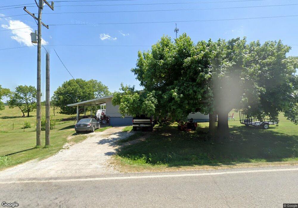
14070 E Highway 32 Stockton, MO 65785
Estimated Value: $158,000 - $257,000
--
Bed
--
Bath
1,275
Sq Ft
$149/Sq Ft
Est. Value
About This Home
This home is located at 14070 E Highway 32, Stockton, MO 65785 and is currently estimated at $190,022, approximately $149 per square foot. 14070 E Highway 32 is a home with nearby schools including Stockton Elementary School, Stockton Middle School, and Stockton High School.
Ownership History
Date
Name
Owned For
Owner Type
Purchase Details
Closed on
Jun 7, 2019
Sold by
Schroeder Richard Lawrence and Smith Desirae E
Bought by
Peach Timothy D and Peach Mary K
Current Estimated Value
Purchase Details
Closed on
Feb 27, 2019
Sold by
Peach Timothy D and Peach Mary K
Bought by
Schroeder Richard Lawrence and Smith Desirae E
Home Financials for this Owner
Home Financials are based on the most recent Mortgage that was taken out on this home.
Original Mortgage
$100,000
Interest Rate
4.4%
Mortgage Type
Seller Take Back
Purchase Details
Closed on
Mar 26, 2009
Sold by
Peach Timothy D
Bought by
Peach Timothy D and Peach Mary K
Home Financials for this Owner
Home Financials are based on the most recent Mortgage that was taken out on this home.
Original Mortgage
$52,500
Interest Rate
5.21%
Mortgage Type
New Conventional
Create a Home Valuation Report for This Property
The Home Valuation Report is an in-depth analysis detailing your home's value as well as a comparison with similar homes in the area
Home Values in the Area
Average Home Value in this Area
Purchase History
| Date | Buyer | Sale Price | Title Company |
|---|---|---|---|
| Peach Timothy D | -- | None Available | |
| Schroeder Richard Lawrence | -- | None Available | |
| Peach Timothy D | -- | None Available |
Source: Public Records
Mortgage History
| Date | Status | Borrower | Loan Amount |
|---|---|---|---|
| Previous Owner | Schroeder Richard Lawrence | $100,000 | |
| Previous Owner | Peach Timothy D | $52,500 |
Source: Public Records
Tax History Compared to Growth
Tax History
| Year | Tax Paid | Tax Assessment Tax Assessment Total Assessment is a certain percentage of the fair market value that is determined by local assessors to be the total taxable value of land and additions on the property. | Land | Improvement |
|---|---|---|---|---|
| 2025 | $644 | $16,480 | $640 | $15,840 |
| 2024 | $644 | $14,620 | $570 | $14,050 |
| 2023 | $643 | $14,620 | $0 | $0 |
| 2022 | $643 | $14,620 | $0 | $0 |
| 2021 | $618 | $14,620 | $0 | $0 |
| 2020 | $618 | $14,010 | $0 | $0 |
| 2019 | $600 | $14,010 | $0 | $0 |
| 2018 | $0 | $14,010 | $0 | $0 |
| 2017 | -- | $14,010 | $0 | $0 |
| 2016 | -- | $14,010 | $0 | $0 |
| 2015 | -- | $14,010 | $0 | $0 |
| 2014 | -- | $14,010 | $0 | $0 |
| 2013 | -- | $14,010 | $0 | $0 |
Source: Public Records
Map
Nearby Homes
- 12175 S B Hwy
- 708 West St
- 602 W Highway 32
- 602 W 32 Hwy
- 21772 State Highway 32
- 003 E 1400 Rd
- 315 Skyline Dr
- 13650 State Highway 39
- 407 S High St
- 000 State Highway 32
- 008 State Highway 32
- 007 State Highway 32
- 006 State Highway 32
- 111 E Locust St
- 212 East St
- 14500 E 1450 Rd
- 204 N Blake
- 14562 S 3rd St
- 000 Englewood Dr
- 209 E Oak St
- 14085 E Highway 32
- 13399 S Highway 39
- 14235 E Highway 32
- 14195 E 1348 Rd
- 13900 E Highway 32
- 4580 E Highway B
- 13900 E Highway 32
- 12099 E Highway 39
- 12099 E Highway 39
- 12510 E Highway 39
- 12510 E Highway 39
- 3710 E 2000 Rd
- 12510 E Highway 39
- 13689 S 1401 Rd
- 13410 S 1425 Rd
- 1100 West St
- 1100 West St
- 1100 West St
- 13295 S Highway 39
- 13370 S 1425 Rd