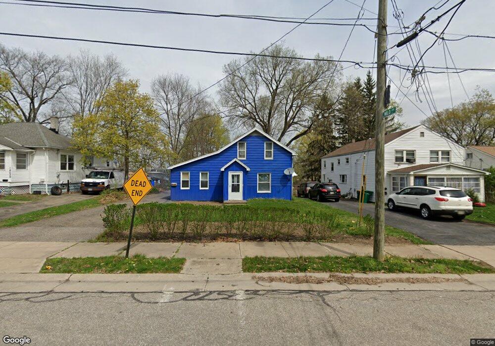
14071 Maple Ave Maple Heights, OH 44137
Estimated Value: $115,680 - $207,000
3
Beds
1
Bath
1,064
Sq Ft
$136/Sq Ft
Est. Value
About This Home
This home is located at 14071 Maple Ave, Maple Heights, OH 44137 and is currently estimated at $144,920, approximately $136 per square foot. 14071 Maple Ave is a home located in Cuyahoga County with nearby schools including Abraham Lincoln Elementary School, Rockside/ J.F. Kennedy School, and Barack Obama School.
Ownership History
Date
Name
Owned For
Owner Type
Purchase Details
Closed on
Sep 2, 2003
Sold by
Moccia Dominic and Moccia Romeo
Bought by
Young Robert and Griffin Young Michelle E
Current Estimated Value
Home Financials for this Owner
Home Financials are based on the most recent Mortgage that was taken out on this home.
Original Mortgage
$71,200
Outstanding Balance
$30,467
Interest Rate
5.12%
Mortgage Type
Purchase Money Mortgage
Estimated Equity
$114,453
Purchase Details
Closed on
May 27, 2003
Sold by
Dill John
Bought by
Moccia Dominic and Moccia Romeo
Purchase Details
Closed on
Oct 15, 2002
Sold by
Dill Nathaniel Wade and Dill William Wade
Bought by
Estate Of Edith E Dill
Purchase Details
Closed on
Sep 11, 1991
Sold by
Brettin Edith E
Bought by
Dill Nathaniel Wade
Purchase Details
Closed on
Jan 1, 1975
Bought by
Brettin Edith E
Create a Home Valuation Report for This Property
The Home Valuation Report is an in-depth analysis detailing your home's value as well as a comparison with similar homes in the area
Home Values in the Area
Average Home Value in this Area
Purchase History
| Date | Buyer | Sale Price | Title Company |
|---|---|---|---|
| Young Robert | $89,000 | Northern Title | |
| Moccia Dominic | $40,000 | Northern Title | |
| Estate Of Edith E Dill | -- | -- | |
| Dill Nathaniel Wade | -- | -- | |
| Brettin Edith E | -- | -- |
Source: Public Records
Mortgage History
| Date | Status | Borrower | Loan Amount |
|---|---|---|---|
| Open | Young Robert | $71,200 |
Source: Public Records
Tax History
| Year | Tax Paid | Tax Assessment Tax Assessment Total Assessment is a certain percentage of the fair market value that is determined by local assessors to be the total taxable value of land and additions on the property. | Land | Improvement |
|---|---|---|---|---|
| 2024 | $3,367 | $37,100 | $9,625 | $27,475 |
| 2023 | $2,678 | $25,240 | $5,080 | $20,160 |
| 2022 | $2,669 | $25,240 | $5,080 | $20,160 |
| 2021 | $2,846 | $25,240 | $5,080 | $20,160 |
| 2020 | $2,428 | $19,110 | $3,850 | $15,260 |
| 2019 | $2,413 | $54,600 | $11,000 | $43,600 |
| 2018 | $2,401 | $19,110 | $3,850 | $15,260 |
| 2017 | $2,467 | $19,290 | $4,870 | $14,420 |
| 2016 | $2,385 | $19,290 | $4,870 | $14,420 |
| 2015 | $2,267 | $19,290 | $4,870 | $14,420 |
| 2014 | $2,267 | $19,890 | $5,010 | $14,880 |
Source: Public Records
Map
Nearby Homes
- 5220 Forest Ave
- 5179 Milo Ave
- 14305 Granger Rd
- 14510 Granger Rd
- 14512 Granger Rd
- 5270 E 135th St
- 13417 Granger Rd
- 13704 Linn Ave
- 5408 Roland Dr
- 4955 E 141st St
- 13719 Wolf Ave
- 15095 Granger Rd
- 5380 E 131st St
- 13009 Willard Ave
- 13008 Willard Ave
- 13116 Oak Park Blvd
- 12328 Granger Rd
- 13206 Shady Oak Blvd
- 16101 Raymond St
- 5069 Henry St
- 14113 Maple Ave
- 14039 Maple Ave
- 14129 Maple Ave
- 14009 Maple Ave
- 14147 Maple Ave
- 14149 Maple Ave
- 5197 Milo Ave
- 14010 Maple Ave
- 5201 Milo Ave
- 5205 Milo Ave
- 5190 Forest Ave
- 5198 Forest Ave
- 5209 Milo Ave
- 5202 Forest Ave
- 5196 Milo Ave
- 5211 Milo Ave
- 13827 Rosalie Dr
- 5206 Forest Ave
- 5245 Evelyn Dr
- 5216 Milo Ave
Your Personal Tour Guide
Ask me questions while you tour the home.