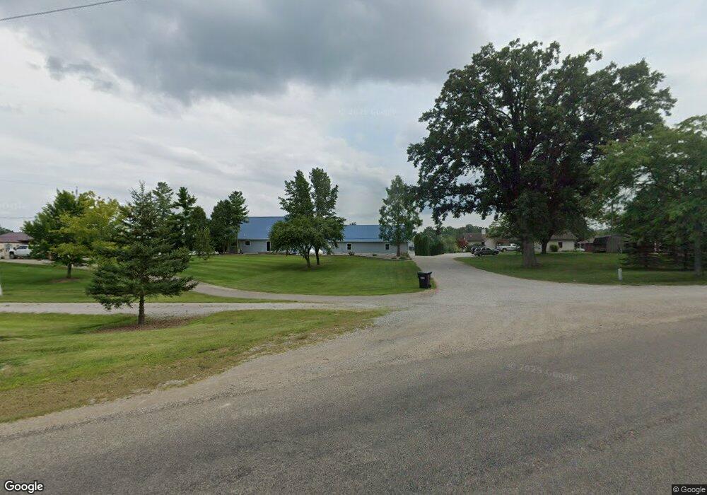
14071 Woodbridge Rd Camden, MI 49232
Estimated Value: $574,000 - $810,093
--
Bed
1
Bath
2,278
Sq Ft
$314/Sq Ft
Est. Value
About This Home
This home is located at 14071 Woodbridge Rd, Camden, MI 49232 and is currently estimated at $715,031, approximately $313 per square foot. 14071 Woodbridge Rd is a home located in Hillsdale County with nearby schools including Camden-Frontier K-8 School and Camden-Frontier High School.
Ownership History
Date
Name
Owned For
Owner Type
Purchase Details
Closed on
Feb 28, 2024
Sold by
Byrne Kimberly Lynn
Bought by
Rupp Terry L
Current Estimated Value
Purchase Details
Closed on
Jan 23, 2012
Sold by
Rupp Terry L and Byrne Kimberly Lynn
Bought by
Rupp Terry L and Byrne Kimberly Lynn
Purchase Details
Closed on
Dec 4, 2010
Sold by
Bonney David and Bonney Margaret A
Bought by
Rupp Terry L
Purchase Details
Closed on
Oct 1, 1988
Sold by
Rupp Terry
Bought by
Rupp Terry
Purchase Details
Closed on
Apr 25, 1986
Sold by
Cramton Elwyn G and Cramton Theresa A
Bought by
Rupp Terry
Create a Home Valuation Report for This Property
The Home Valuation Report is an in-depth analysis detailing your home's value as well as a comparison with similar homes in the area
Home Values in the Area
Average Home Value in this Area
Purchase History
| Date | Buyer | Sale Price | Title Company |
|---|---|---|---|
| Rupp Terry L | -- | None Listed On Document | |
| Rupp Terry L | -- | Midstate Title | |
| Rupp Terry L | -- | None Available | |
| Rupp Terry | -- | -- | |
| Rupp Terry | $6,000 | -- |
Source: Public Records
Tax History Compared to Growth
Tax History
| Year | Tax Paid | Tax Assessment Tax Assessment Total Assessment is a certain percentage of the fair market value that is determined by local assessors to be the total taxable value of land and additions on the property. | Land | Improvement |
|---|---|---|---|---|
| 2025 | $5,065 | $421,800 | $0 | $0 |
| 2024 | $2,214 | $387,600 | $0 | $0 |
| 2023 | $2,109 | $333,900 | $0 | $0 |
| 2022 | $4,842 | $294,800 | $0 | $0 |
| 2021 | $4,722 | $250,300 | $0 | $0 |
| 2020 | $4,779 | $245,500 | $0 | $0 |
| 2019 | $4,568 | $235,300 | $0 | $0 |
| 2018 | $4,382 | $225,900 | $0 | $0 |
| 2017 | $4,198 | $225,490 | $0 | $0 |
| 2016 | $4,168 | $173,970 | $0 | $0 |
| 2015 | $1,776 | $173,970 | $0 | $0 |
| 2013 | $1,721 | $167,170 | $0 | $0 |
| 2012 | $1,681 | $161,220 | $0 | $0 |
Source: Public Records
Map
Nearby Homes
- 13857 E Diane Dr
- 13791 E Diane Dr
- 14600 W Diane Dr
- 14401 Woodbridge Rd
- 14934 Heather Ct
- 13551 Hillsdale Rd
- 623-624 Yuma Trail
- 362 Wasco Trail
- 0 W Territorial Rd Unit 25043960
- 11794 Clark Rd
- 199 Shoshone Trail
- 8800 W Territorial Rd
- 988-989 Seneca Dr
- 207 Modoc Trail
- 155 Navajo Trail
- 213 Navajo Trail
- 15791 Rice Rd
- 600 Seneca Dr
- 0 Seneca Dr
- 234 Seneca Dr
- 14011 Woodbridge Rd
- 2011 Sampson Rd
- 2031 Sampson Rd
- 2051 Sampson Rd
- 13899 Woodbridge Rd
- 2091 Sampson Rd
- 13881 Woodbridge Rd
- 2131 Sampson Rd
- 13863 Woodbridge Rd
- 13845 Woodbridge Rd
- 13827 Woodbridge Rd
- 14420 Horn Dr
- 14251 W Diane Dr
- 14249 W Diane Dr
- 14263 W Diane Dr
- 13791 Woodbridge Rd
- 14242 W Diane Dr
- 14271 W Diane Dr
- 2239 Florida Ln
- 2232 Florida Ln