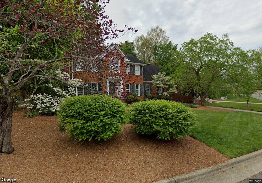
1408 Christopher Ct High Point, NC 27265
Deep River NeighborhoodEstimated Value: $366,735 - $429,000
3
Beds
3
Baths
2,280
Sq Ft
$172/Sq Ft
Est. Value
About This Home
This home is located at 1408 Christopher Ct, High Point, NC 27265 and is currently estimated at $391,184, approximately $171 per square foot. 1408 Christopher Ct is a home located in Guilford County with nearby schools including Southwest Elementary School, Welborn Academy of Science & Technology, and T.W. Andrews High School.
Ownership History
Date
Name
Owned For
Owner Type
Purchase Details
Closed on
Jun 16, 2000
Sold by
Ryan Michael E and Ryan Rosalyn P
Bought by
Simpson John C and Simpson Lori R
Current Estimated Value
Home Financials for this Owner
Home Financials are based on the most recent Mortgage that was taken out on this home.
Original Mortgage
$200,000
Interest Rate
8.27%
Create a Home Valuation Report for This Property
The Home Valuation Report is an in-depth analysis detailing your home's value as well as a comparison with similar homes in the area
Home Values in the Area
Average Home Value in this Area
Purchase History
| Date | Buyer | Sale Price | Title Company |
|---|---|---|---|
| Simpson John C | $230,000 | -- |
Source: Public Records
Mortgage History
| Date | Status | Borrower | Loan Amount |
|---|---|---|---|
| Closed | Simpson John C | $200,000 |
Source: Public Records
Tax History
| Year | Tax Paid | Tax Assessment Tax Assessment Total Assessment is a certain percentage of the fair market value that is determined by local assessors to be the total taxable value of land and additions on the property. | Land | Improvement |
|---|---|---|---|---|
| 2025 | $3,693 | $268,000 | $52,000 | $216,000 |
| 2024 | $3,693 | $268,000 | $52,000 | $216,000 |
| 2023 | $3,693 | $268,000 | $52,000 | $216,000 |
| 2022 | $3,613 | $268,000 | $52,000 | $216,000 |
| 2021 | $3,329 | $241,600 | $48,000 | $193,600 |
| 2020 | $3,329 | $241,600 | $48,000 | $193,600 |
| 2019 | $3,329 | $241,600 | $0 | $0 |
| 2018 | $3,313 | $241,600 | $0 | $0 |
| 2017 | $3,313 | $241,600 | $0 | $0 |
| 2016 | $3,129 | $223,100 | $0 | $0 |
| 2015 | $3,146 | $223,100 | $0 | $0 |
| 2014 | $3,199 | $223,100 | $0 | $0 |
Source: Public Records
Map
Nearby Homes
- 4217 Chilton Way
- 4301 Bradbury Way
- 2431 Tweedmore Ct
- 4001 Tesa Ct
- 3023 Maple Branch Dr
- 4008 Deerfield St
- 4004 Baywater Point
- 3924 Braddock Rd
- 3421 Wildwood Ave
- 4518 Oak Hollow Dr
- 3905 Wynne Brook Ct
- 3025 Sycamore Point Trail
- 3912 Wynne Brook Ct
- 4000 Grind Stone Ct
- 1517 Skeet Club Rd
- 1515 Skeet Club Rd
- 4358 Ashton Oaks Ct
- 3273 Alyssa Way
- 2435 Lake Oak
- 2501 White Fence Way
- 1406 Christopher Ct
- 1410 Christopher Ct
- 4111 Jeffrey Lane Point
- 4109 Jeffrey Lane Point
- 1409 Christopher Ct
- 1411 Christopher Ct
- 1407 Christopher Ct
- 1405 Christopher Ct
- 4119 Jeffrey Lane Point
- 1402 Christopher Ct
- 4107 Jeffrey Lane Point
- 1403 Christopher Ct
- 4112 Jeffrey Lane Point
- 4114 Jeffrey Lane Point
- 4116 Jeffrey Lane Point
- 4110 Jeffrey Lane Point
- 4103 Chilton Way
- 4118 Jeffrey Lane Point
- 4105 Jeffrey Lane Point
- 1400 Christopher Ct
Your Personal Tour Guide
Ask me questions while you tour the home.