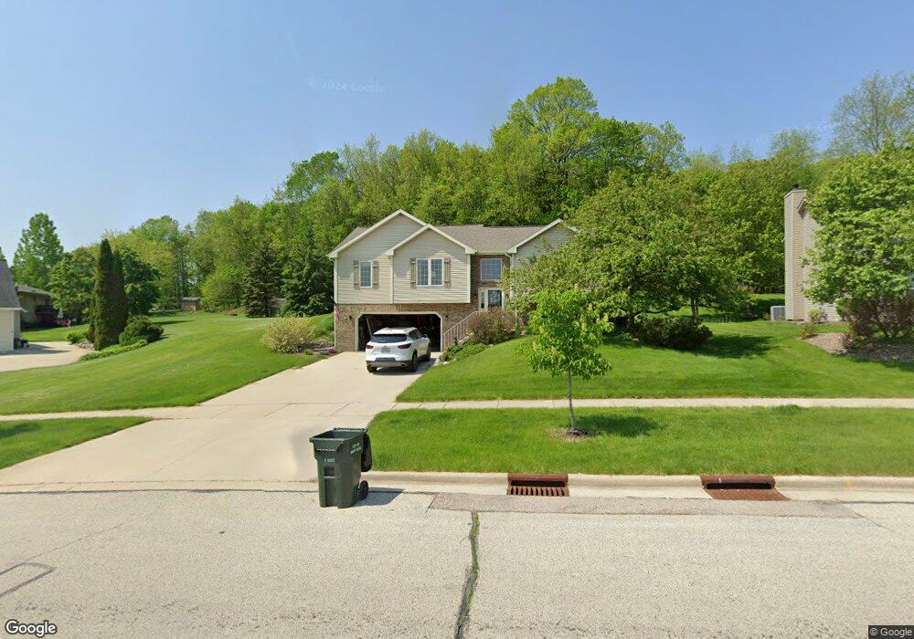
1408 Wolf Dr West Bend, WI 53090
Estimated Value: $391,628 - $428,000
3
Beds
3
Baths
1,860
Sq Ft
$222/Sq Ft
Est. Value
About This Home
This home is located at 1408 Wolf Dr, West Bend, WI 53090 and is currently estimated at $413,657, approximately $222 per square foot. 1408 Wolf Dr is a home located in Washington County with nearby schools including McLane Elementary School, Silverbrook Intermediate School, and East High School.
Ownership History
Date
Name
Owned For
Owner Type
Purchase Details
Closed on
Jul 24, 2009
Sold by
Knoll John M and Knoll Tami S
Bought by
Fischer Thomas J and Fischer Karen E
Current Estimated Value
Home Financials for this Owner
Home Financials are based on the most recent Mortgage that was taken out on this home.
Original Mortgage
$215,950
Outstanding Balance
$139,484
Interest Rate
5.43%
Mortgage Type
FHA
Estimated Equity
$274,173
Create a Home Valuation Report for This Property
The Home Valuation Report is an in-depth analysis detailing your home's value as well as a comparison with similar homes in the area
Home Values in the Area
Average Home Value in this Area
Purchase History
| Date | Buyer | Sale Price | Title Company |
|---|---|---|---|
| Fischer Thomas J | $220,000 | None Available |
Source: Public Records
Mortgage History
| Date | Status | Borrower | Loan Amount |
|---|---|---|---|
| Open | Fischer Thomas J | $215,950 |
Source: Public Records
Tax History
| Year | Tax Paid | Tax Assessment Tax Assessment Total Assessment is a certain percentage of the fair market value that is determined by local assessors to be the total taxable value of land and additions on the property. | Land | Improvement |
|---|---|---|---|---|
| 2025 | $5,119 | $212,900 | $49,500 | $163,400 |
| 2024 | $4,662 | $327,600 | $57,400 | $270,200 |
| 2023 | $4,199 | $212,900 | $49,500 | $163,400 |
| 2022 | $4,251 | $212,900 | $49,500 | $163,400 |
| 2021 | $4,241 | $212,900 | $49,500 | $163,400 |
| 2020 | $4,202 | $212,900 | $49,500 | $163,400 |
| 2019 | $3,615 | $212,900 | $49,500 | $163,400 |
| 2018 | $4,000 | $212,900 | $49,500 | $163,400 |
| 2017 | $3,991 | $194,400 | $49,500 | $144,900 |
| 2016 | $4,047 | $194,400 | $49,500 | $144,900 |
| 2015 | $4,135 | $194,400 | $49,500 | $144,900 |
| 2014 | $4,135 | $194,400 | $49,500 | $144,900 |
| 2013 | $4,106 | $194,400 | $49,500 | $144,900 |
Source: Public Records
Map
Nearby Homes
- 3222 Windsor Place
- 906 Villa Park Dr
- 1423 Lower Forest Ct
- Lt1 Beaver Dam Rd
- 715 Canterberry Ct Unit 109
- 715 Canterberry Ct Unit 105
- 2346 W Washington St
- 4000 W Washington St
- 151 N University Dr Unit 215
- 125 N University Dr Unit 108
- Lt1 Dandelion Ln
- 1521 Quietwood Ln Unit 1A
- 4444 Wurbro Dr
- 1130 Green Tree Rd
- 1511 Roosevelt Dr S
- 7345 Friendly Dr
- 1203 N 14th Ave
- 1318 Jefferson St
- 1600 Patricia Dr
- 1925 Hilltop Dr
- 1412 Wolf Dr
- 3305 Dubin Cir
- 3303 Dubin Cir
- 1407 Wolf Dr
- 1416 Wolf Dr
- 1415 Wolf Dr
- 3301 Dubin Cir
- 1329 Wolf Dr
- 0 Wolf Dr Unit LOT 1 1618576
- 0 Wolf Dr Unit LOT 4 1619527
- 0 Wolf Dr Unit LOT 2 1618897
- 0 Wolf Dr Unit LOT 3 1619292
- 1425 Wolf Dr
- 3306 Dubin Cir
- 1430 Wolf Dr
- 3302 Dubin Cir
- 1317 Wolf Dr
- 1433 Wolf Dr
- 1428 Villa Park Ct
- 1320 Wolf Dr
Your Personal Tour Guide
Ask me questions while you tour the home.