Estimated Value: $541,000 - $640,289
3
Beds
3
Baths
2,131
Sq Ft
$270/Sq Ft
Est. Value
About This Home
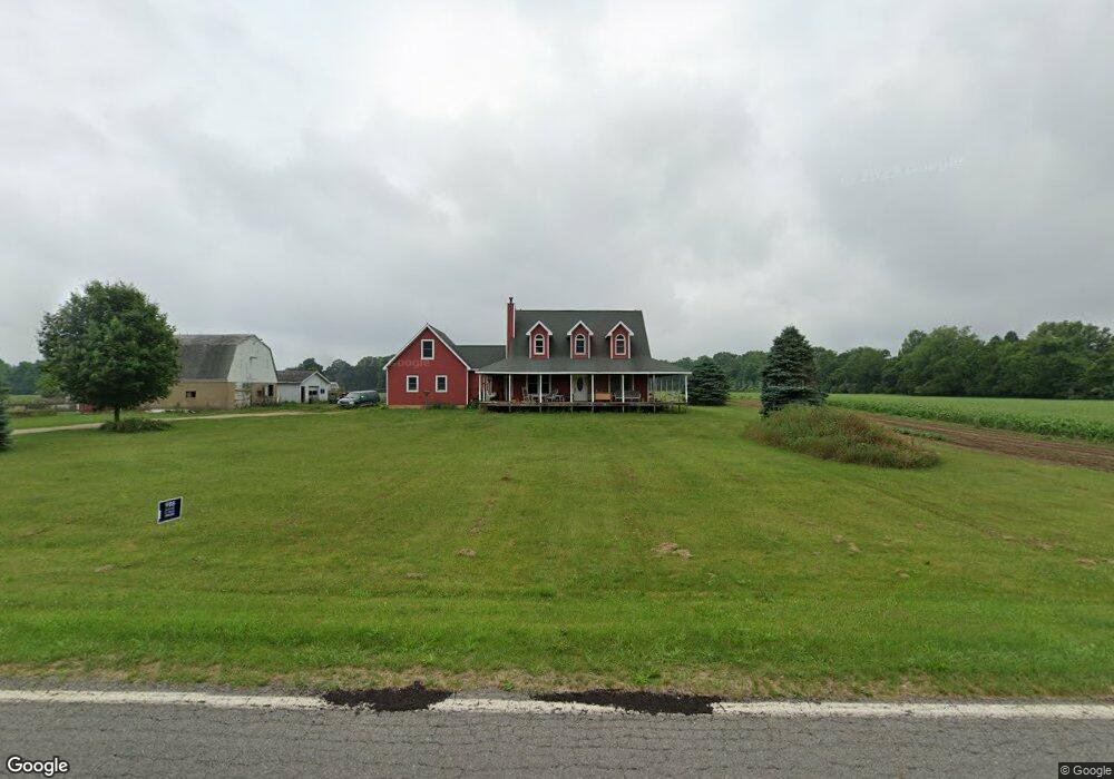
This home is located at 14082 Range Line Rd, Niles, MI 49120 and is currently estimated at $576,430, approximately $270 per square foot. 14082 Range Line Rd is a home with nearby schools including Ottawa Elementary School, Moccasin Elementary School, and Buchanan Middle School.
Ownership History
Date
Name
Owned For
Owner Type
Purchase Details
Closed on
May 11, 2023
Sold by
Bachman Mark Alan and Bachman Heather
Bought by
Bachman Mark Alan
Current Estimated Value
Home Financials for this Owner
Home Financials are based on the most recent Mortgage that was taken out on this home.
Original Mortgage
$236,000
Outstanding Balance
$229,098
Interest Rate
6.32%
Mortgage Type
New Conventional
Estimated Equity
$347,332
Purchase Details
Closed on
Oct 19, 2007
Sold by
Bachman Mark Alan
Bought by
Bachman Mark Alan and Bachman Heather
Purchase Details
Closed on
Nov 23, 1998
Purchase Details
Closed on
Mar 17, 1998
Purchase Details
Closed on
Jun 1, 1976
Create a Home Valuation Report for This Property
The Home Valuation Report is an in-depth analysis detailing your home's value as well as a comparison with similar homes in the area
Home Values in the Area
Average Home Value in this Area
Purchase History
| Date | Buyer | Sale Price | Title Company |
|---|---|---|---|
| Bachman Mark Alan | -- | None Listed On Document | |
| Bachman Mark Alan | -- | None Available | |
| -- | $100 | -- | |
| -- | $100 | -- | |
| -- | $31,000 | -- |
Source: Public Records
Mortgage History
| Date | Status | Borrower | Loan Amount |
|---|---|---|---|
| Open | Bachman Mark Alan | $236,000 |
Source: Public Records
Tax History
| Year | Tax Paid | Tax Assessment Tax Assessment Total Assessment is a certain percentage of the fair market value that is determined by local assessors to be the total taxable value of land and additions on the property. | Land | Improvement |
|---|---|---|---|---|
| 2025 | $4,032 | $295,900 | $0 | $0 |
| 2024 | $3,215 | $235,000 | $0 | $0 |
| 2023 | $3,113 | $206,900 | $0 | $0 |
| 2022 | $3,140 | $195,500 | $0 | $0 |
| 2021 | $3,678 | $169,000 | $42,200 | $126,800 |
| 2020 | $3,631 | $167,100 | $0 | $0 |
| 2019 | $3,565 | $160,200 | $41,400 | $118,800 |
| 2018 | $3,529 | $160,200 | $0 | $0 |
| 2017 | $3,470 | $157,700 | $0 | $0 |
| 2016 | $3,449 | $165,600 | $0 | $0 |
| 2015 | $3,448 | $164,900 | $0 | $0 |
| 2014 | $2,769 | $137,600 | $0 | $0 |
Source: Public Records
Map
Nearby Homes
- 4336 Hills Haven Rd
- 14275 Deer Path
- 14556 Red Bud Trail N Unit Lot 83
- 1919 Jay St
- V/L Mead Rd
- 14566 N Red Bud Trail Unit 20
- 0 E River Rd
- 2434 Jeffery Ln
- 14823 N Main St
- 426 Elizabeth St
- 15165 Main St
- 14918 Main St
- 00 Herman Rd
- 903 N Detroit St
- 415 Remus Dr
- 315 N Red Bud Trail
- Vactant Land 1400 Block
- 1025 E Front St
- 1005 E Front St
- 3119 N US Highway 31
- 14129 Daisy Ct
- 14128 Daisy Ct
- 14145 Daisy Ct
- 14144 Daisy Ct
- 14131 Catalpa Ct
- 14137 Catalpa Ct
- 14177 Daisy Ct
- 14158 Daisy Ct
- 14185 Daisy Ct
- 14185 Daisy Ct Unit 60-67
- 14130 Catalpa Ct
- 14161 Catalpa Ct
- 14182 Daisy Ct
- 13912 Range Line Rd
- 4801 River Pointe Blvd
- 14140 Catalpa Ct
- 13927 Range Line Rd
- 14219 Daisy Ct
- 14160 Catalpa Ct
- 4824 River Pointe Blvd
Your Personal Tour Guide
Ask me questions while you tour the home.