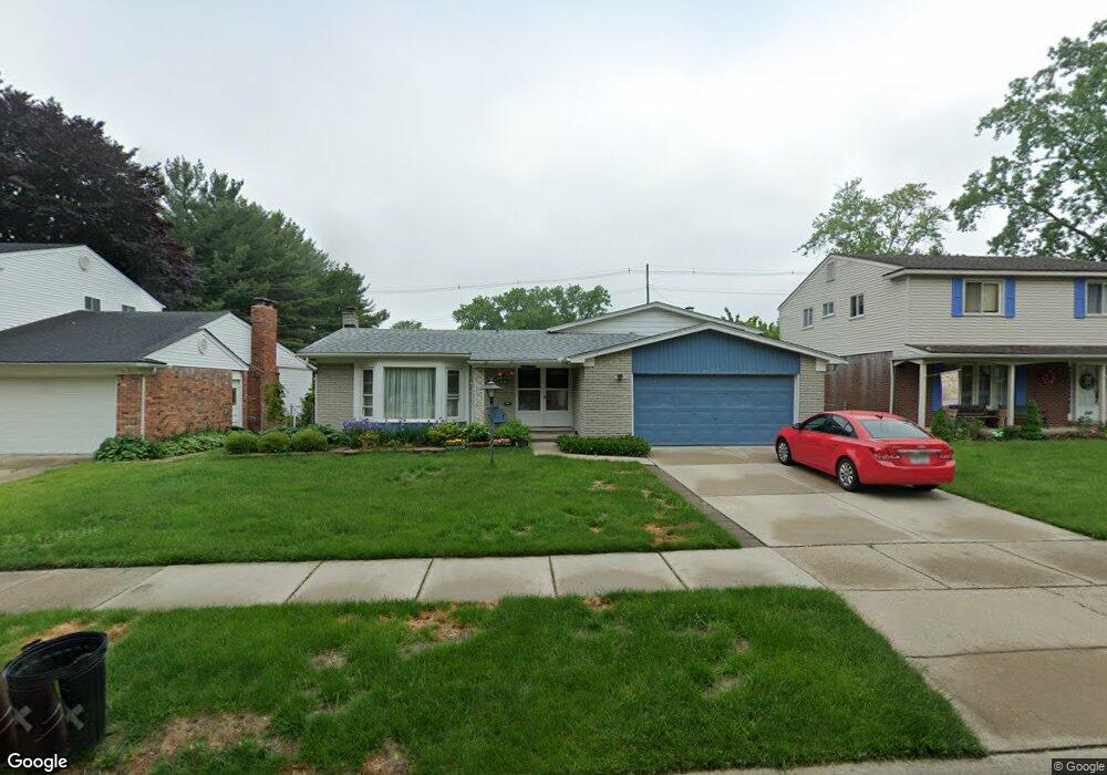
14087 Hubbard St Livonia, MI 48154
Estimated Value: $344,635 - $406,000
--
Bed
3
Baths
2,148
Sq Ft
$180/Sq Ft
Est. Value
About This Home
This home is located at 14087 Hubbard St, Livonia, MI 48154 and is currently estimated at $386,409, approximately $179 per square foot. 14087 Hubbard St is a home located in Wayne County with nearby schools including Kennedy Elementary School, Johnson Upper Elementary School, and Frost Middle School.
Ownership History
Date
Name
Owned For
Owner Type
Purchase Details
Closed on
Feb 2, 2023
Sold by
Rini Pauline
Bought by
Rini Pauline
Current Estimated Value
Purchase Details
Closed on
Apr 29, 2016
Sold by
Rini Frederick and Rini Pauline
Bought by
Rini Frederick and Rini Pauline
Home Financials for this Owner
Home Financials are based on the most recent Mortgage that was taken out on this home.
Original Mortgage
$77,200
Interest Rate
3.71%
Mortgage Type
New Conventional
Create a Home Valuation Report for This Property
The Home Valuation Report is an in-depth analysis detailing your home's value as well as a comparison with similar homes in the area
Home Values in the Area
Average Home Value in this Area
Purchase History
| Date | Buyer | Sale Price | Title Company |
|---|---|---|---|
| Rini Pauline | -- | -- | |
| Rini Frederick | -- | Attorney |
Source: Public Records
Mortgage History
| Date | Status | Borrower | Loan Amount |
|---|---|---|---|
| Previous Owner | Rini Frederick | $77,200 |
Source: Public Records
Tax History Compared to Growth
Tax History
| Year | Tax Paid | Tax Assessment Tax Assessment Total Assessment is a certain percentage of the fair market value that is determined by local assessors to be the total taxable value of land and additions on the property. | Land | Improvement |
|---|---|---|---|---|
| 2025 | $2,119 | $168,900 | $0 | $0 |
| 2024 | $2,119 | $161,300 | $0 | $0 |
| 2023 | $2,022 | $145,300 | $0 | $0 |
| 2022 | $1,925 | $132,300 | $0 | $0 |
| 2021 | $3,448 | $125,600 | $0 | $0 |
| 2019 | $3,308 | $116,000 | $0 | $0 |
| 2018 | $1,709 | $107,400 | $0 | $0 |
| 2017 | $3,025 | $103,800 | $0 | $0 |
| 2016 | $3,180 | $103,800 | $0 | $0 |
| 2015 | $7,742 | $96,360 | $0 | $0 |
| 2012 | -- | $73,710 | $15,810 | $57,900 |
Source: Public Records
Map
Nearby Homes
- 14214 Cranston St
- 32950 Perth St
- 33025 Martin St
- 32136 Lyndon St
- 33040 Allen St
- 14327 Arden St
- 14563 Melrose St
- 14677 Auburndale St
- 14879 Fairfield St
- 15075 Hubbard St Unit 5
- 14164 Bainbridge St
- 31126 Grennada St
- 31221 Lyndon St
- 15040 Berwick St
- 14154 Hubbell St
- 14292 Hubbell St
- 32651 5 Mile Rd Unit 15
- 30831 Lyndon St
- 14127 Hillcrest St
- 15600 Auburndale St
- 14105 Hubbard St
- 14069 Hubbard St
- 14123 Hubbard St
- 14051 Hubbard St
- 14141 Hubbard St
- 14033 Hubbard St
- 14086 Hubbard St
- 14104 Hubbard St
- 14068 Hubbard St
- 14122 Hubbard St
- 14050 Hubbard St
- 14015 Hubbard St
- 14140 Hubbard St
- 14032 Hubbard St
- 14158 Hubbard St
- 13997 Hubbard St
- 14089 Cranston St
- 14014 Hubbard St
- 14107 Cranston St
- 14071 Cranston St