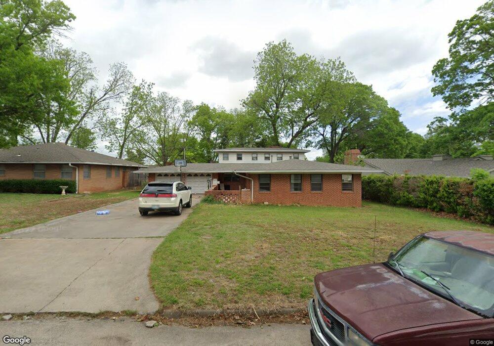
1409 Aspen Ave Duncan, OK 73533
Estimated Value: $182,000 - $212,000
4
Beds
3
Baths
2,264
Sq Ft
$87/Sq Ft
Est. Value
About This Home
This home is located at 1409 Aspen Ave, Duncan, OK 73533 and is currently estimated at $197,586, approximately $87 per square foot. 1409 Aspen Ave is a home located in Stephens County with nearby schools including Plato Elementary School, Duncan Middle School, and Duncan High School.
Ownership History
Date
Name
Owned For
Owner Type
Purchase Details
Closed on
Apr 5, 2018
Sold by
Rogers Logan G and Rogers Jamie B
Bought by
Cain Chris F and Cain Robin R
Current Estimated Value
Purchase Details
Closed on
Jan 27, 2015
Sold by
Edwin Cpyle Revocable Trust
Bought by
Rogers Logan Gene and Rogers Jamie Brooke Sagayo
Create a Home Valuation Report for This Property
The Home Valuation Report is an in-depth analysis detailing your home's value as well as a comparison with similar homes in the area
Home Values in the Area
Average Home Value in this Area
Purchase History
| Date | Buyer | Sale Price | Title Company |
|---|---|---|---|
| Cain Chris F | -- | None Available | |
| Rogers Logan Gene | $97,000 | None Available |
Source: Public Records
Tax History Compared to Growth
Tax History
| Year | Tax Paid | Tax Assessment Tax Assessment Total Assessment is a certain percentage of the fair market value that is determined by local assessors to be the total taxable value of land and additions on the property. | Land | Improvement |
|---|---|---|---|---|
| 2025 | $1,105 | $13,622 | $1,020 | $12,602 |
| 2024 | $1,105 | $12,973 | $1,020 | $11,953 |
| 2023 | $1,105 | $12,355 | $1,020 | $11,335 |
| 2022 | $1,028 | $12,639 | $1,020 | $11,619 |
| 2021 | $981 | $11,521 | $1,020 | $10,501 |
| 2020 | $969 | $11,226 | $1,020 | $10,206 |
| 2019 | $989 | $11,429 | $1,020 | $10,409 |
| 2018 | $968 | $11,873 | $1,020 | $10,853 |
| 2017 | $945 | $11,997 | $1,020 | $10,977 |
| 2016 | $1,011 | $12,889 | $1,020 | $11,869 |
| 2015 | $823 | $11,363 | $897 | $10,466 |
| 2014 | $823 | $11,032 | $884 | $10,148 |
Source: Public Records
Map
Nearby Homes
- 1404 1404 Ne Aspen
- 1601 1601 Pearl
- 1527 1527 N 13th
- 1405 Evergreen Dr
- 1508 1508 N 13th St
- 1402 1402 W Elk Ave
- 1107 W Elk Ave
- 1412 N 12th St
- 1706 Windsor Dr
- 2108 W Club Rd
- 2110 W Club Rd
- 1311 1311 N 20 St
- 2201 W Club Rd
- 1202 N Grand Blvd
- 1302 N 21st St
- 2120 2120 Flamingo Ln
- 1829 1829 Terrace Dr
- 1807 W Chisholm Dr
- 1212 1212 N 21st
- 1902 W Randall Ave
- 1411 Aspen Ave
- 1403 Aspen Ave
- 1411 1411 Aspen
- 1406 Mimosa Ave
- 1413 Aspen Ave
- 1521 Pearl St
- 1404 Mimosa Ave
- 1408 Mimosa Ave
- 1408 Aspen Ave
- 1406 Aspen Ave
- 1523 Pearl St
- 1410 Aspen Ave
- 1412 Mimosa Ave
- 1412 Aspen Ave
- 1404 Aspen Ave
- 1515 Pearl St
- 1518 Pearl St
- 1409 Wisteria Ave
- 1403 1403 Mimosa
- 1403 Mimosa Ave