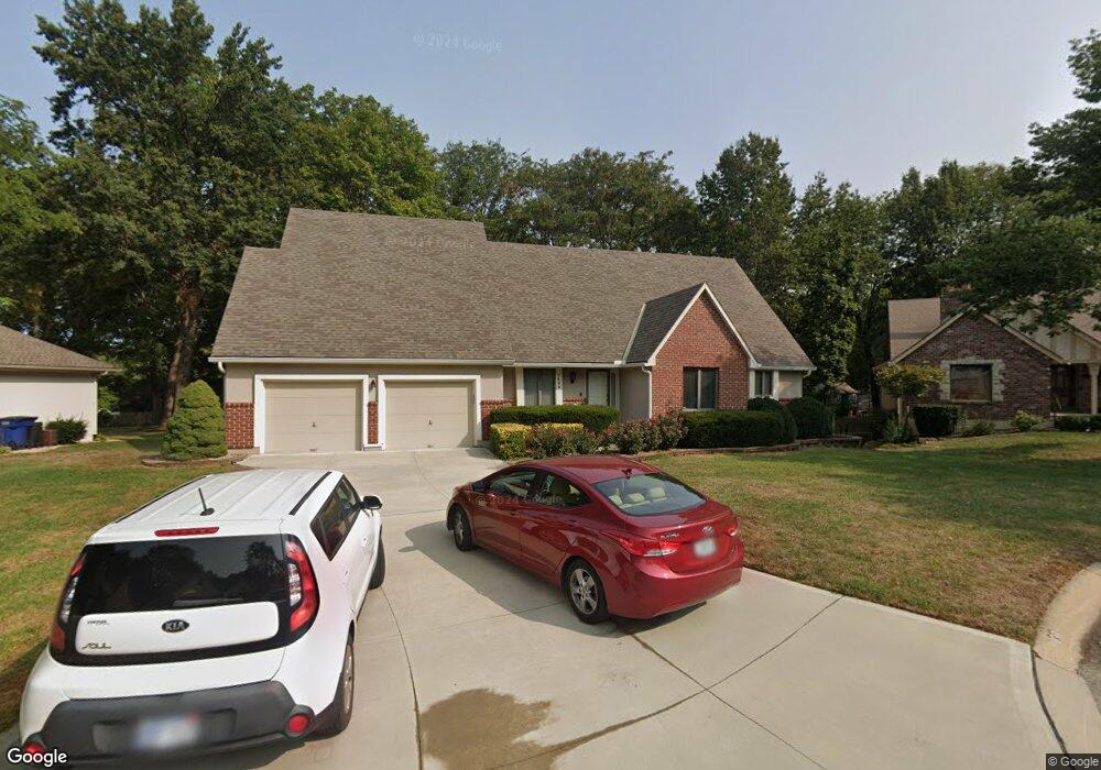
1409 NW Wildwood Dr Blue Springs, MO 64015
Estimated Value: $359,000 - $413,000
4
Beds
3
Baths
2,601
Sq Ft
$148/Sq Ft
Est. Value
About This Home
This home is located at 1409 NW Wildwood Dr, Blue Springs, MO 64015 and is currently estimated at $384,345, approximately $147 per square foot. 1409 NW Wildwood Dr is a home located in Jackson County with nearby schools including James Lewis Elementary School, Brittany Hill Middle School, and Blue Springs High School.
Ownership History
Date
Name
Owned For
Owner Type
Purchase Details
Closed on
Jun 13, 2013
Sold by
Bush Marcus S and Bush Jill C
Bought by
Sneed John D
Current Estimated Value
Purchase Details
Closed on
Oct 20, 2003
Sold by
Phillips Joel R and Phillips Barbara L
Bought by
Sneed John D and Sneed Mildred E
Home Financials for this Owner
Home Financials are based on the most recent Mortgage that was taken out on this home.
Original Mortgage
$195,200
Interest Rate
5.99%
Mortgage Type
Purchase Money Mortgage
Create a Home Valuation Report for This Property
The Home Valuation Report is an in-depth analysis detailing your home's value as well as a comparison with similar homes in the area
Home Values in the Area
Average Home Value in this Area
Purchase History
| Date | Buyer | Sale Price | Title Company |
|---|---|---|---|
| Sneed John D | -- | None Available | |
| Sneed John D | -- | Old Republic Title Of Kansas |
Source: Public Records
Mortgage History
| Date | Status | Borrower | Loan Amount |
|---|---|---|---|
| Previous Owner | Sneed John D | $195,200 |
Source: Public Records
Tax History Compared to Growth
Tax History
| Year | Tax Paid | Tax Assessment Tax Assessment Total Assessment is a certain percentage of the fair market value that is determined by local assessors to be the total taxable value of land and additions on the property. | Land | Improvement |
|---|---|---|---|---|
| 2025 | $4,040 | $56,944 | $9,510 | $47,434 |
| 2024 | $3,962 | $49,516 | $6,196 | $43,320 |
| 2023 | $3,962 | $49,516 | $4,425 | $45,091 |
| 2022 | $5,625 | $62,130 | $7,445 | $54,685 |
| 2021 | $5,620 | $62,130 | $7,445 | $54,685 |
| 2020 | $5,026 | $56,512 | $7,445 | $49,067 |
| 2019 | $4,859 | $56,512 | $7,445 | $49,067 |
| 2018 | $892,819 | $49,184 | $6,480 | $42,704 |
| 2017 | $4,123 | $49,184 | $6,480 | $42,704 |
| 2016 | $4,123 | $46,284 | $5,472 | $40,812 |
| 2014 | $3,899 | $43,624 | $5,116 | $38,508 |
Source: Public Records
Map
Nearby Homes
- 1513 NW Weatherstone Ct
- 1601 NW Weatherstone Ct
- 1501 NW 18th St
- 1113 NW Forest Dr
- 1400 NW Deer Run Trail
- 813 NW North Ridge Ct
- 1701 NW Duncan Rd
- 1389 NW Jefferson Ct
- 2100 NW Parker Ct
- 1000 NW Forest Dr
- 2117 NW Parker Ct
- 2100 NW 12th St
- 1201 NW Burr Oak Ct
- 1109 NW Mock Ave
- 1604 NW Sunridge Dr
- 908 NW Timber Oak Dr
- 804 NW Maynard St
- 904 NW Oakridge Dr
- 2105 NW 5th St
- 2412 NW 9th St
- 1413 NW Wildwood Dr
- 1410 NW Weatherstone Ln
- 1414 NW Weatherstone Ln
- 1406 NW Weatherstone Ln
- 1501 NW Wildwood Dr
- 1400 NW Wildwood Dr
- 1408 NW Wildwood Dr
- 1412 NW Wildwood Dr
- 1502 NW Weatherstone Ln
- 1404 NW Wildwood Dr
- 1500 NW Wildwood Dr
- 1605 NW 12th St
- 1505 NW Wildwood Dr
- 1601 NW 12th St
- 1402 NW Weatherstone Ln
- 1609 NW 12th St
- 1506 NW Weatherstone Ln
- 1517 NW 12th St
- 1409 NW Fox Ridge Dr
- 1504 NW Wildwood Dr