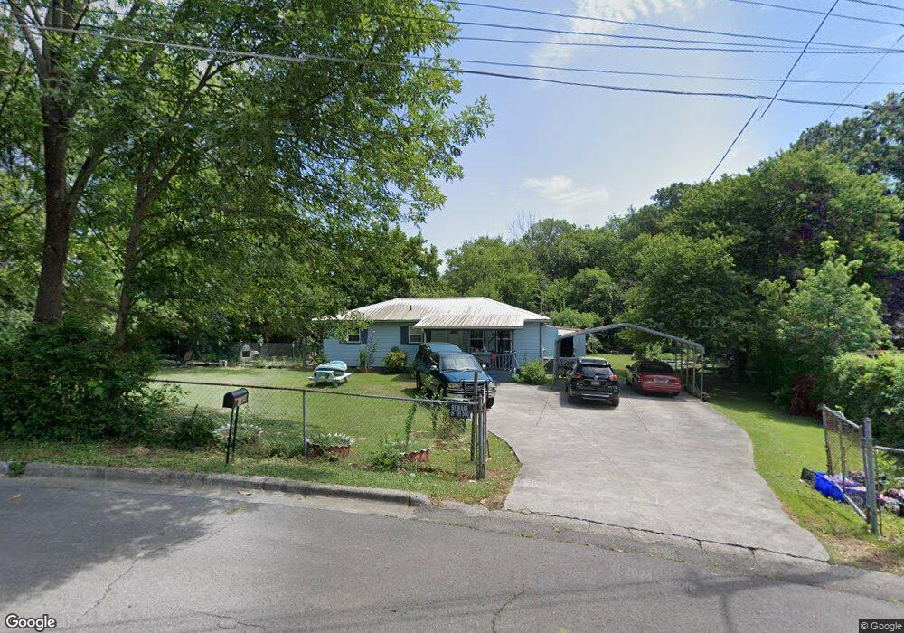
1409 Pierce Cir Dalton, GA 30721
Estimated Value: $175,000 - $213,000
Studio
1
Bath
1,584
Sq Ft
$122/Sq Ft
Est. Value
About This Home
This home is located at 1409 Pierce Cir, Dalton, GA 30721 and is currently estimated at $193,761, approximately $122 per square foot. 1409 Pierce Cir is a home located in Whitfield County with nearby schools including Roan Elementary School, Dalton High School, and Christian Heritage School.
Ownership History
Date
Name
Owned For
Owner Type
Purchase Details
Closed on
Apr 30, 2024
Sold by
Fraire Maria and Martinez Leonel
Bought by
Fraire-Alvarez Pedro and Fraire Sonya
Current Estimated Value
Purchase Details
Closed on
Nov 1, 2022
Sold by
Fraire-Alvarez Pedro
Bought by
Fraire Maria
Purchase Details
Closed on
Jan 23, 2006
Sold by
Fraire Manuel
Bought by
Fraire Manuel
Home Financials for this Owner
Home Financials are based on the most recent Mortgage that was taken out on this home.
Original Mortgage
$15,000
Interest Rate
6.21%
Mortgage Type
New Conventional
Purchase Details
Closed on
Oct 1, 1996
Bought by
Fraire Manuel
Create a Home Valuation Report for This Property
The Home Valuation Report is an in-depth analysis detailing your home's value as well as a comparison with similar homes in the area
Purchase History
| Date | Buyer | Sale Price | Title Company |
|---|---|---|---|
| Fraire-Alvarez Pedro | -- | None Listed On Document | |
| Fraire Maria | -- | -- | |
| Fraire Manuel | -- | -- | |
| Fraire Manuel | -- | -- |
Source: Public Records
Mortgage History
| Date | Status | Borrower | Loan Amount |
|---|---|---|---|
| Previous Owner | Fraire Manuel | $15,000 |
Source: Public Records
Tax History
| Year | Tax Paid | Tax Assessment Tax Assessment Total Assessment is a certain percentage of the fair market value that is determined by local assessors to be the total taxable value of land and additions on the property. | Land | Improvement |
|---|---|---|---|---|
| 2024 | $1,788 | $67,986 | $8,400 | $59,586 |
| 2023 | $1,128 | $36,601 | $7,400 | $29,201 |
| 2022 | $735 | $28,739 | $5,400 | $23,339 |
| 2021 | $736 | $28,739 | $5,400 | $23,339 |
| 2020 | $753 | $28,739 | $5,400 | $23,339 |
| 2019 | $773 | $28,739 | $5,400 | $23,339 |
| 2018 | $779 | $28,739 | $5,400 | $23,339 |
| 2017 | $744 | $28,739 | $5,400 | $23,339 |
| 2016 | $643 | $25,908 | $4,620 | $21,288 |
| 2014 | $626 | $25,908 | $4,620 | $21,288 |
| 2013 | -- | $25,908 | $4,620 | $21,288 |
Source: Public Records
Map
Nearby Homes
- 311 Shady Ln
- 0 Underwood St Unit 129860
- 1114 Underwood St
- 1133 Orman St
- 601 Juniper Ave
- 301B Fields Ave
- 916 Avenue E
- 171 Keith St
- 1326 Veterans Dr
- Lot 5 Avenue E
- 825 Martin Luther King jr Blvd
- 717 Morningside Dr
- 928 Avenue C
- 204 N Bogle St
- 533 Underwood St
- 1118 Dozier St
- 0 Robinwood Dr
- 303 Janice St
- 258 Richardson Dr
- 306 Robinwood Dr
- 1411 Pierce Cir
- 1511 Shady Ln
- 1404 Pierce Cir
- 1413 Pierce Cir
- 1408 Pierce Cir
- 1513 Shady Ln
- 1515 Shady Ln
- 1517 Shady Ln
- 1308 Underwood St
- 1318 Underwood St
- 1410 Pierce Cir
- 1518 Shady Ln
- 704 Burchfield Ave
- 1500 Shady Ln
- 706 Burchfield Ave
- 1520 Shady Ln
- 1529 Shady Ln
- 1519 Shady Ln
- 705 Burchfield Ave
- 1306 Shady Ln