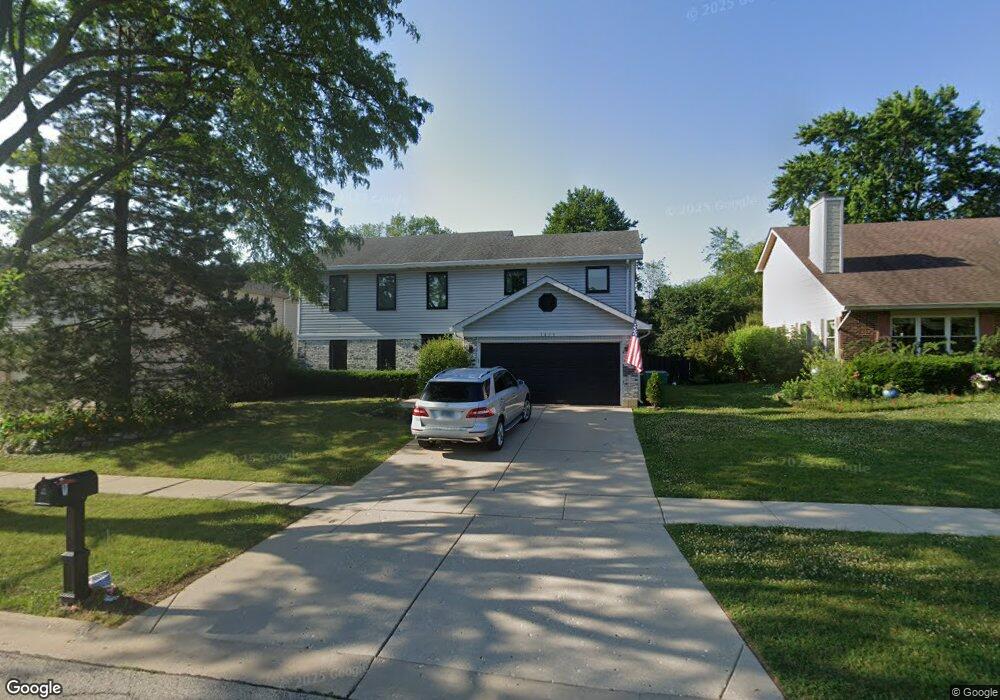
1409 Rose Blvd Buffalo Grove, IL 60089
South Buffalo Grove NeighborhoodEstimated Value: $444,000 - $572,000
4
Beds
3
Baths
2,084
Sq Ft
$250/Sq Ft
Est. Value
About This Home
This home is located at 1409 Rose Blvd, Buffalo Grove, IL 60089 and is currently estimated at $520,346, approximately $249 per square foot. 1409 Rose Blvd is a home located in Cook County with nearby schools including Henry W Longfellow Elementary School, Cooper Middle School, and Buffalo Grove High School.
Ownership History
Date
Name
Owned For
Owner Type
Purchase Details
Closed on
Nov 12, 2004
Sold by
Johar Ramanjeet and Delori Ramanpreet
Bought by
Goswami Manash and Goswami Sharmistha
Current Estimated Value
Home Financials for this Owner
Home Financials are based on the most recent Mortgage that was taken out on this home.
Original Mortgage
$289,600
Outstanding Balance
$133,238
Interest Rate
4.62%
Mortgage Type
Unknown
Estimated Equity
$387,108
Purchase Details
Closed on
Sep 3, 2002
Sold by
Chawla Prem V
Bought by
Johar Ramanjeet and Delori Ramanpreet
Home Financials for this Owner
Home Financials are based on the most recent Mortgage that was taken out on this home.
Original Mortgage
$252,000
Interest Rate
6.18%
Purchase Details
Closed on
Jan 14, 1997
Sold by
Grossman David N and Grossman Patricia J
Bought by
Massarsky Michael
Home Financials for this Owner
Home Financials are based on the most recent Mortgage that was taken out on this home.
Original Mortgage
$204,750
Interest Rate
8%
Create a Home Valuation Report for This Property
The Home Valuation Report is an in-depth analysis detailing your home's value as well as a comparison with similar homes in the area
Home Values in the Area
Average Home Value in this Area
Purchase History
| Date | Buyer | Sale Price | Title Company |
|---|---|---|---|
| Goswami Manash | $362,000 | Pntn | |
| Johar Ramanjeet | $315,000 | -- | |
| Massarsky Michael | $227,500 | -- |
Source: Public Records
Mortgage History
| Date | Status | Borrower | Loan Amount |
|---|---|---|---|
| Open | Goswami Manash | $289,600 | |
| Previous Owner | Johar Ramanjeet | $252,000 | |
| Previous Owner | Massarsky Michael | $204,750 |
Source: Public Records
Tax History Compared to Growth
Tax History
| Year | Tax Paid | Tax Assessment Tax Assessment Total Assessment is a certain percentage of the fair market value that is determined by local assessors to be the total taxable value of land and additions on the property. | Land | Improvement |
|---|---|---|---|---|
| 2024 | $11,294 | $35,287 | $7,945 | $27,342 |
| 2023 | $11,701 | $35,287 | $7,945 | $27,342 |
| 2022 | $11,701 | $38,000 | $7,945 | $30,055 |
| 2021 | $13,028 | $36,875 | $4,514 | $32,361 |
| 2020 | $11,611 | $36,875 | $4,514 | $32,361 |
| 2019 | $11,667 | $41,110 | $4,514 | $36,596 |
| 2018 | $11,869 | $37,900 | $3,972 | $33,928 |
| 2017 | $11,671 | $37,900 | $3,972 | $33,928 |
| 2016 | $11,119 | $37,900 | $3,972 | $33,928 |
| 2015 | $10,051 | $32,210 | $3,430 | $28,780 |
| 2014 | $9,903 | $32,210 | $3,430 | $28,780 |
| 2013 | $9,136 | $32,210 | $3,430 | $28,780 |
Source: Public Records
Map
Nearby Homes
- 476 W Happfield Dr Unit 10AL
- 715 W Happfield Dr
- 751 W Happfield Dr Unit 30
- 715 W Whiting Ln
- 812 W Whiting Ln
- 811 W Nichols Rd
- 705 Grove Dr Unit 101
- 720 Weidner Rd Unit 302
- 921 Bernard Dr
- 6 Villa Verde Dr Unit 103
- 859 Beechwood Rd
- 571 Estate Dr
- 813 Stradford Cir Unit 21B2
- 535 Estate Dr
- 410 Chatham Cir
- 1631 W Partridge Ct Unit 8
- 820 Weidner Rd Unit 4013
- 820 Weidner Rd Unit 409
- 18 E Heritage Ct
- 4210 N Mallard Dr Unit 4
- 1407 Rose Blvd
- 1411 Rose Blvd
- 626 W Happfield Dr Unit 1717CL
- 1405 Rose Blvd
- 1413 Rose Blvd
- 624 W Happfield Dr Unit 1717DL
- 624 W Happfield Dr Unit 1717D
- 630 W Happfield Dr Unit 1818BR
- 632 W Happfield Dr Unit 1818AR
- 634 W Happfield Dr Unit 1818CR
- 1410 Rose Blvd
- 622 W Happfield Dr Unit 1717DR
- 636 W Happfield Dr Unit 1818CL
- 1408 Rose Blvd
- 1412 Rose Blvd
- 638 W Happfield Dr Unit 1818AL
- 620 W Happfield Dr Unit 1717CR
- 640 W Happfield Dr Unit 1818BL
- 1415 Rose Blvd
- 1403 Rose Blvd