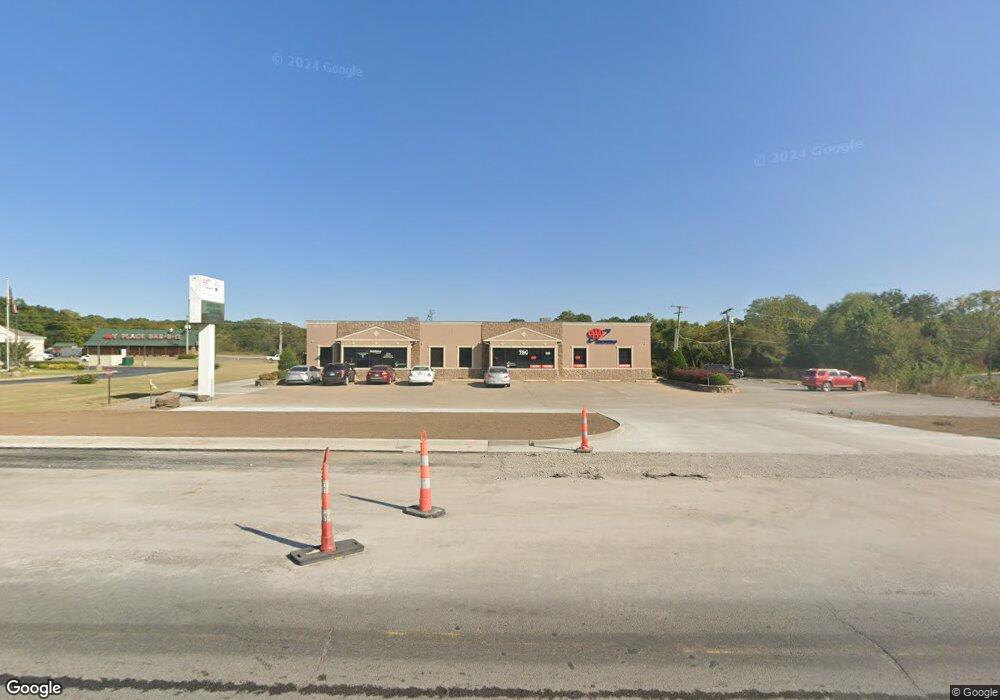
1409 S Muskogee Ave Tahlequah, OK 74464
Estimated Value: $1,090,734
--
Bed
--
Bath
9,100
Sq Ft
$120/Sq Ft
Est. Value
About This Home
This home is located at 1409 S Muskogee Ave, Tahlequah, OK 74464 and is currently estimated at $1,090,734, approximately $119 per square foot. 1409 S Muskogee Ave is a home located in Cherokee County with nearby schools including Greenwood Elementary School, Cherokee Elementary School, and Tahlequah Middle School.
Ownership History
Date
Name
Owned For
Owner Type
Purchase Details
Closed on
Jul 29, 2010
Sold by
Estate Of William B Tucker
Bought by
The Resource Group Llc
Current Estimated Value
Home Financials for this Owner
Home Financials are based on the most recent Mortgage that was taken out on this home.
Original Mortgage
$709,604
Outstanding Balance
$234,194
Interest Rate
4.54%
Mortgage Type
Commercial
Estimated Equity
$856,540
Purchase Details
Closed on
Jan 26, 1996
Sold by
Carl Greenhaw
Bought by
William Brian Tucker
Create a Home Valuation Report for This Property
The Home Valuation Report is an in-depth analysis detailing your home's value as well as a comparison with similar homes in the area
Home Values in the Area
Average Home Value in this Area
Purchase History
| Date | Buyer | Sale Price | Title Company |
|---|---|---|---|
| The Resource Group Llc | -- | None Available | |
| William Brian Tucker | $140,000 | -- |
Source: Public Records
Mortgage History
| Date | Status | Borrower | Loan Amount |
|---|---|---|---|
| Open | The Resource Group Llc | $709,604 |
Source: Public Records
Tax History Compared to Growth
Tax History
| Year | Tax Paid | Tax Assessment Tax Assessment Total Assessment is a certain percentage of the fair market value that is determined by local assessors to be the total taxable value of land and additions on the property. | Land | Improvement |
|---|---|---|---|---|
| 2025 | $9,379 | $104,883 | $15,731 | $89,152 |
| 2024 | $9,379 | $99,889 | $14,982 | $84,907 |
| 2023 | $8,932 | $95,132 | $12,042 | $83,090 |
| 2022 | $8,826 | $95,132 | $12,042 | $83,090 |
| 2021 | $8,859 | $95,132 | $12,042 | $83,090 |
| 2020 | $8,749 | $92,289 | $12,042 | $80,247 |
| 2019 | $8,259 | $87,894 | $12,042 | $75,852 |
| 2018 | $7,957 | $83,709 | $12,042 | $71,667 |
| 2017 | $7,565 | $79,723 | $12,042 | $67,681 |
| 2016 | $7,611 | $79,723 | $12,042 | $67,681 |
| 2015 | $7,131 | $79,549 | $12,042 | $67,507 |
| 2014 | $7,131 | $75,761 | $12,042 | $63,719 |
Source: Public Records
Map
Nearby Homes
- 14351 U S Highway 62
- 16133 U S Highway 62
- 902 S Mission Ave
- 1500 Stickross Mountain Rd
- 802 S College Ave
- 2463 S Park Hill Rd
- 1104 Chase Ave
- 1105 S Maple Ave
- 757 S Bluff Ave
- 902 S Owens Ave
- 306 Short St
- 1290 E 4th St
- 702 Wilson Ave
- 1700 Stickross Mountain Rd
- 201 Sandy Cir
- 413 Greenwood Dr
- 513 S State Ave
- 510 S Cherokee Ave
- 516 W Fox St
- 4733 S Muskogee Ave
- 1392 S Muskogee Ave
- 1401 S Muskogee Ave
- 1606.5 S Muskogee Ave
- 1404 S Muskogee Ave
- 0 S Muskogee Ave Unit 1005685
- 0 S Muskogee Ave Unit 1023396
- 0 S Muskogee Ave Unit 1104968
- 0 S Muskogee Ave Unit 1206185
- 0 S Muskogee Ave Unit 22081
- 0 S Muskogee Ave Unit 1003026
- 0 S Muskogee Ave Unit 104639
- 0 S Muskogee Ave Unit 1125266
- 0 S Muskogee Ave Unit 5900
- 0 S Muskogee Ave Unit 142115
- 0 S Muskogee Ave Unit 1405781
- 0 S Muskogee Ave Unit 617592
- 0 S Muskogee Ave Unit 736271
- 0 S Muskogee Ave Unit 826616
- 0 S Muskogee Ave Unit 931305
- 0 S Muskogee Ave Unit 921576