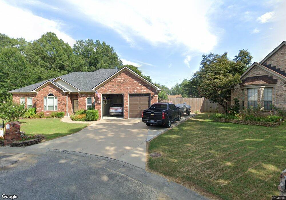
1409 Wild Rose Cir Conway, AR 72032
East Conway NeighborhoodEstimated Value: $303,000 - $363,000
--
Bed
3
Baths
2,822
Sq Ft
$116/Sq Ft
Est. Value
About This Home
This home is located at 1409 Wild Rose Cir, Conway, AR 72032 and is currently estimated at $326,553, approximately $115 per square foot. 1409 Wild Rose Cir is a home located in Faulkner County with nearby schools including Preston & Florence Mattison Elementary School, Bob Courtway Middle School, and Conway Junior High School.
Ownership History
Date
Name
Owned For
Owner Type
Purchase Details
Closed on
Jul 20, 2012
Sold by
Bell James F and Bell Martha S
Bought by
Bell James F and Bell Martha S
Current Estimated Value
Purchase Details
Closed on
Jul 21, 2009
Bought by
Bell
Home Financials for this Owner
Home Financials are based on the most recent Mortgage that was taken out on this home.
Original Mortgage
$214,864
Interest Rate
5.71%
Mortgage Type
VA
Purchase Details
Closed on
Dec 29, 2006
Bought by
Bredlau Trust
Purchase Details
Closed on
May 15, 2006
Bought by
Bredlau Family
Purchase Details
Closed on
May 12, 2006
Bought by
Bredlau Trust
Purchase Details
Closed on
Feb 14, 1996
Bought by
Walls
Create a Home Valuation Report for This Property
The Home Valuation Report is an in-depth analysis detailing your home's value as well as a comparison with similar homes in the area
Home Values in the Area
Average Home Value in this Area
Purchase History
| Date | Buyer | Sale Price | Title Company |
|---|---|---|---|
| Bell James F | -- | None Available | |
| Bell | $208,000 | -- | |
| Bell James F | $208,000 | Realty Title | |
| Bredlau Trust | $202,000 | -- | |
| Bredlau Family | $202,000 | -- | |
| Bredlau Trust | $202,000 | -- | |
| Bredlau Family | $202,000 | -- | |
| Walls | $155,000 | -- |
Source: Public Records
Mortgage History
| Date | Status | Borrower | Loan Amount |
|---|---|---|---|
| Closed | Bell James F | $214,864 |
Source: Public Records
Tax History Compared to Growth
Tax History
| Year | Tax Paid | Tax Assessment Tax Assessment Total Assessment is a certain percentage of the fair market value that is determined by local assessors to be the total taxable value of land and additions on the property. | Land | Improvement |
|---|---|---|---|---|
| 2025 | $1,960 | $65,650 | $3,600 | $62,050 |
| 2024 | $1,960 | $65,650 | $3,600 | $62,050 |
| 2023 | $1,960 | $48,960 | $3,600 | $45,360 |
| 2022 | $1,585 | $48,960 | $3,600 | $45,360 |
| 2021 | $1,585 | $48,960 | $3,600 | $45,360 |
| 2020 | $1,585 | $39,950 | $3,600 | $36,350 |
| 2019 | $1,585 | $39,950 | $3,600 | $36,350 |
| 2018 | $1,610 | $39,950 | $3,600 | $36,350 |
| 2017 | $1,610 | $39,950 | $3,600 | $36,350 |
| 2016 | $1,610 | $38,730 | $3,600 | $35,130 |
| 2015 | $1,960 | $38,730 | $3,600 | $35,130 |
| 2014 | $1,610 | $38,730 | $3,600 | $35,130 |
Source: Public Records
Map
Nearby Homes
- 440 Bernard Dr
- 8 Bridgestone Dr
- 1550 Gold Falls
- 60 Sandpiper Ct
- 2.2 Acres Amity Rd
- 1510 Silver Falls
- 2485 E Oak St
- 425 Cheyenne Ln
- 2510 E Oak St
- 2515 E Oak St
- 1605 Duke St
- 00 Caskay Dr
- 00 Museum Rd
- 24 Lots Hays Add
- 62 Addi Ln
- 82 Addi Ln
- 1012 Woodside Dr
- 30 Hazelwood Rd
- 575 5th Ave
- 2100 Mary Alice Dr
- 1407 Wild Rose Cir
- 1408 Wild Rose Cir
- 1406 Wild Rose Cir
- 1405 Wild Rose Cir
- 43 Frances Dr
- 45 Frances Dr
- 47 Frances Dr
- 41 Frances Dr
- 0 Wild Rose Cir Unit 17014739
- 1404 Wild Rose Cir
- 49 Frances Dr
- 39 Frances Dr
- 1403 Wild Rose Cir
- 1402 Wild Rose Cir
- 51 Frances Dr
- 37 Frances Dr
- 0 Frances Unit 16004554
- 0 Frances Unit 16008887
- 0 Frances Unit 18001521
- 1401 Wild Rose Cir