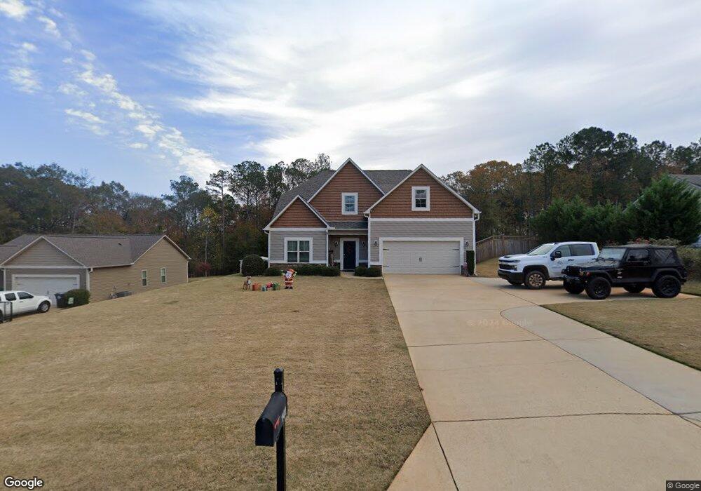
141 Amhurst Dr Unit 23 West Point, GA 31833
Estimated Value: $311,000 - $338,000
4
Beds
3
Baths
2,464
Sq Ft
$132/Sq Ft
Est. Value
About This Home
This home is located at 141 Amhurst Dr Unit 23, West Point, GA 31833 and is currently estimated at $324,778, approximately $131 per square foot. 141 Amhurst Dr Unit 23 is a home located in Troup County with nearby schools including West Point Elementary School, Long Cane Elementary School, and Whitesville Road Elementary School.
Ownership History
Date
Name
Owned For
Owner Type
Purchase Details
Closed on
May 6, 2016
Sold by
Inman V Samuel
Bought by
Inman V Samuel and Townsend Amanda Lois Anne
Current Estimated Value
Home Financials for this Owner
Home Financials are based on the most recent Mortgage that was taken out on this home.
Original Mortgage
$194,720
Outstanding Balance
$154,656
Interest Rate
3.59%
Mortgage Type
VA
Estimated Equity
$170,122
Create a Home Valuation Report for This Property
The Home Valuation Report is an in-depth analysis detailing your home's value as well as a comparison with similar homes in the area
Home Values in the Area
Average Home Value in this Area
Purchase History
| Date | Buyer | Sale Price | Title Company |
|---|---|---|---|
| Inman V Samuel | $188,500 | -- | |
| Inman V Samuel | $188,500 | -- |
Source: Public Records
Mortgage History
| Date | Status | Borrower | Loan Amount |
|---|---|---|---|
| Open | Inman V Samuel | $194,720 |
Source: Public Records
Tax History Compared to Growth
Tax History
| Year | Tax Paid | Tax Assessment Tax Assessment Total Assessment is a certain percentage of the fair market value that is determined by local assessors to be the total taxable value of land and additions on the property. | Land | Improvement |
|---|---|---|---|---|
| 2024 | $2,674 | $100,040 | $14,000 | $86,040 |
| 2023 | $2,746 | $102,680 | $14,000 | $88,680 |
| 2022 | $2,423 | $88,800 | $10,000 | $78,800 |
| 2021 | $2,464 | $83,680 | $10,000 | $73,680 |
| 2020 | $2,403 | $81,680 | $8,000 | $73,680 |
| 2019 | $2,301 | $78,280 | $6,000 | $72,280 |
| 2018 | $2,301 | $78,280 | $6,000 | $72,280 |
| 2017 | $2,214 | $78,280 | $6,000 | $72,280 |
| 2016 | $2,361 | $78,280 | $6,000 | $72,280 |
| 2015 | $163 | $5,400 | $5,400 | $0 |
| 2014 | $163 | $5,400 | $5,400 | $0 |
| 2013 | -- | $5,400 | $5,400 | $0 |
Source: Public Records
Map
Nearby Homes
- 4172 Bartley Rd
- 333 Shoemaker Rd
- 648 Warner Rd
- 208 Harris Walk Unit 80
- 0 Johns Rd Unit 10615130
- 0 Sandtown Rd Unit 10255987
- Sandtown Road Unit: 1 2+ - Acre
- 797 Gabbettville Rd
- 311 Tomme Rd
- 143 W Drummond Rd
- 151 W Drummond Rd
- 157 W Drummond Rd
- 137 W Drummond Rd
- 131 W Drummond Rd
- 111 Tudor Way
- 134 Garden Walk
- 202 Reed Rd
- 0 Lambert Rd
- 345 Robert Taylor Rd
- 0 Cannonville Rd
- 139 Amhurst Dr Unit 22
- 143 Amhurst Dr Unit 24
- 137 Amhurst Dr
- 137 Amhurst Dr Unit 21
- 145 Amhurst Dr
- 135 Amhurst Dr Unit 20
- 147 Amhurst Dr
- 147 Amhurst Dr Unit 26
- 142 Amhurst Dr Unit 50
- 140 Amhurst Dr
- 140 Amhurst Dr Unit 51
- 149 Amhurst Cir Unit LOT 27
- 149 Amhurst Cir
- 133 Amhurst Dr
- 133 Amhurst Dr Unit 19
- 138 Amhurst Dr Unit 52
- 144 Amhurst Dr Unit 49
- 136 Amhurst Dr
- 151 Amhurst Cir
- 194 Amhurst Cir