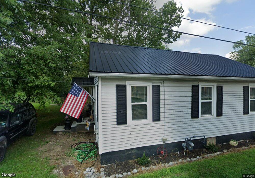
141 Brook St Burgin, KY 40310
Estimated Value: $143,000 - $265,000
3
Beds
3
Baths
1,608
Sq Ft
$130/Sq Ft
Est. Value
About This Home
This home is located at 141 Brook St, Burgin, KY 40310 and is currently estimated at $208,546, approximately $129 per square foot. 141 Brook St is a home with nearby schools including Burgin Independent School.
Ownership History
Date
Name
Owned For
Owner Type
Purchase Details
Closed on
Apr 18, 2023
Sold by
Mercer County Circuit Court
Bought by
Five Four Lean Llc
Current Estimated Value
Purchase Details
Closed on
Mar 13, 2023
Sold by
Martin Spyro C and Martin Angela G
Bought by
Martin Cattle Company Llc
Purchase Details
Closed on
Oct 13, 2021
Sold by
Noel Davis Wilmert and Noel Dayna Lynn
Bought by
Noel Davis Wilmert and Noel Dayna Lynn
Purchase Details
Closed on
Jun 15, 2015
Sold by
Noel Mark Bradley
Bought by
Noel Wilmert Davis
Create a Home Valuation Report for This Property
The Home Valuation Report is an in-depth analysis detailing your home's value as well as a comparison with similar homes in the area
Purchase History
| Date | Buyer | Sale Price | Title Company |
|---|---|---|---|
| Five Four Lean Llc | $149 | None Listed On Document | |
| Martin Cattle Company Llc | -- | None Listed On Document | |
| Noel Davis Wilmert | -- | None Available | |
| Noel Wilmert Davis | $30,000 | Attorney |
Source: Public Records
Tax History
| Year | Tax Paid | Tax Assessment Tax Assessment Total Assessment is a certain percentage of the fair market value that is determined by local assessors to be the total taxable value of land and additions on the property. | Land | Improvement |
|---|---|---|---|---|
| 2025 | $275 | $68,908 | $7,000 | $61,908 |
| 2024 | $275 | $68,908 | $7,000 | $61,908 |
| 2023 | $231 | $56,437 | $0 | $0 |
| 2022 | $231 | $56,437 | $0 | $0 |
| 2021 | $239 | $56,437 | $0 | $0 |
| 2020 | $239 | $56,437 | $7,000 | $49,437 |
| 2019 | $239 | $56,437 | $7,000 | $49,437 |
| 2018 | $239 | $56,437 | $0 | $0 |
| 2017 | $231 | $56,437 | $0 | $0 |
| 2016 | $229 | $56,437 | $0 | $0 |
| 2015 | $79 | $56,437 | $7,000 | $49,437 |
| 2014 | $79 | $56,437 | $7,000 | $49,437 |
| 2010 | -- | $56,437 | $7,000 | $49,437 |
Source: Public Records
Map
Nearby Homes
- 615 W Main St
- 307 W Main St
- 202 3rd St
- 342 Pleasant Hill Dr
- 633 Pleasant Hill Dr
- 121 Paradise Camp Rd
- 279 Dossett Ln
- Tract 2B Handy Rd
- 195 Lakeland Dr
- 315 Lakeland Dr
- 520 Mallard Cove
- 1453 Normans Camp Rd
- 626 Mallard Cove
- 207 Dean Dr
- 103 Dean Dr
- 111 Dean Dr
- 275 Beams Rd
- 241 Beams Dr
- 240 Persimmon Way
- 230 Persimmon Way
- 310 N First St
- 133 Brook St
- 315 N First St N
- 215 N First St N
- 133 W Court St
- 133 W Court St
- 403 1st St N
- 403 N First St
- 107 W Court St
- 400 N First St
- 400 1st St N
- 200 Railroad St
- 102 Brook St
- 102 W Court St
- 126 W W Court St
- 208 N First St
- 110 W Court St
- 120 W Court St W
- 110 W Court St
- 214 W Bonta St
Your Personal Tour Guide
Ask me questions while you tour the home.