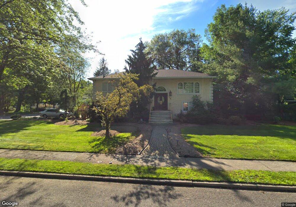
141 Caroline Rd Paramus, NJ 07652
Estimated Value: $948,501 - $1,094,000
Studio
--
Bath
2,174
Sq Ft
$468/Sq Ft
Est. Value
About This Home
This home is located at 141 Caroline Rd, Paramus, NJ 07652 and is currently estimated at $1,017,625, approximately $468 per square foot. 141 Caroline Rd is a home located in Bergen County with nearby schools including Paramus High School, Yavneh Academy, and Visitation Academy.
Ownership History
Date
Name
Owned For
Owner Type
Purchase Details
Closed on
Dec 21, 2011
Sold by
Barsa Rainery
Bought by
Hao Xuejun and Wang Lei
Current Estimated Value
Home Financials for this Owner
Home Financials are based on the most recent Mortgage that was taken out on this home.
Original Mortgage
$512,000
Outstanding Balance
$344,598
Interest Rate
3.98%
Mortgage Type
Purchase Money Mortgage
Estimated Equity
$673,027
Create a Home Valuation Report for This Property
The Home Valuation Report is an in-depth analysis detailing your home's value as well as a comparison with similar homes in the area
Home Values in the Area
Average Home Value in this Area
Purchase History
| Date | Buyer | Sale Price | Title Company |
|---|---|---|---|
| Hao Xuejun | $640,000 | -- |
Source: Public Records
Mortgage History
| Date | Status | Borrower | Loan Amount |
|---|---|---|---|
| Open | Hao Xuejun | $512,000 |
Source: Public Records
Tax History
| Year | Tax Paid | Tax Assessment Tax Assessment Total Assessment is a certain percentage of the fair market value that is determined by local assessors to be the total taxable value of land and additions on the property. | Land | Improvement |
|---|---|---|---|---|
| 2025 | $10,100 | $711,800 | $411,000 | $300,800 |
| 2024 | $9,805 | $667,100 | $380,300 | $286,800 |
| 2023 | $9,545 | $639,200 | $362,200 | $277,000 |
| 2022 | $9,545 | $615,000 | $338,000 | $277,000 |
| 2021 | $9,377 | $566,900 | $312,000 | $254,900 |
| 2020 | $8,910 | $558,600 | $307,200 | $251,400 |
| 2019 | $10,902 | $587,400 | $318,900 | $268,500 |
| 2018 | $10,767 | $587,400 | $318,900 | $268,500 |
| 2017 | $10,579 | $587,400 | $318,900 | $268,500 |
| 2016 | $10,291 | $587,400 | $318,900 | $268,500 |
| 2015 | $10,186 | $587,400 | $318,900 | $268,500 |
| 2014 | $10,097 | $587,400 | $318,900 | $268,500 |
Source: Public Records
Map
Nearby Homes
- 127 Village Cir E
- 122 Village Cir E
- 189 Forest Ave Unit 117
- 189 Forest Ave Unit 409
- 374 Valley Rd
- 285 Wayne Ave
- 187 Brookfield Ave
- 64 E Century Rd
- 81 Eastbrook Dr
- 177 Haase Ave
- 302 Howland Ave
- 215 Kensington Rd
- 192 Thomas Dr
- 300 Spring Valley Rd
- 179 Clayton Terrace
- 239 Greenway Terrace
- 16 Coles Ct
- 219 N Farview Ave
- 156 Stuart St
- 212 Monroe Ave
- 145 Caroline Rd
- 157 Lucky Hollow Dr
- 164 Lucky Hollow Dr
- 149 Caroline Rd
- 168 Lucky Hollow Dr
- 148 Caroline Rd
- 140 Caroline Rd
- 156 Lucky Hollow Dr
- 153 Lucky Hollow Dr
- 152 Caroline Rd
- 153 Caroline Rd
- 141 Village Cir W
- 145 Village Cir W
- 152 Lucky Hollow Dr
- 137 Village Cir W
- 149 Village Cir W
- 149 Lucky Hollow Dr
- 156 Caroline Rd
- 133 Village Cir W
- 151 Village Cir W
Your Personal Tour Guide
Ask me questions while you tour the home.