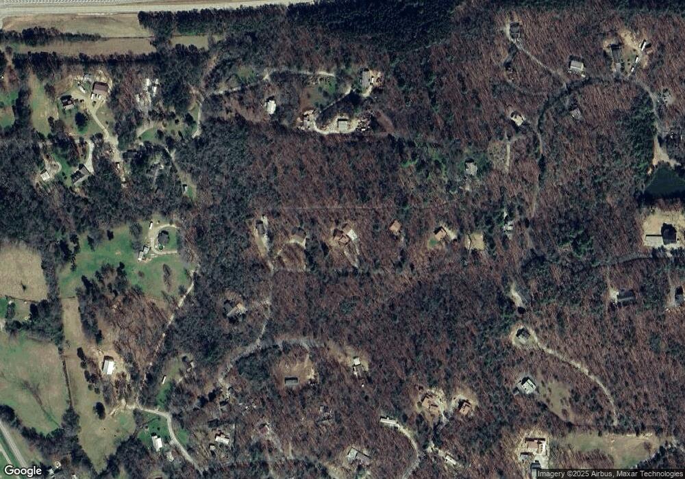
141 Cedar Branch Rd Blairsville, GA 30512
Ivylog NeighborhoodEstimated Value: $441,000 - $547,000
3
Beds
4
Baths
2,121
Sq Ft
$227/Sq Ft
Est. Value
About This Home
This home is located at 141 Cedar Branch Rd, Blairsville, GA 30512 and is currently estimated at $481,689, approximately $227 per square foot. 141 Cedar Branch Rd is a home located in Union County with nearby schools including Union County Primary School, Union County Elementary School, and Union County Middle School.
Ownership History
Date
Name
Owned For
Owner Type
Purchase Details
Closed on
Jun 30, 2006
Sold by
Beaver Aaron
Bought by
Godwin Elizabeth J and Godwin Michael E
Current Estimated Value
Home Financials for this Owner
Home Financials are based on the most recent Mortgage that was taken out on this home.
Original Mortgage
$184,900
Outstanding Balance
$102,651
Interest Rate
5.5%
Mortgage Type
New Conventional
Estimated Equity
$379,038
Purchase Details
Closed on
Oct 28, 2005
Sold by
Beaver Aaron
Bought by
Russell Gary
Create a Home Valuation Report for This Property
The Home Valuation Report is an in-depth analysis detailing your home's value as well as a comparison with similar homes in the area
Home Values in the Area
Average Home Value in this Area
Purchase History
| Date | Buyer | Sale Price | Title Company |
|---|---|---|---|
| Godwin Elizabeth J | $184,900 | -- | |
| Russell Gary | $53,000 | -- |
Source: Public Records
Mortgage History
| Date | Status | Borrower | Loan Amount |
|---|---|---|---|
| Open | Godwin Elizabeth J | $184,900 |
Source: Public Records
Tax History Compared to Growth
Tax History
| Year | Tax Paid | Tax Assessment Tax Assessment Total Assessment is a certain percentage of the fair market value that is determined by local assessors to be the total taxable value of land and additions on the property. | Land | Improvement |
|---|---|---|---|---|
| 2024 | $2,139 | $188,920 | $6,080 | $182,840 |
| 2023 | $2,409 | $188,680 | $6,080 | $182,600 |
| 2022 | $1,741 | $138,440 | $5,640 | $132,800 |
| 2021 | $1,736 | $117,840 | $5,640 | $112,200 |
| 2020 | $1,658 | $95,369 | $12,910 | $82,459 |
| 2019 | $1,564 | $95,369 | $12,910 | $82,459 |
| 2018 | $1,675 | $95,369 | $12,910 | $82,459 |
| 2017 | $775 | $52,156 | $12,910 | $39,246 |
| 2016 | $776 | $52,156 | $12,910 | $39,246 |
| 2015 | $780 | $52,156 | $12,910 | $39,246 |
| 2013 | -- | $52,155 | $12,910 | $39,245 |
Source: Public Records
Map
Nearby Homes
- 763 Sharp Top Cir
- 70 Martys Dr
- 542 Sharp Top Cir
- LOT 29 Sharp Top Cir
- LOT 26 Sharp Top Cir
- 189 Fountain Oaks Dr
- LOT 48 Laurel Brooke
- 110 Alex Way
- TBD Alex Way
- TBD Leisure Way
- 435 Richlen Ridge Rd
- 33 Carley Dr
- LOT 10 Hawks Nest Rd Unit 10
- lot 8 Hawks Nest Rd
- 10 W Hawks Nest Rd
- 305 Kimbolton Dr
- LOT 32 Byers Rd
- LT 32 Byers Rd
- 8328 Cedar Branch Rd
- LOT2A Cedar Branch Rd
- 71 Cedar Branch Rd
- 171 Cedar Branch Rd
- 0 Cedar Branch Rd Unit 182795
- 0 Cedar Branch Rd Unit 8913637
- 0 Cedar Branch Rd Unit 7130431
- 69 Cedar Branch Rd
- 221 Cedar Branch Rd Unit 3
- 221 Cedar Branch Rd
- 41 Cedar Branch Rd
- 120 Spears Ln
- 503 Wilcoxon Way
- 207 Nichols Cir
- 101 Lee Harkins Rd
- 644 Sharp Top Cir
- 65 Carney Ln
- 750 Sharp Top Cir
- 750 Sharp Top Cir
- 205 Wilcoxon Way
