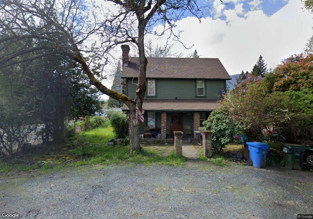
141 Cedar St Rogue River, OR 97537
Estimated Value: $198,000 - $280,000
--
Bed
--
Bath
2,660
Sq Ft
$89/Sq Ft
Est. Value
About This Home
This home is located at 141 Cedar St, Rogue River, OR 97537 and is currently estimated at $235,836, approximately $88 per square foot. 141 Cedar St is a home located in Jackson County with nearby schools including South Valley Academy, Rogue River Elementary School, and Rogue River Junior/Senior High School.
Ownership History
Date
Name
Owned For
Owner Type
Purchase Details
Closed on
Feb 9, 2007
Sold by
Beaumont Judy A
Bought by
Beaumont Lee C and Beaumont Judy A
Current Estimated Value
Purchase Details
Closed on
Jan 10, 2007
Sold by
Costello Cari A
Bought by
Beaumont Judy A and Costello Judy A
Purchase Details
Closed on
Nov 30, 2006
Sold by
Costello Jess
Bought by
Beaumont Judy A and Costello Judy A
Purchase Details
Closed on
Jan 13, 2005
Sold by
Costello Judy A and Beaumont Judy A
Bought by
Beaumont Judy A and Costello Jess
Create a Home Valuation Report for This Property
The Home Valuation Report is an in-depth analysis detailing your home's value as well as a comparison with similar homes in the area
Home Values in the Area
Average Home Value in this Area
Purchase History
| Date | Buyer | Sale Price | Title Company |
|---|---|---|---|
| Beaumont Lee C | -- | None Available | |
| Beaumont Judy A | -- | None Available | |
| Beaumont Judy A | -- | None Available | |
| Beaumont Judy A | -- | -- |
Source: Public Records
Tax History Compared to Growth
Tax History
| Year | Tax Paid | Tax Assessment Tax Assessment Total Assessment is a certain percentage of the fair market value that is determined by local assessors to be the total taxable value of land and additions on the property. | Land | Improvement |
|---|---|---|---|---|
| 2025 | $1,559 | $109,160 | $54,650 | $54,510 |
| 2024 | $1,559 | $105,990 | $53,060 | $52,930 |
| 2023 | $1,508 | $102,910 | $51,510 | $51,400 |
| 2022 | $1,473 | $102,910 | $51,510 | $51,400 |
| 2021 | $1,431 | $99,920 | $50,010 | $49,910 |
| 2020 | $1,395 | $97,010 | $48,550 | $48,460 |
| 2019 | $1,361 | $91,450 | $45,770 | $45,680 |
| 2018 | $1,325 | $88,790 | $44,440 | $44,350 |
| 2017 | $1,295 | $88,790 | $44,440 | $44,350 |
| 2016 | $1,263 | $83,700 | $41,890 | $41,810 |
| 2015 | $1,228 | $83,700 | $41,890 | $41,810 |
| 2014 | $1,188 | $78,910 | $39,500 | $39,410 |
Source: Public Records
Map
Nearby Homes
- 111 Cedar St
- TL 1303 E Main St
- 419 E Main St
- 0 Oak St
- 105 Brolin Ct
- 202 Arbor St
- 207 Madrone St
- 904 Broadway St Unit 503
- 208 W Main St
- 182 Wards Creek Rd
- 300 Woodville Way
- 2661 Wards Creek Rd
- 305 Woodville Way
- 405 Magerle Ln
- 299 Foothill Blvd
- 5525 Red Tail Ln
- 5500 Red Tail Ln
- 5508 Rogue River Hwy
- 5504 Rogue River Hwy
- 815 Pine St Unit 10