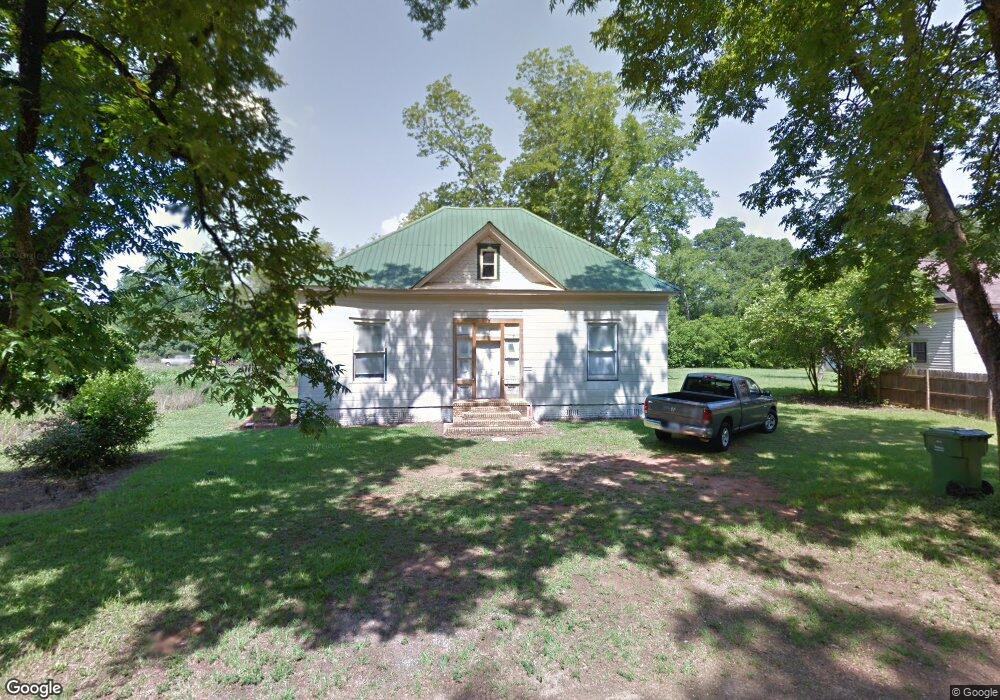
141 College St Shellman, GA 39886
Estimated Value: $56,000 - $131,000
About This Home
This home is located at 141 College St, Shellman, GA 39886 and is currently estimated at $83,004, approximately $40 per square foot. 141 College St is a home with nearby schools including Randolph County Elementary School, Randolph Clay Middle School, and Randolph Clay High School.
Ownership History
We collect this data history from publicly available records. To have your information removed, we recommend requesting removal directly through your county’s website.
Purchase Details
Purchase Details
Purchase Details
Home Values in the Area
Average Home Value in this Area
Purchase History
We collect this data history from publicly available records. To have your information removed, we recommend requesting removal directly through your county’s website.
| Date | Buyer | Sale Price | Title Company |
|---|---|---|---|
| -- | -- | ||
| -- | -- | ||
| $22,326 | -- | ||
| $22,326 | -- | ||
| -- | -- | ||
| -- | -- |
Tax History
We collect this data history from publicly available records. To have your information removed, we recommend requesting removal directly through your county’s website.
| Year | Tax Paid | Tax Assessment Tax Assessment Total Assessment is a certain percentage of the fair market value that is determined by local assessors to be the total taxable value of land and additions on the property. | Land | Improvement |
|---|---|---|---|---|
| 2025 | $1,368 | $28,720 | $2,120 | $26,600 |
| 2024 | $1,434 | $25,600 | $1,760 | $23,840 |
| 2023 | $990 | $25,600 | $1,760 | $23,840 |
| 2022 | $1,210 | $33,080 | $1,760 | $31,320 |
| 2021 | $700 | $18,820 | $1,732 | $17,088 |
| 2020 | $720 | $18,820 | $1,732 | $17,088 |
| 2019 | $716 | $18,820 | $1,732 | $17,088 |
| 2018 | $890 | $18,820 | $1,732 | $17,088 |
| 2017 | $685 | $18,820 | $1,732 | $17,088 |
| 2016 | $687 | $18,820 | $1,732 | $17,088 |
| 2015 | -- | $18,820 | $1,732 | $17,088 |
| 2014 | -- | $13,371 | $1,752 | $11,618 |
| 2013 | -- | $13,370 | $1,752 | $11,618 |
Map
- 3468 Pearl St
- 3109 Calhoun St
- 56 W Phelps St
- 2415 Highway 82
- Sam Bentley Rd
- Pierce Rd
- 246 Melton Mill Rd
- 0 Bird Song Rd
- 4008 Horseshoe Rd
- U S 82
- 945 Pearson Dr SW
- 361/552 NW Tenth Ave
- 705 Ferguson Creek Rd
- 300 Five Forks Rd
- 216 Stonewall St NE
- 009 George Milling Rd
- 005 Fountain Bridge Rd
- 004 Fountain Bridge Rd
- 379 E Lee St
- 414 2nd Ave SE
Ask me questions while you tour the home.